
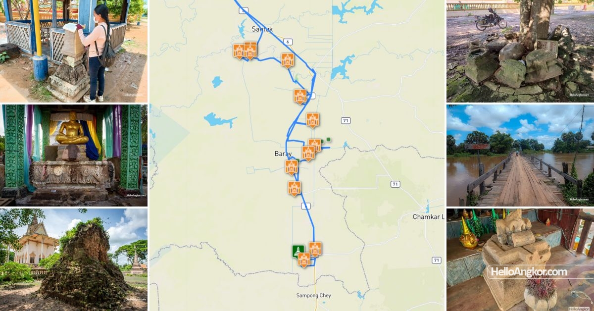
This was a short tour from Sep 22 – 24, 2023, following the scribbled notes on a map by Henri Parmentier in the 1930s, turns out it’s an intriguing heritage trail.
As you likely well know, there is a large volume of maps available in various sections of the EFEO website much of which comes from the early 1900s when the French were under the full grasp of Angkor’s spell, documenting almost everything, sometimes with mind-blowing detail. The maps are often hand-drawn illustrations providing detail on places and landforms well before modern development took hold. Sometimes they connect with the documentation found in Bulletin de l’Ecole française d’Extreme-Orient (BEFEO), creating a picture of the world at that time through their eyes.
So, what could be cooler than following an old map of ancient mysteries? Not much, for me at least.
So who was Henri Parmentier? He won’t need any introduction to many, as he was an iconic and pivotal figure in the studies of the ancient Khmer world, and also Indochina. He left behind invaluable documentation of temples in numerous tomes of work describing art and architecture. But today, it’s his maps produced between 1928-1944 that we’ll take a look at, and focus on one peculiar point.
I do warn you in advance, if you love studying Khmer history and the French documentation of such, then you’ll likely lose hours trolling through these maps. Mountains, hills, creeks and rivers are all marked and mostly named, the old village names are there and the temples are marked by IK number on the reverse side. All very cool stuff, but one thing stands out, his red pen. Take a look
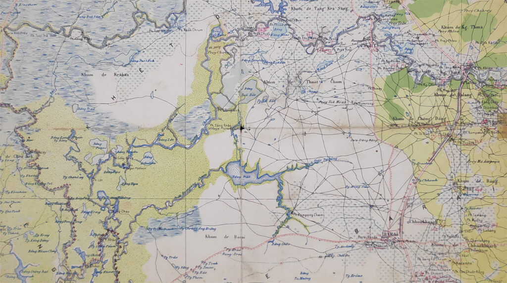
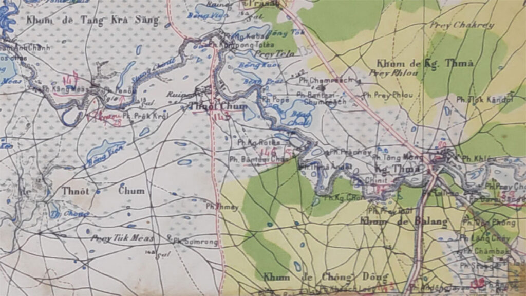
This section of the map stretches from the Tonle Sap floodplains to Kampong Thma, and the second image zooms in on the Kampong Thma/Tnaot Chum/Baray area of Kampong Thom. Note the red pen markings. Parmentier was never that interested in pagodas, why would he start marking out these sites? The numbers I assume are MH or Monuments Historiques numbers. There’s only one real way to know.
This is Chanthim’s home turf, so I’d depart from Siem Reap and we’d meet up in Tang Krasang and go on a little mission to explore a selection of sites from Parmentier’s scribbled annotations.
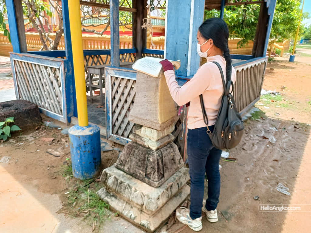
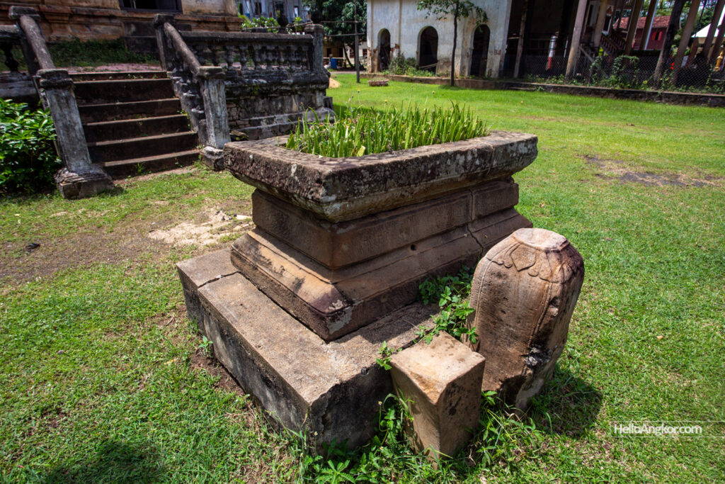
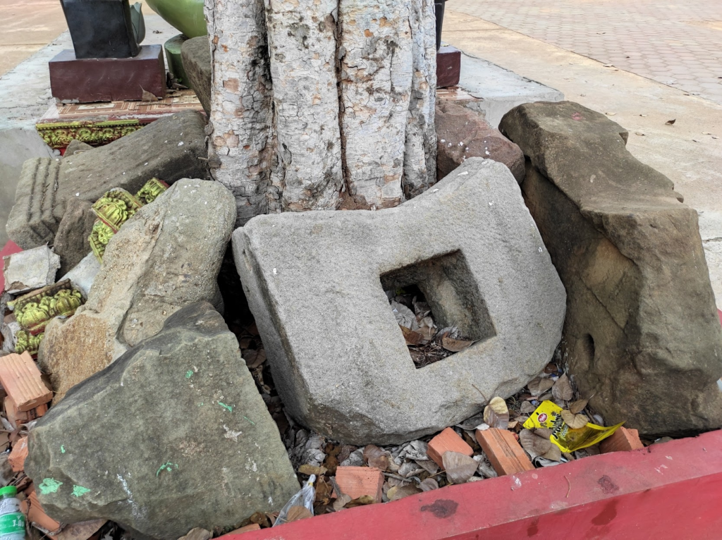
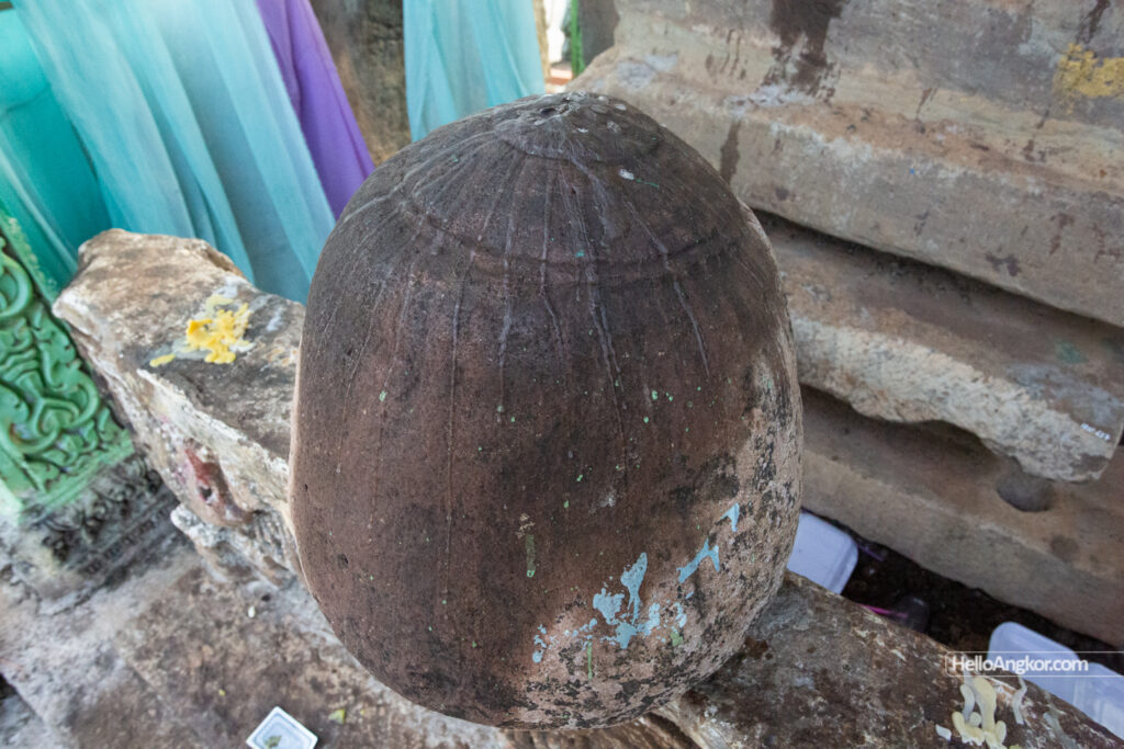
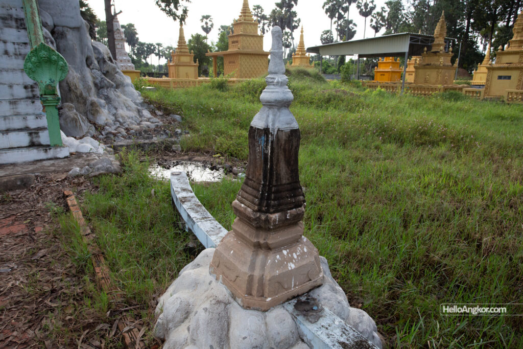
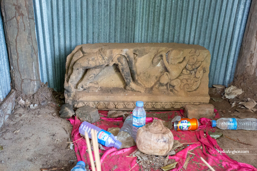
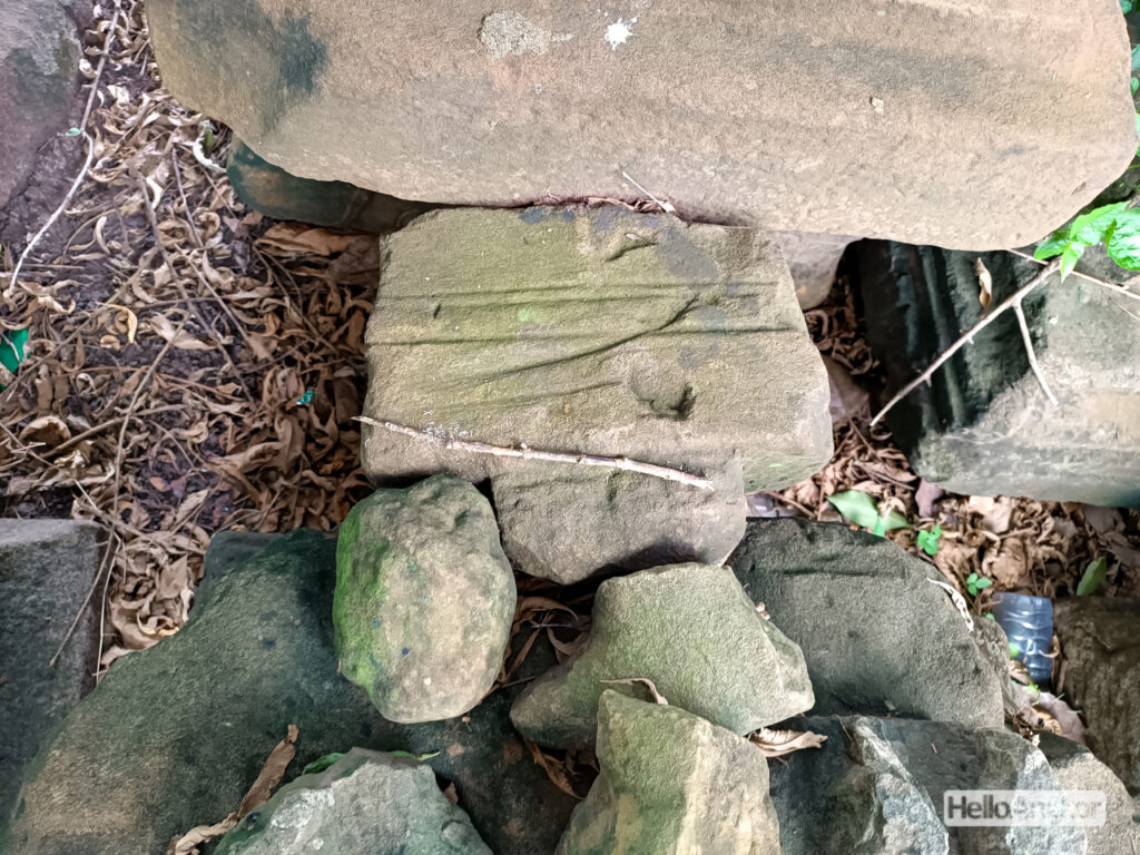
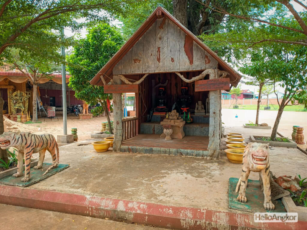
Wat Phnov – has a small collection of laterite blocks and three pieces of a votive stupa/s that *may* date to around the Longvek-Oudong era of the 16th-19th century, and a couple of other mysterious fragments.
Wat Sor Sophon – a contemporary pagoda that faces onto the river also has a stupa fragment from around that same era.
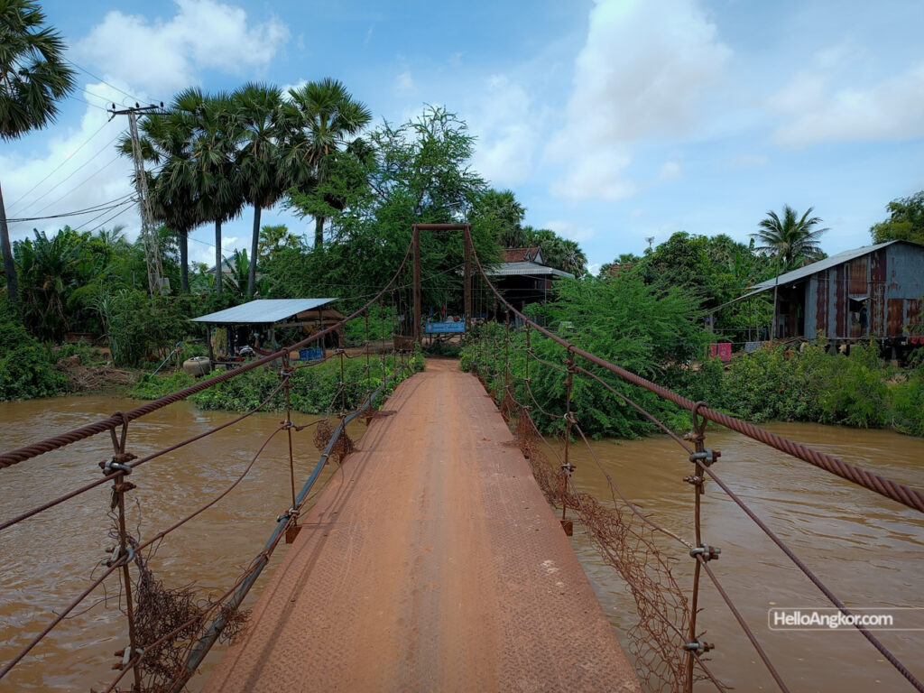
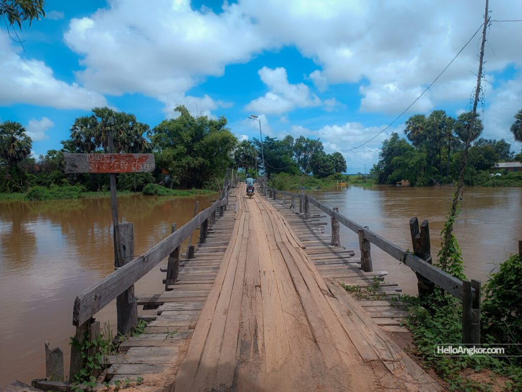
Wat Kang Meas – a little further along the river had no visible remnants but regardless, it’s a lovely rural village ride, crisscrossing the river as needed.

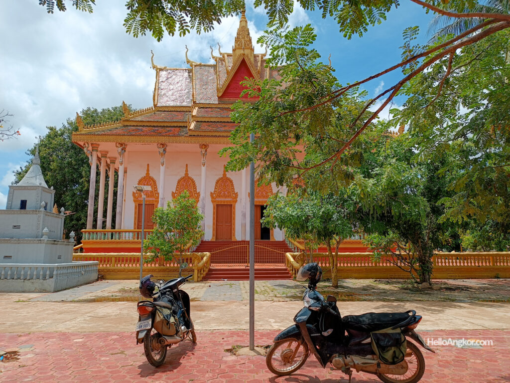
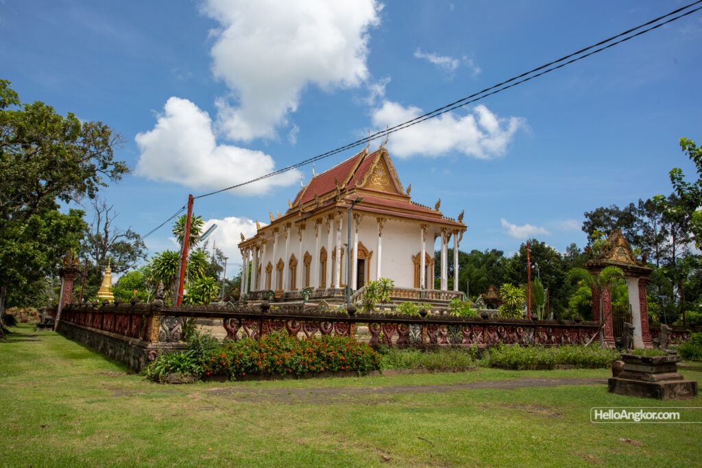
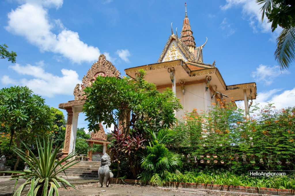
Wat Tnaot Chum – is of course a very special pagoda, it too featuring a fragment of a stupa similar to those seen earlier. Nearby are the two temple sites of Tnaot Chum Khang Cheung Temple, and Tnaot Chum Khang Lech Temple.
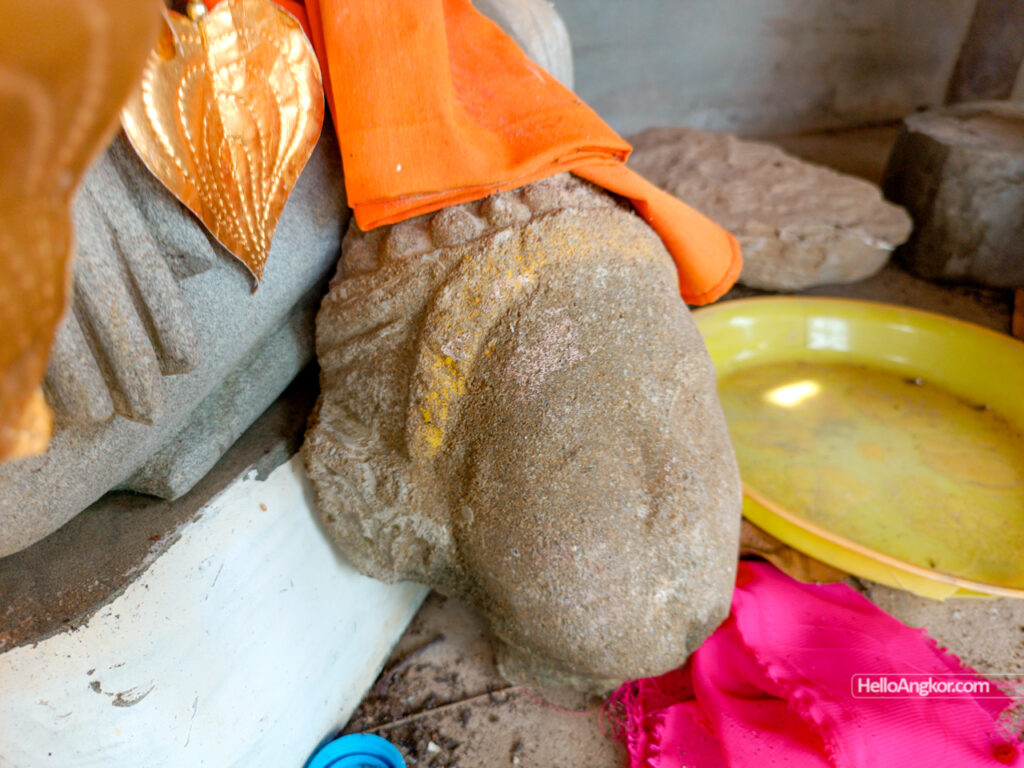
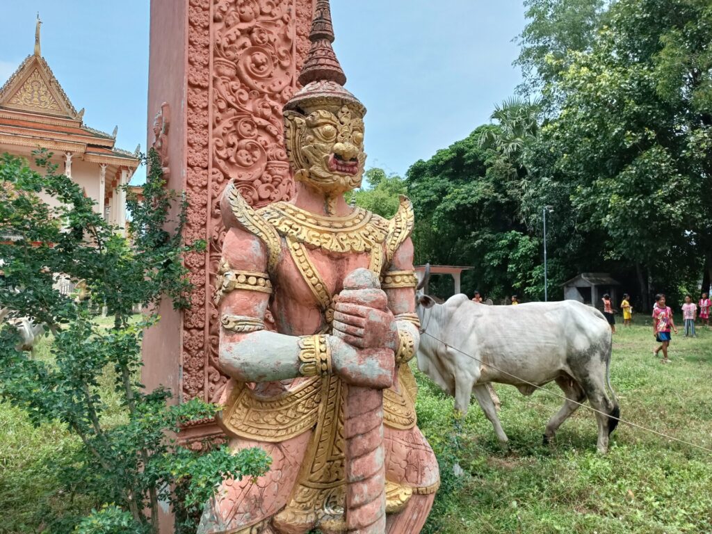
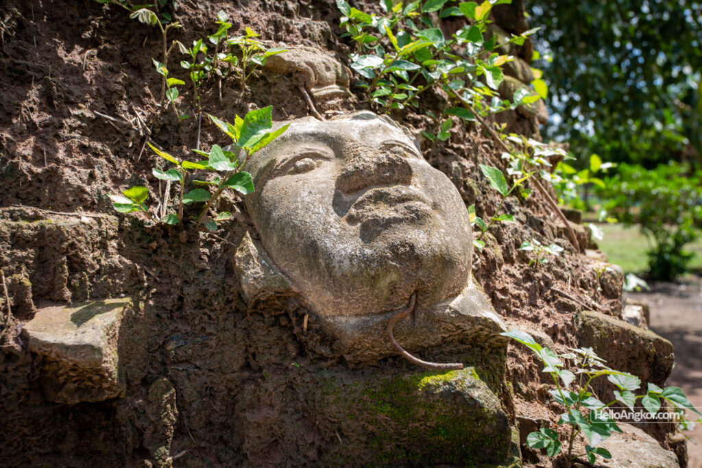
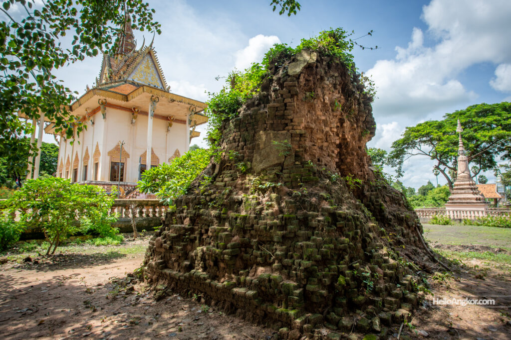
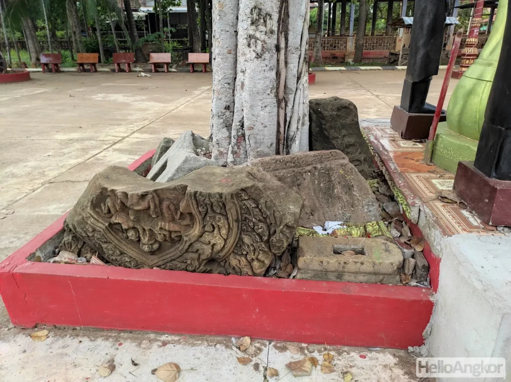
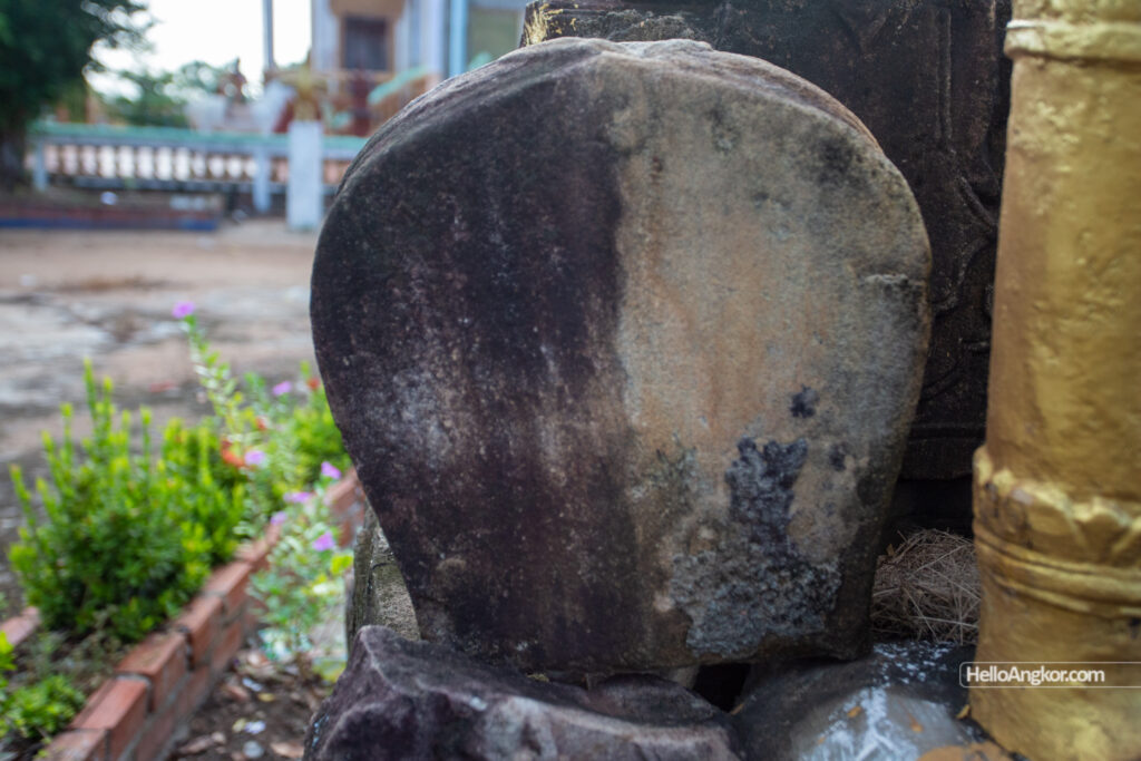
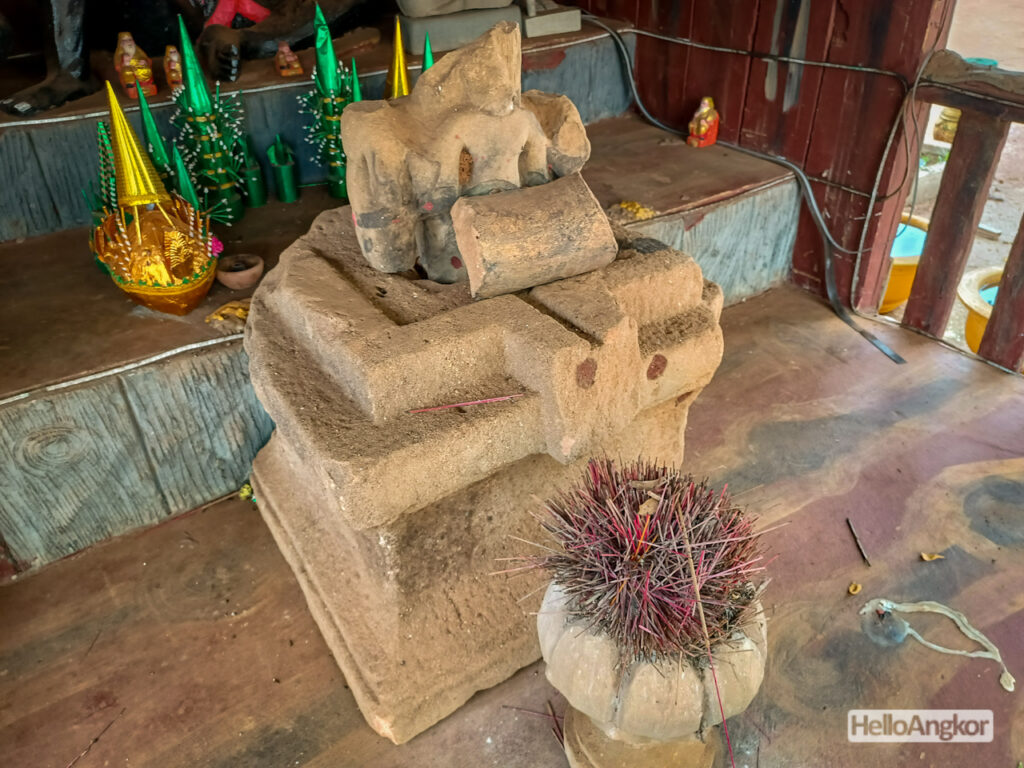
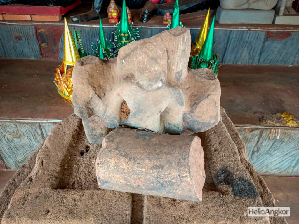
Wat Banteay Chas – an ominous name, and it features the remains of a grand brick stupa but it’s a little bit hard to guess how old but old Brahmas face is perhaps helpful.
Wat Chong Doung – one of the more interesting sites, featuring a large collection of remnants, one assumes, are from the vihara that preceded the pagoda we see today, originating from sometime around the 16th-19th c. There’s some odd pieces here, hopefully on another visit, we can meet the achar who will surely know a lot more.
I visited Wat Baray, Wat Banak, and Wat Chakto Lok on an early trip in June 2022, and they too feature some fascinating remnants, some from the Angkorian era, and some from the between the 16th-19th century, along with documented remnants form the pre-Angkorian era.

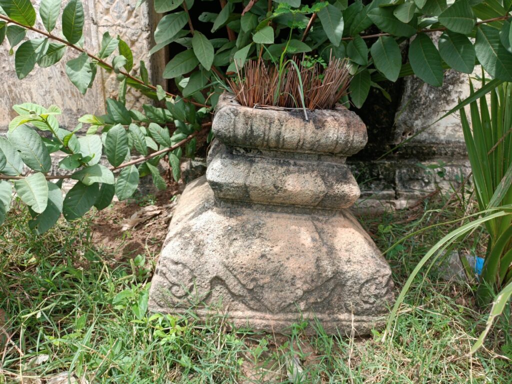
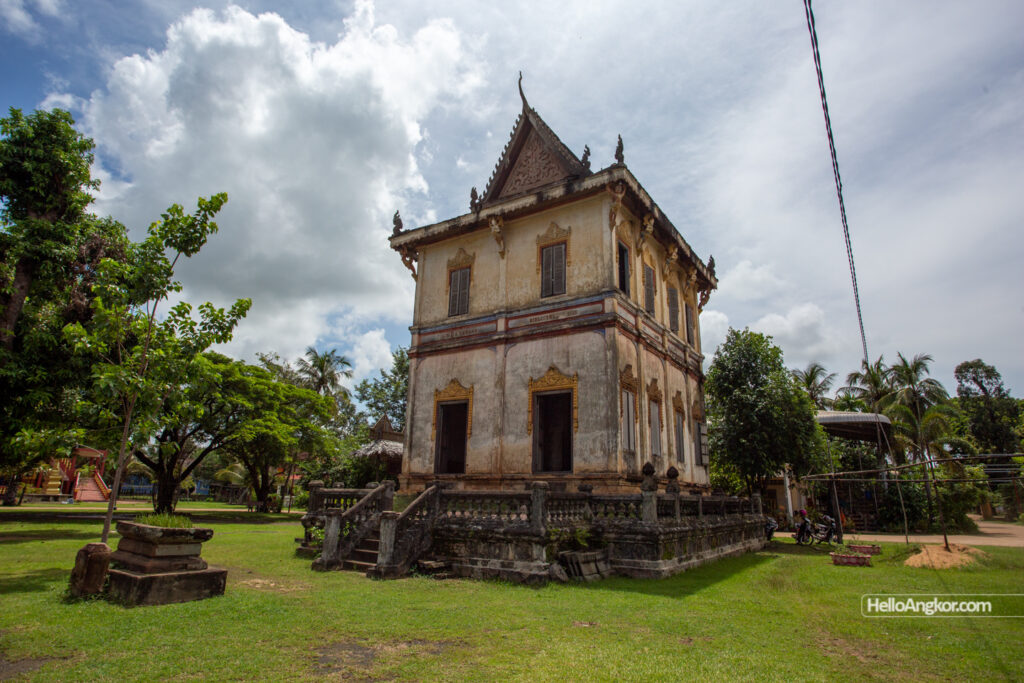
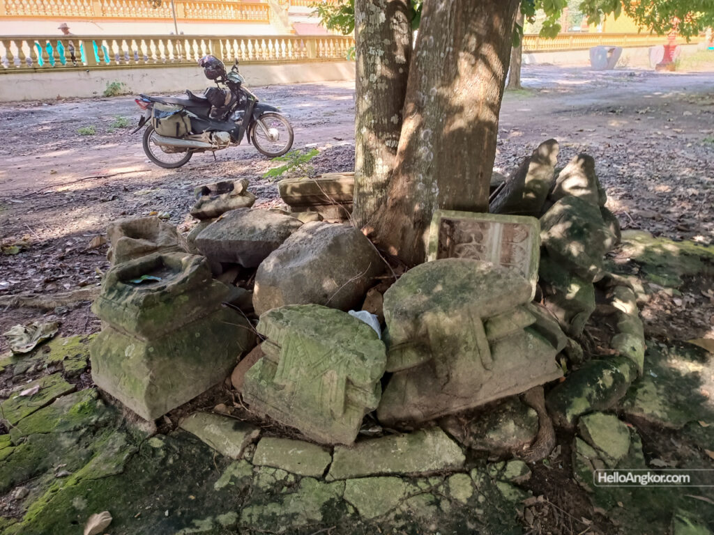
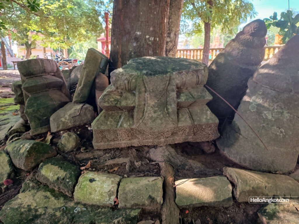
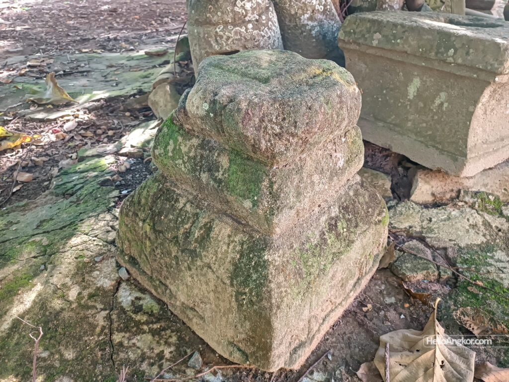
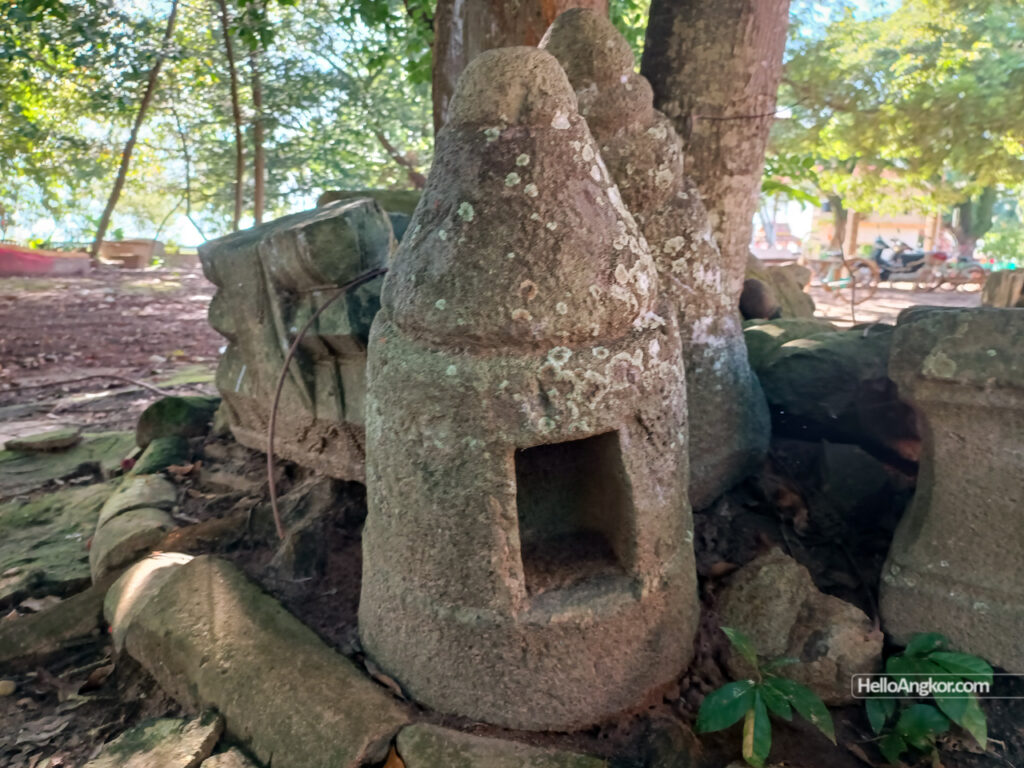
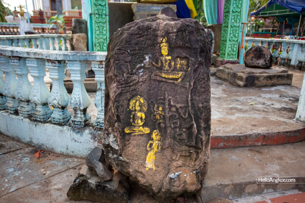
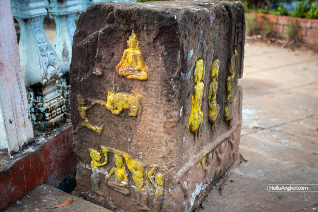
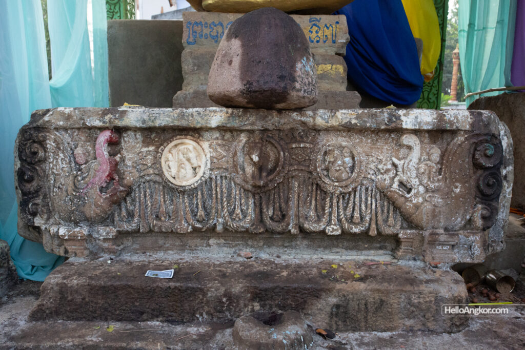
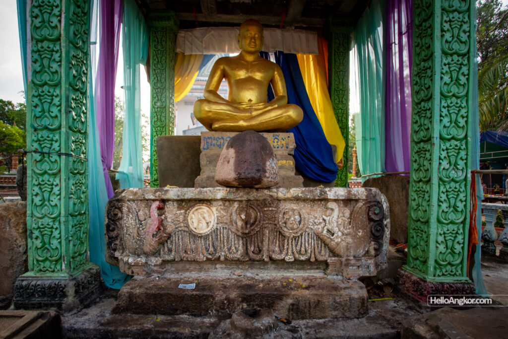
Wat Boeung Tbong – features an incredible collection of remnants. Some from a pre-Angkorian era site and some from a vihara that preceded the pagoda we see today. The lintel is fascinating, appearing to retain some stucco or lacquering and also for its era, the other remnants include base sema, leaf style sema, fragments of Buddha pedestals, uniquely carved plinths with a range of iconography, and another votive stupa similar to those seen earlier.
At Wat Chhouk Khsac, no remnants were seen but it appears to have once been an ancient temple site noting the surrounding basins. Just south is Wat Muniroth Nong Orm and also no remnants were seen. Not far from there are the remains of two Angkorian-era sites, Ta Pich Temple and Tuol Don Srei.


Wat Angkor Tung Knong – is a moat-surrounded mound featuring a small shelter with a contemporary Buddha statue, and a lot of remnants from an ancient Angkorian era temple and what appear to be sema pedestals and sema fragments which *may* also be from the 16th to 19th period.


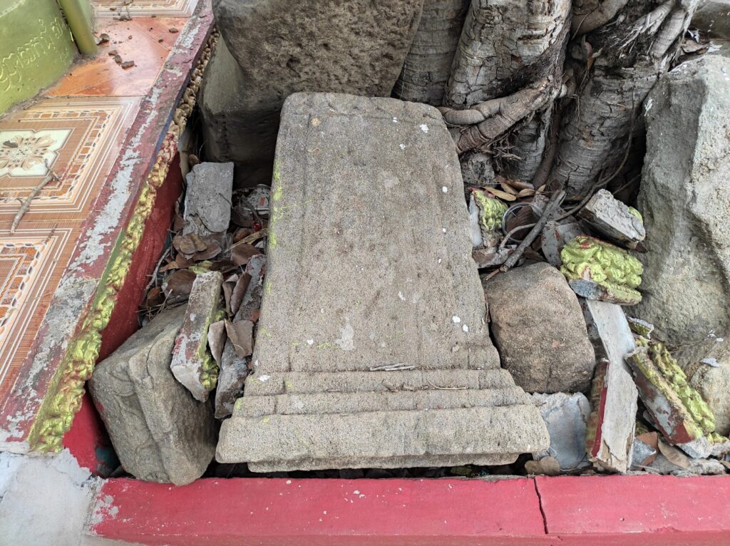
Wat Tnaot – also features a collection of ancient temple remnants, Brahma and a pedestal.
We’d continue south, drop by a series of other pagodas, and get some fresh photos of Kuk Nokor Temple, Wat Pong Chas which has a collection of ancient temple remnants, and once a piece of votive stupa but it’s not seen there anymore, and Wat Tang Kork.
Conclusion
Exploring old maps is really cool fun, but I don’t need to tell you that. As for Parmentier’s notes, there’s enough evidence to keep following that trail in the future. I was quite pleased to see so many artifacts originating from around the 16th to 19th century (by appearances at least) and hopefully, their preservation is maintained. It’s also an easy-going and enjoyable place to explore the local pagodas and village scenery.
Get the Ultimate Passport to Exploring Siem Reap
Essential Siem Reap - City & Temples 2026
Designed especially for short-term visitors, packed with local info and deeper insight, this guide puts you on the fast track to ticking off the city’s highlights & attractions, and local foods, with comprehensive info on the must-see temples of ancient Angkor. Read More
Essential Siem Reap - Explorer Edition 2026
Written for history explorers, culture seekers, and long-stay adventurers alike. It includes everything in Essential Siem Reap, plus expanded details on history, ancient art, architecture, all the remote temple highlights found in the outer districts, and more. Read More