

The ancient Khmer road network that we can still see the remains of today was built during the 11th to 13th centuries CE and connected Angkor (present-day Siem Reap) to the outer reaches of the empire including Vat Phou (present-day Laos) via Beng Mealea and Koh Ker, Phimai (present-day Thailand), Sdok Kok Thom (present-day Thailand), Preah Khan of Kampong Svay via Beng Mealea, and Sambor Prei Kuk.
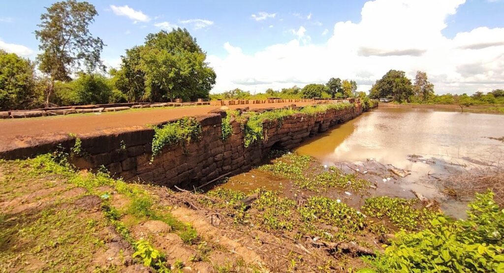
The road network provided communication, trade, and transport routes for foot traffic, elephants, ox carts, chariots, and likely great armies, via 1000km of raised earthen roads connected across rivers via over 100 masonry bridges ranging from the petite to the massive. Bridges ranged in size, most around 6-7 m wide and from 10 m long through to the largest, Spean Toap at 140 m long and 14.5 m wide.
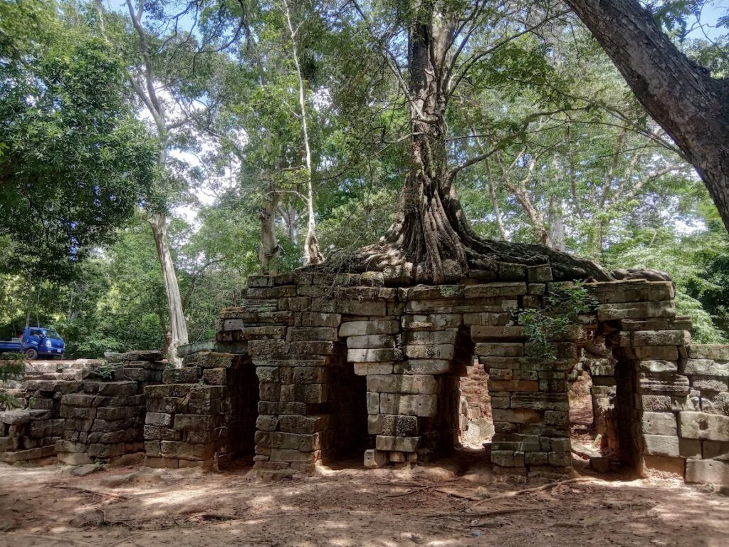
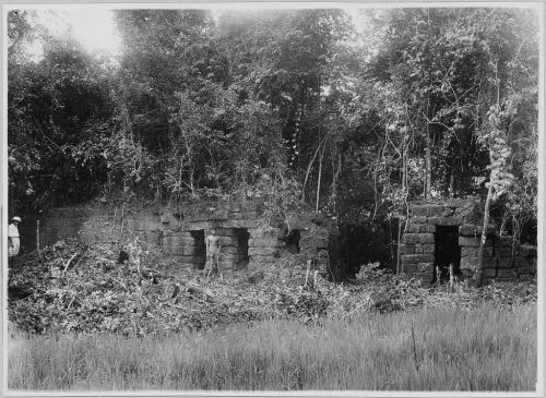
The road network was also complemented by water basins, and two specific types of “resthouse” temples known as the “Firehouse” and what the French researchers would call “Temples d’etape“, or stopping/staging place, all of which were typically grouped around bridges along the routes. Occasionally, another type of temple appeared along the route, being the “hospital chapel“. There are twenty-five recorded “Firehouses” that can be found in Cambodia, along with present-day Thailand and Laos likely providing travelers a place of rest and supplies with the area surrounding the temple shrine likely featuring lots of wooden structures to provide those services. There are nine recorded “Temple d’etapes” which are only found along the road from Angkor to Preah Khan of Kampong Svay.
When were the bridges and road network constructed? Researchers point initially to the likelihood, or necessity, of routes existing prior to the Angkorian era which were later built upon by Suryavarman l (1002-1050 CE) and Suryavarman II (1113-1150 CE) attributing them with some certainty the construction of bridges and the Temple d’etapes along the eastern route from Angkor to Preah Khan. They attribute later modifications of that infrastructure and the addition of Firehouses on the eastern and western routes out of Angkor to Jayavarman VII (1182–1218 CE).
The road network was mapped to some degree by French explorers as early as the 1900s and in more recent times by Asger Mollerup, Bruno Brugier, followed by the detailed works of Mitch Hendrickson. I’ll list those research papers below, and if the ancient roads and bridges interest you then I would strongly recommend reading those for deep insight into this often-overlooked marvel of the ancient Khmer Empire.
It’s also important to mention local explorers here too, including Sowanna Yun, Laurent Dambies, and Steve Lidgey who have pointed out one fascinating bridge located above Ta Nei temple that was completely missed on HelloAngkor’s map, and following Steve Lidgey’s Facebook page I think he may have also come across at least one possibly unknown bridge on one of his many epic bike rides!
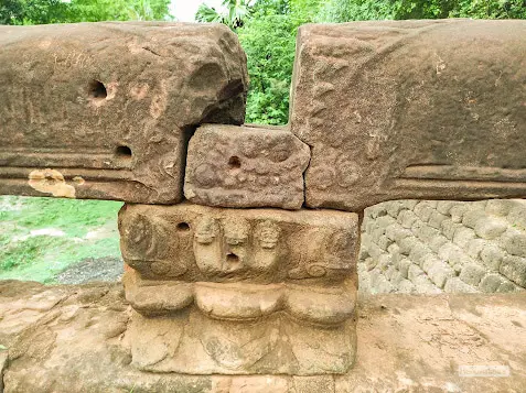
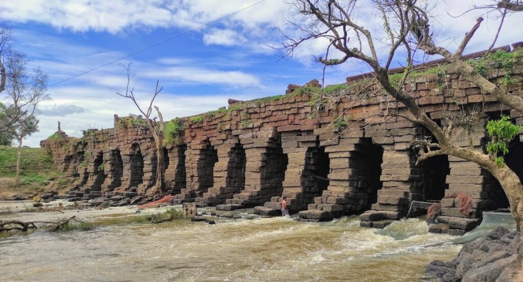
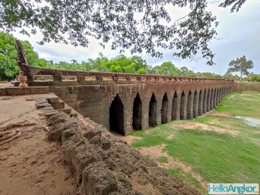
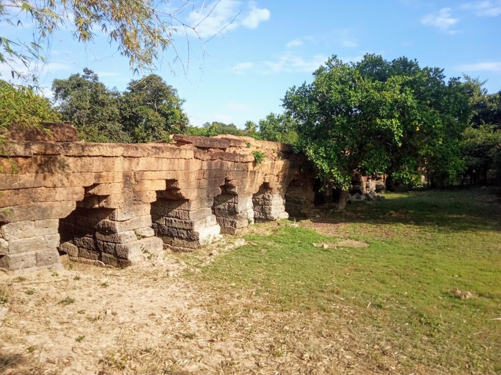
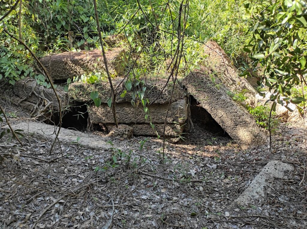
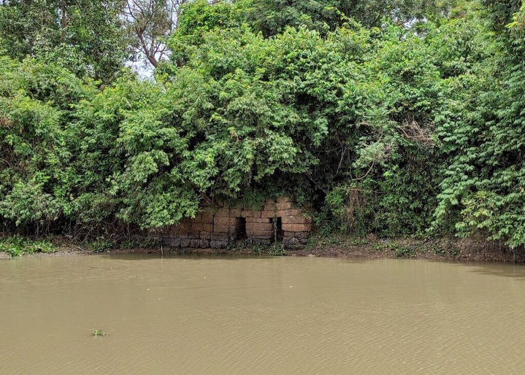
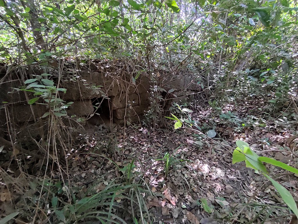
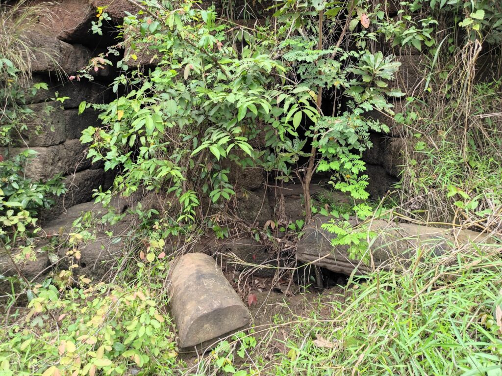
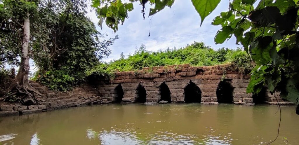
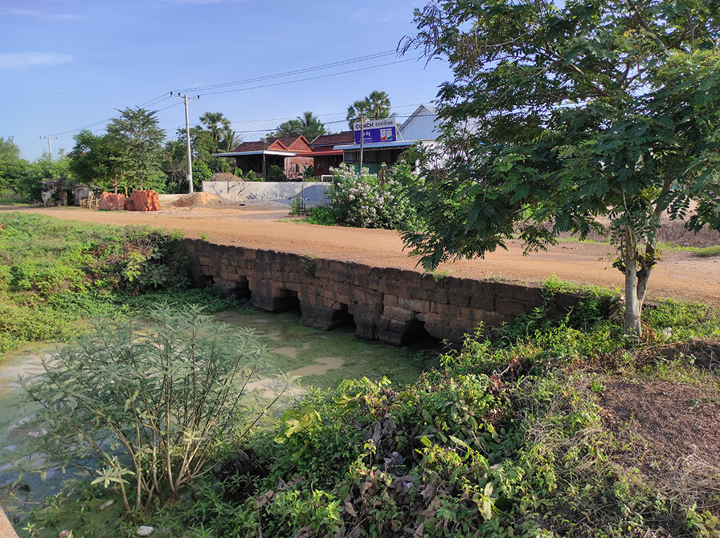
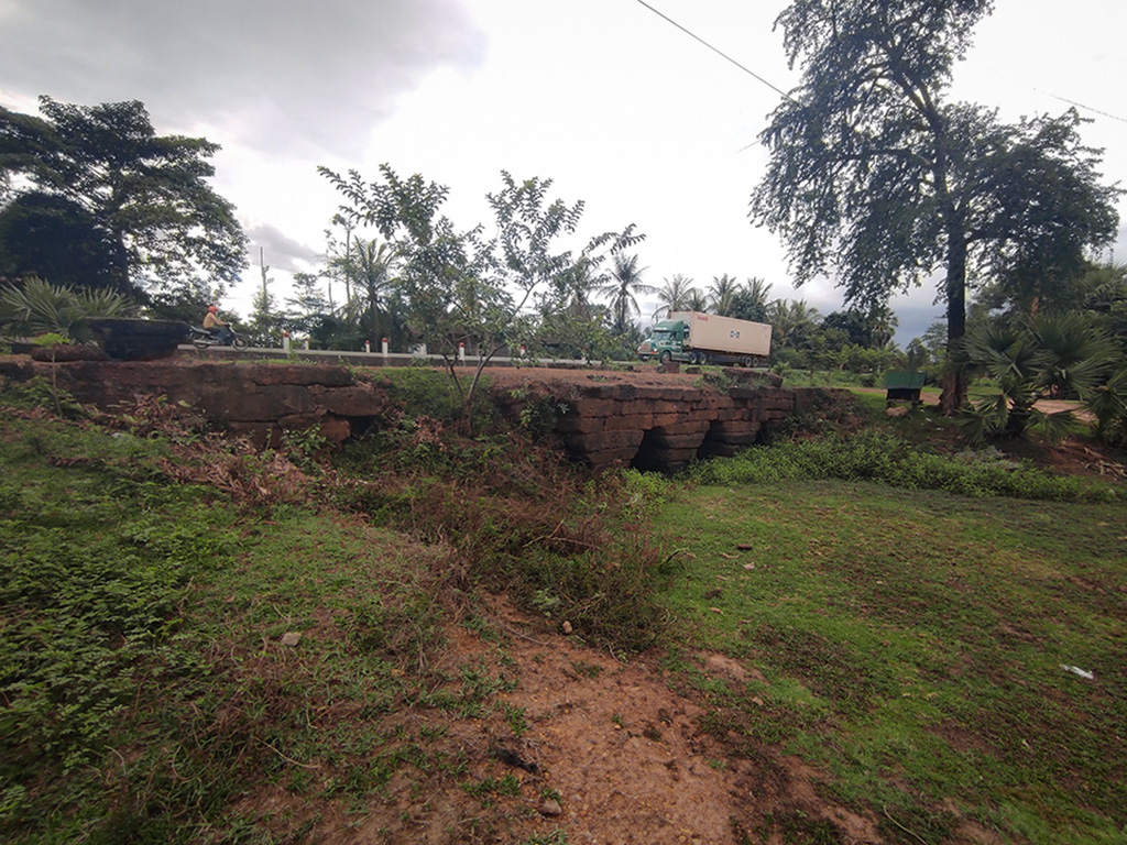
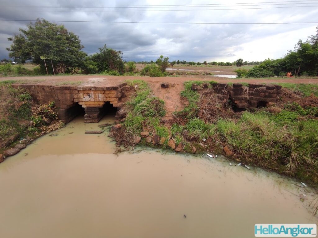
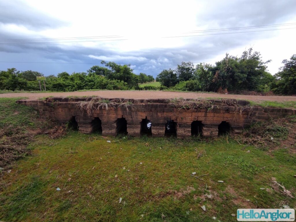
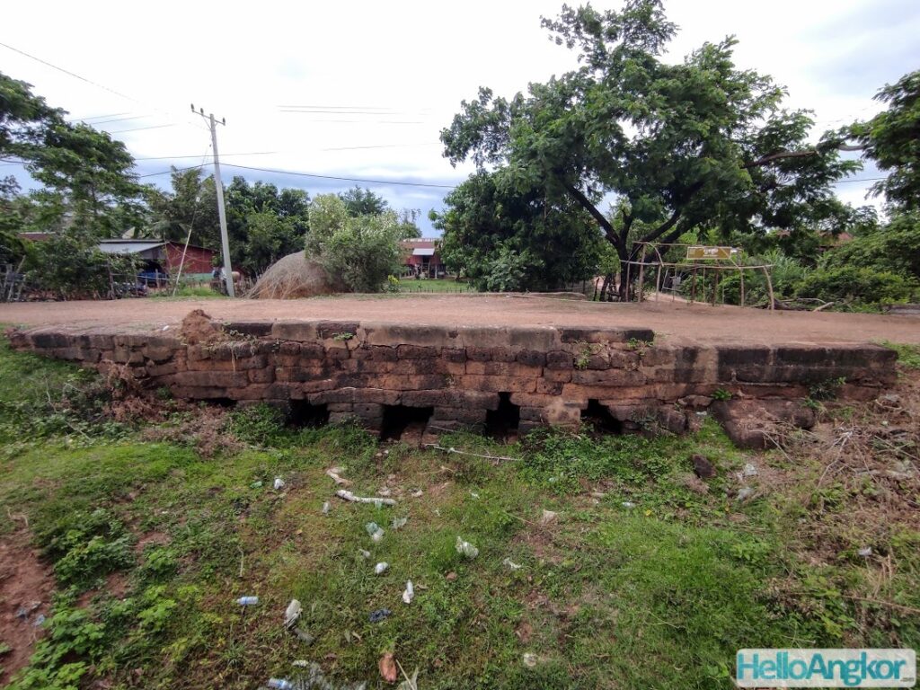
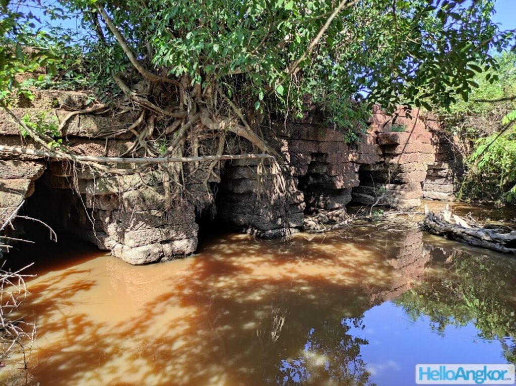
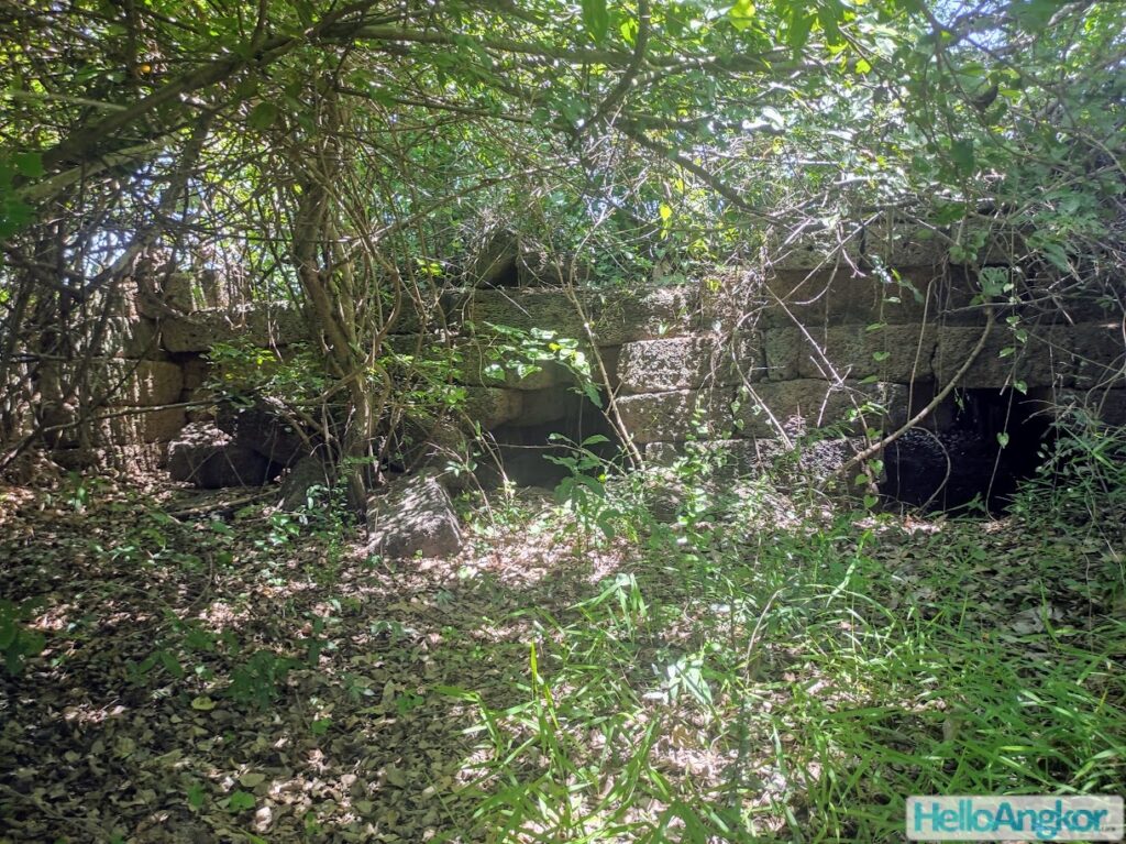
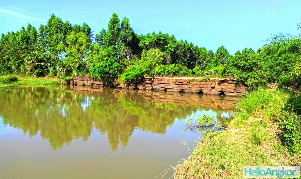
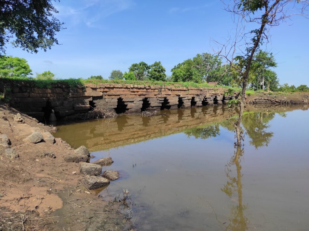
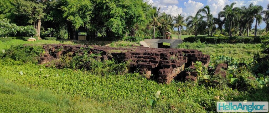
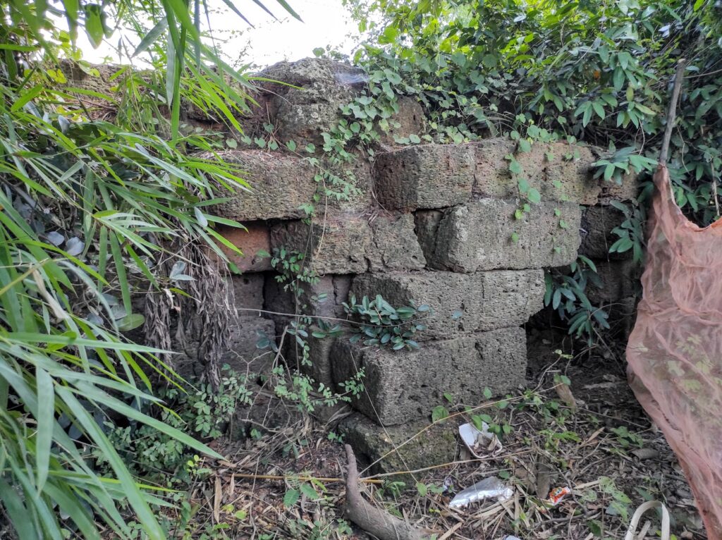
SO, back to bridges. Built of laterite (bar one) with sandstone embellishments, for the most part, they follow a very generic design of corbelled arches with piers the same width as the arches rising from a base of laterite set in the river bed with aprons that are sometimes angled and varied in size.
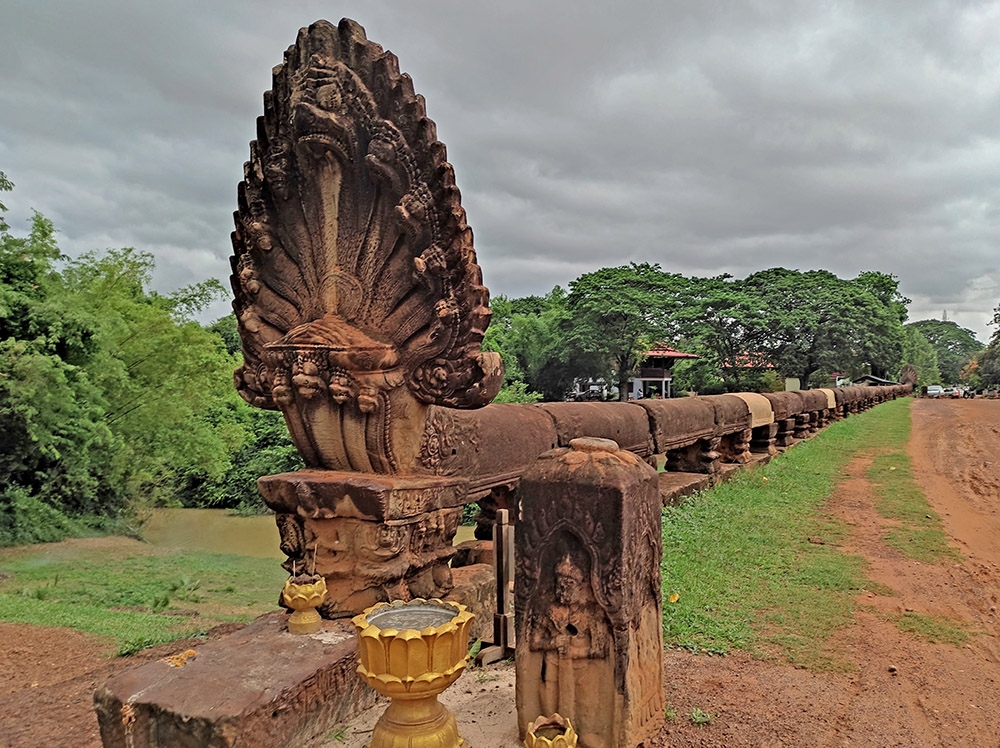
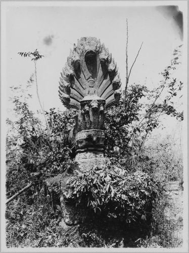
Atop the bridges, most still feature remnants of a sandstone balustrade railing and many still feature remnants of end-pieces decorating those balustrades being a large naga. The balustrades themselves feature decorative carvings particularly around the joins and the supporting pier, and especially so as it connects to the naga end-piece. Some bridges were also preceded by decorative bollards such as Spean Praptos.


An exception to that generic design is Spean Thmor near Victory Gate of Angkor Thom which is constructed from recycled sandstone blocks along with several bridges, such as Spean Tor, that do not feature corbelled arches and instead use a post and lintel design.
Bridge names often lead to some confusion. Spean is simply Khmer for bridge, as for the name of the bridge it can follow the village name, the nearby temple name, or use generic names such as Thma (or Thmor, meaning stone), Memay (or Memai meaning widow), or Khmeng (meaning young, but in this context probably meaning small).
The Big Three Bridges
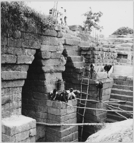
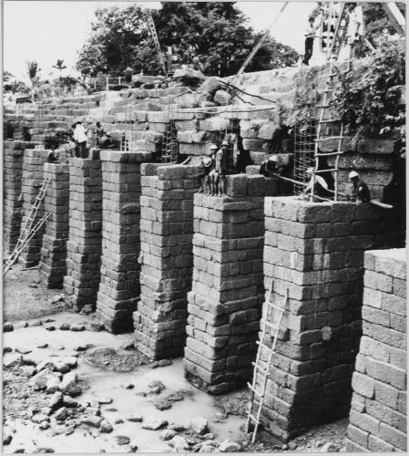
The three largest, most well-known, and iconic bridges of the ancient Khmer Empire are Spean Toap of Oddar Meanchey (140 m long), Spean Praptos of Siem Reap (86 m long) and Spean Ta Ong of Siem Reap (63 m long). Spean Praptos is the best-restored example and perhaps the most iconic of all also being featured on the nation’s 5000 Reil banknote. Spean Sreng (or Sraeng) was a 136 m long bridge but was lost to decay/development sometime post 1966 and only scant remains can be found on my last visit, there is a picture of the bridge under the historical photos heading further below. There are also the remains of a large bridge just north of Preah Khan of Kampong Svay.
Accessible bridges along the Ancient Routes
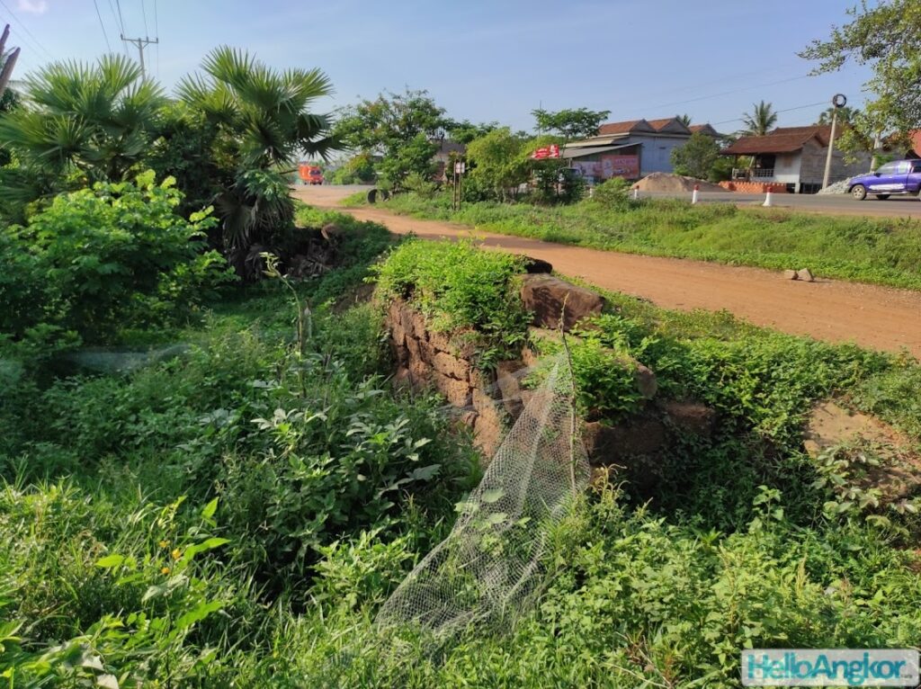
Some parts of the ancient road network are more accessible than others and access to some parts is seasonal. These routes have amazing potential to become valuable and incredibly scenic tour routes leading around the wonders of this massive ancient empire. I can imagine it being a great sense of national pride also. See here for a map and list of all the ancient bridges (known to me at this time) and the ancient Royal Roads.
Angkor Urban Area
Around the “urban core” of Angkor there are several bridges perhaps the most interesting being Spean Thmor.

Angkor <> Beng Mealea <> Khvav (and onwards to Preah Khan)
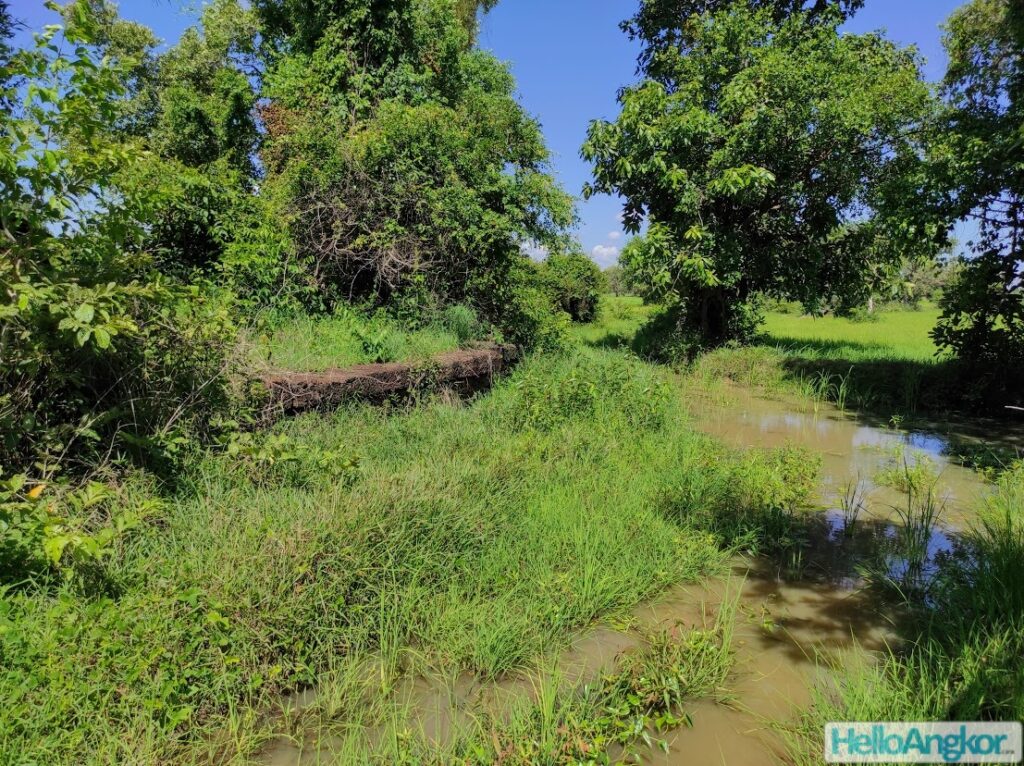
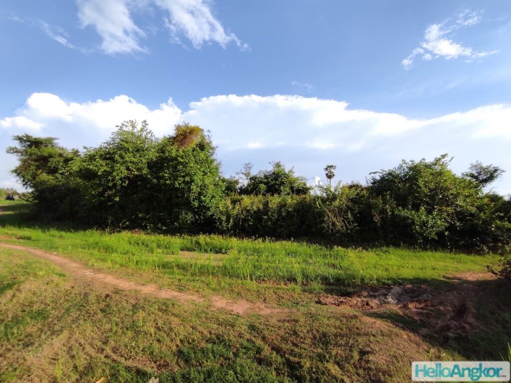
Angkor to Beng Mealea is a beautiful countryside route along red gravel roads covered here after which you can also follow the red gravel road to Khav taking in more bridges, firehouses, and temples d’etapes. The section from Beng Mealea to Khvav hasn’t been supplemented with a modern road and traffic including cars, trucks, and machinery still follow this same ancient route with the bridges still, somehow, withholding (barely). Further past Khvav to Preah Khan it becomes a seasonal moto trail that I hope to cover in detail soon.


Angkor <> Kampong Kdei
The lower eastern route (beginning after Roulous) is now replaced by the modern Road 6 which is covered here and perhaps the easiest way to encounter an array of bridges and the iconic Spean Praptos.

Angkor <> Kdei Ta Kom <> Spean Toap (and onwards to Phimai)
The ancient upper western road from Angkor to Kdei Ta Kom is not much more than a seasonal moto trail that crosses farmlands, although from nearby modern roads you can access most of the bridges easily and some smaller bridges via farmland with the goodwill of locals permitting. The Kdei Ta Kom group itself is easily reached by alternate modern sealed roads as is the magnificent Spean Toap and its surrounding bridges. There are still six + bridges on this route that will be added when accessible hopefully after the rice harvest.

Angkor <> Phnom Srok (and onwards to Sdak Kok Thom)
The road red gravel road here is atop a well-raised levee alongside a canal that is passable by moto or bike. Phnom Srok and onwards to be covered soon.


Historical Images
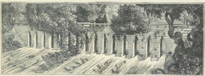
Spean Ta Ong (Ta-On) as illustrated by Louis Delaporte in his 1880 publication, Voyage au Cambodge

.
Restoration of Spean Praptos in 1966 – Photos property of EFEO

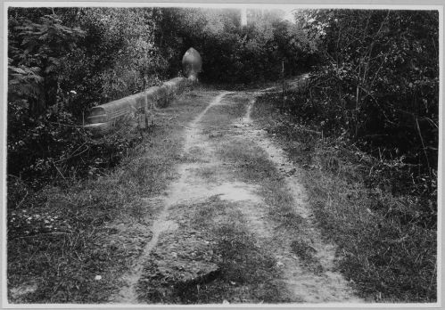
Photos between 1931 – 1934 some are undated – Photos property of EFEO


Further Reading/References
- Historic routes to Angkor: development of the Khmer road system (ninth to thirteenth centuries AD) in mainland Southeast Asia – Mitch Hendrickson
- ARTERIES OF EMPIRE: An operational study of transport and communication in Angkorian Southeast Asia (9th to 15th centuries CE) – Mitch Hendrickson
- Re-Appraising a Myth of the Angkorian Period Road System (Ninth to Fifteenth Centuries CE) – Mitch Hendrickson
- Les ponts en pierre du Cambodge ancien – Bruno Bruguier
- Consideration of the Construction Period of the Khmer Temples along the East Royal Road to Preah Khan of Kompong Svay and the Provenance of Sandstone Blocks Based on Their Magnetic Susceptibility – Etsuo Uchida et al
- Supply ranges of stone blocks used in masonry bridges and their construction period along the East Royal Road in the Khmer Empire, Cambodia – Etsuo Uchida et al
- The Dharmasala Route from Angkor Ta Muan, Phanom Rung to Phimai – Asger Mollerup
- Dharmacalas au Cambodge – Louis Finot
- Le Cambodge – E. Aymonier
- Untampered and intact ancient bridges to stay that way (Ta Ong) – Phnom Penh Post – 2017
- Ancient Bridge Repaired (Ta Ong) – Phnom Penh Post – 2021
- Authorities assess removal of soil from ancient bridge (Spean Toch) – Phnom Penh Post – 2019
Get the Ultimate Passport to Exploring Siem Reap

Essential Siem Reap - City & Temples 2026
Designed especially for short-term visitors, packed with local info and deeper insight, this guide puts you on the fast track to ticking off the city’s highlights & attractions, and local foods, with comprehensive info on the must-see temples of ancient Angkor. Read More

Essential Siem Reap - Explorer Edition 2026
Written for history explorers, culture seekers, and long-stay adventurers alike. It includes everything in Essential Siem Reap, plus expanded details on history, ancient art, architecture, all the remote temple highlights found in the outer districts, and more. Read More