
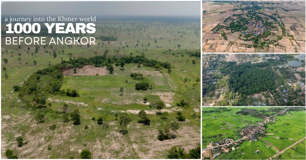
On the border of Siem Reap Province and Oddar Meanchey, the Srei Snam area of Siem Reap is a fascinating area to explore by motorbike with numerous ancient temples, interesting pagodas, charming countryside and the all important route of the ancient Royal Road that stretches from Angkor to Phimai.
More than all that, it’s also home to numerous, quite curious, circular sites. I highlighted some of the radial field clusters in the tour journal covering Tour T24: Siem Reap – Ta Moan Thom – Banteay Chhmar, and those sites would later become Facebook-famous for a minute or two, thanks to local influencers. I’ll come back to those sites towards the end of the post.
There was one other intriguing circular site further to the northeast, near the ancient Angkor-Phimai road, that I’d been wanting to visit for a long time after spotting it on Google Earth. On my first attempt, I tried to reach the site from Kok Mon temple (circa 12th-13th century), following the ancient road in part, but that was impossible due to the relentless deep sand. On another attempt, coming from the same direction during the rainy season, the whole area was cut off by flooding. On the T24 tour in September 2024, I tried to reach the site from Preah Phnom Temple (circa 10th century) and got fairly close before finding the whole area to be flooded.
Come May 2025, on the tail of the dry season, I would try again, and this time my colleague Chanthim would come along too. Starting from Preah Phnom village, it’s a deep sandy trail that is almost exclusively for local Kubota tractors, but we’d push through that and the heat, and make it without too much trouble.
Here’s where things get interesting, we’d run into a local farmer and ask if he knew anything about the site. He did. He knew it to be a very ancient village site and that no one lives there now, ending by stating “As for wild animals like pigs or deer, I don’t know for sure. Ask the people over there”, OK :).
So off we went. After meeting another local farmer, he pointed us in a totally different direction. We soon learnt there was more than one ancient village site. This would suggest that researchers have been here before and identified sites, but any public record of that has been impossible to find. We knew where the circular site was; it’s easy to see on the map, so we headed that way.
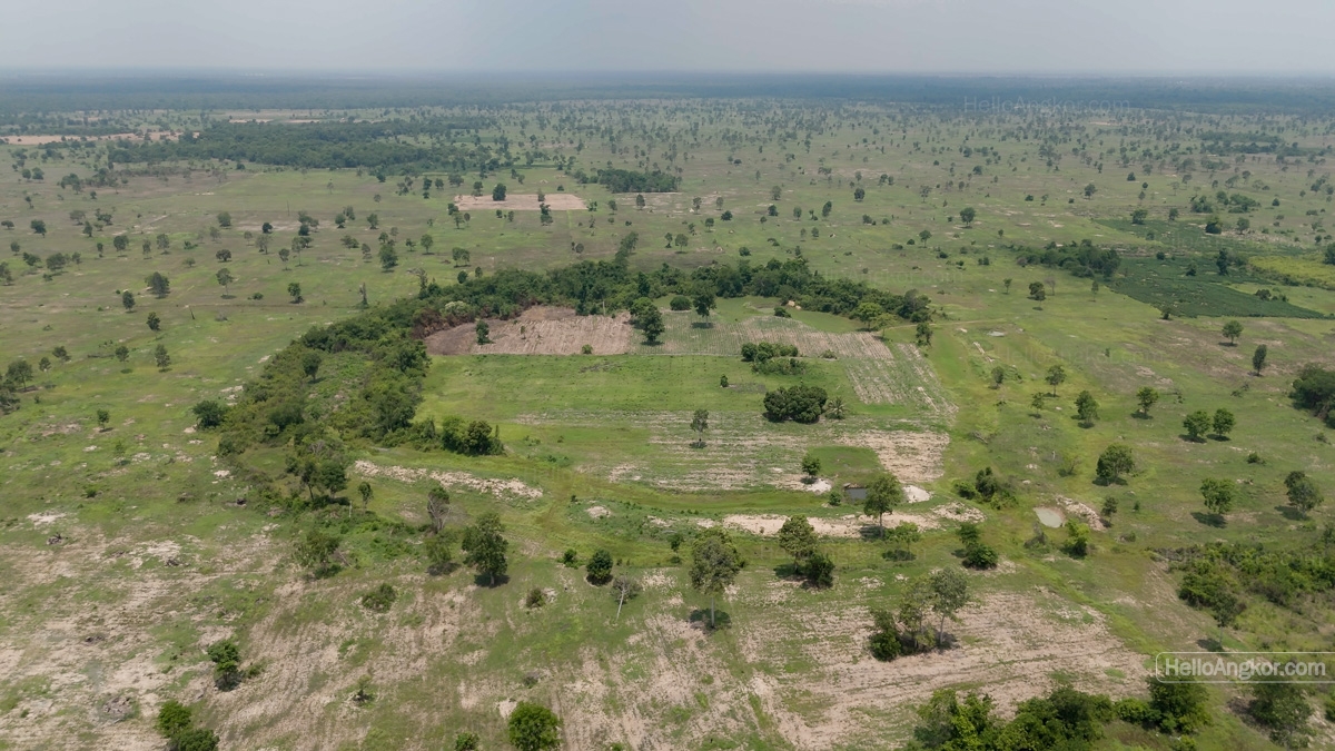
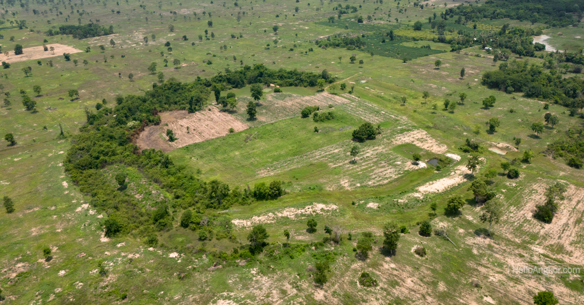
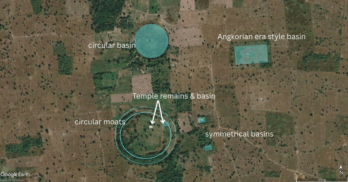
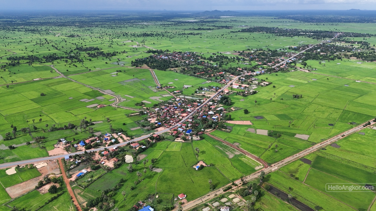
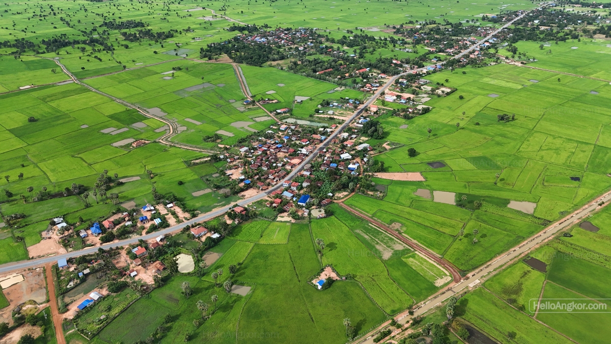
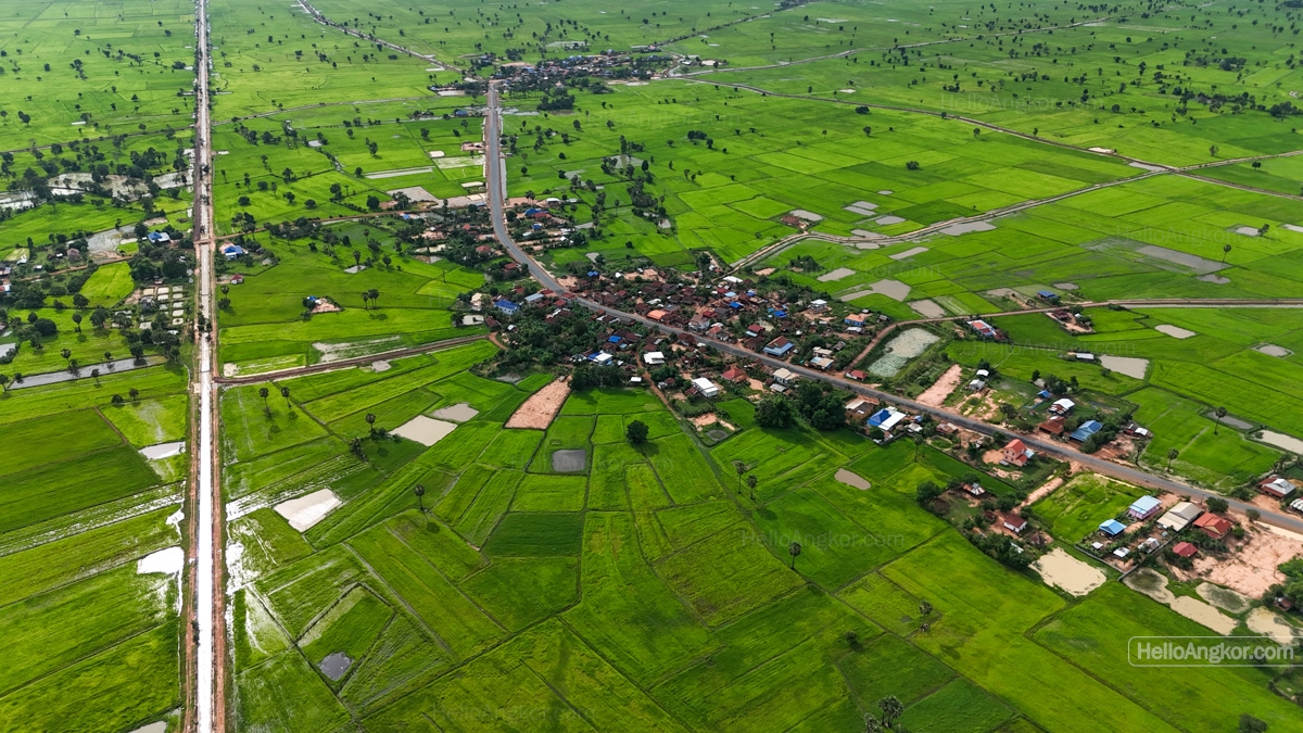
Nearby, we found a shady spot and took some drone footage of the circular site and what looks like an Angkorian-era-style basin to the northeast. Note the shrubbery clearance on the bank. I really do wonder if there is some yet to be documented archaeological work. Then we bumped into another farmer. He led us over to the circular site to show us the remnants of an ancient brick temple, which was a bit of a surprise, as it was actually located inside the moated area. For sure, Khmer temple sites have moats, but not gigantic circular ones 🙂
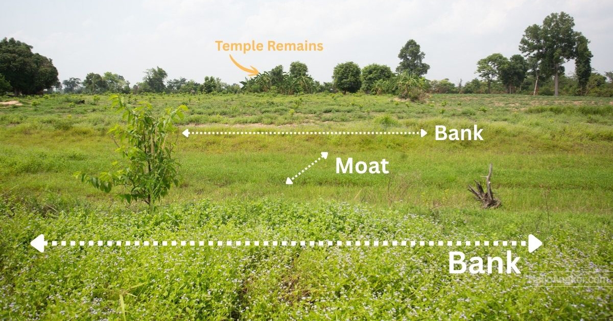
Inside the seemingly double-moated circular site, positioned in the northern half of the moated area, it’s a small area, uncleared and overgrown by palms. It does have a distinct rise, and laterite blocks can be seen along with a scattering of bricks. The chalky nature of the bricks makes me think of pre-Angkorian sites, but that’s not more than a guess. Given the sign of laterite, it likely points more to the Angkorian era. There’s also the possibility that the material may be repurposed from elsewhere nearby to create a new site, as was the trend with Buddhist sites in the late/post-Angkorian era.
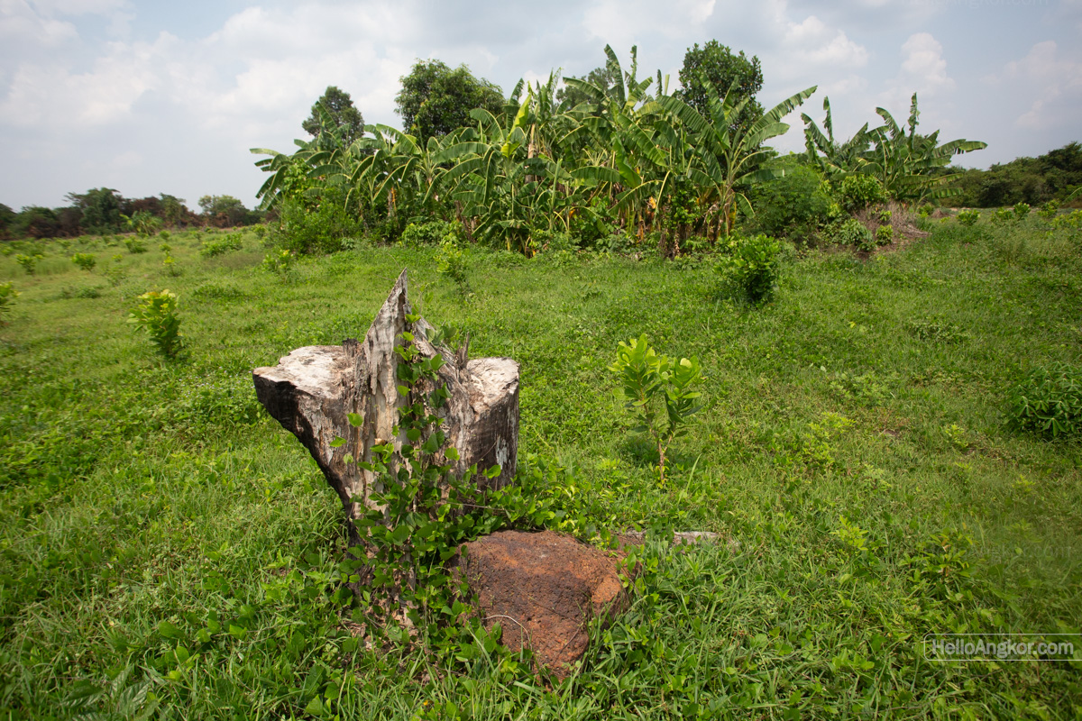
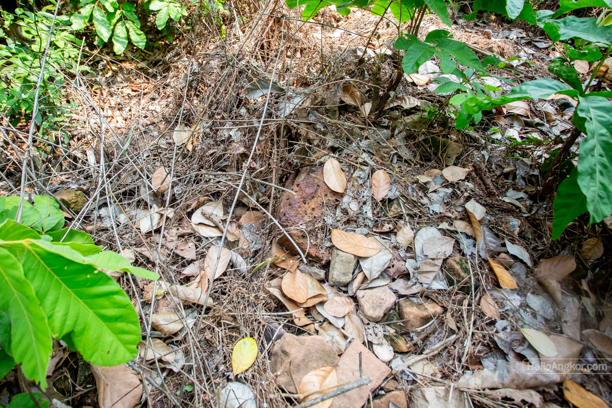
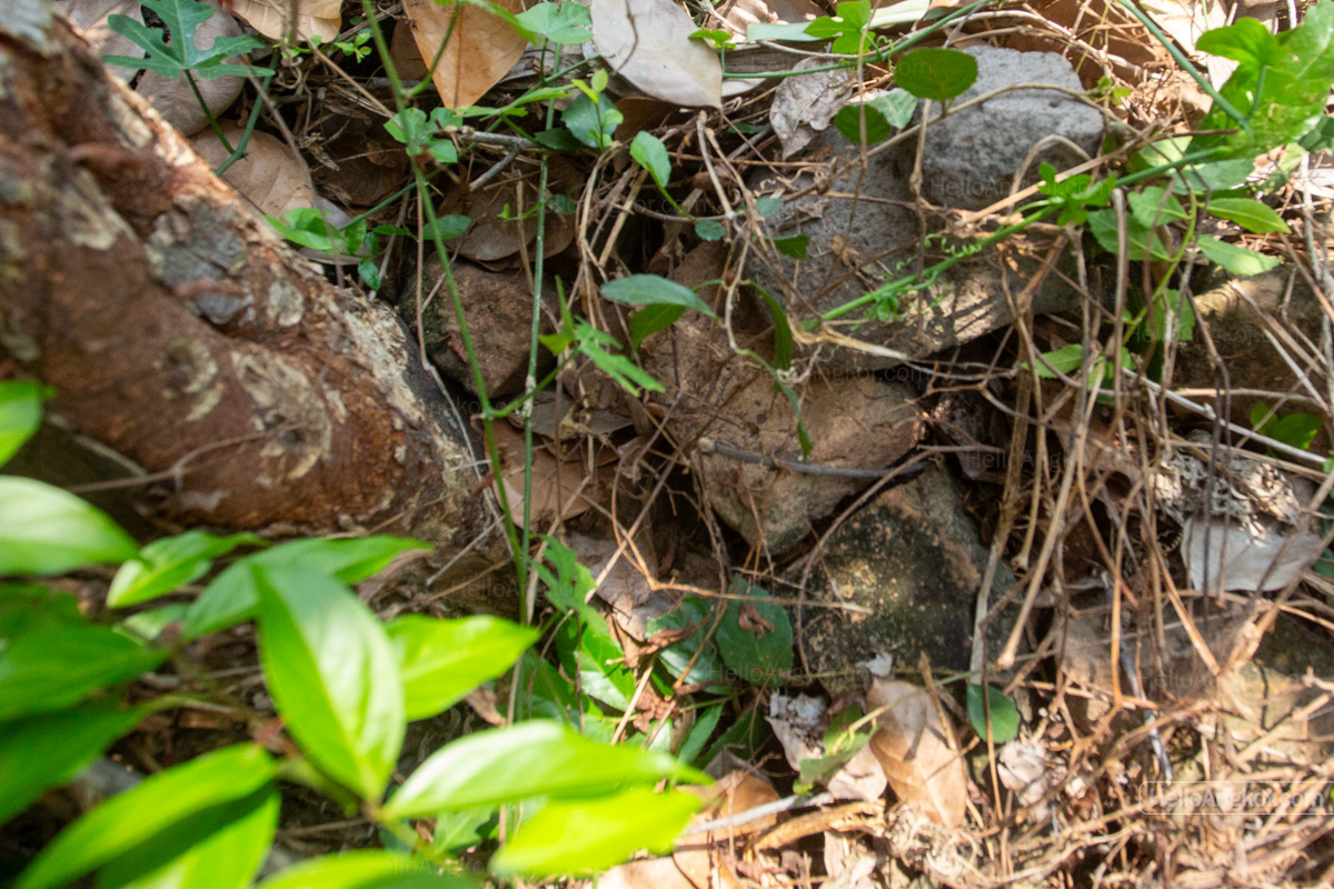
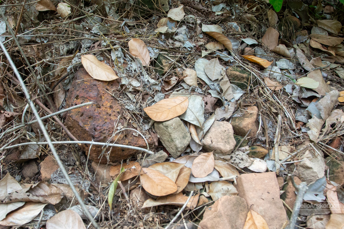
Immediately east of the site, an outline of a rectangular basin can be seen, which actually cuts into the inner moat. Outside the moated area on the east side, there are two symmetrical square basins. To the north, there is a densely overgrown, but the farmer suggested there was nothing to see in there, so we left it be. To the northeast is a larger “Angkorian-era style basin”. To the north is a circular basin. These round and semi-round basins litter the broader landscape, and one could also be curious about those.
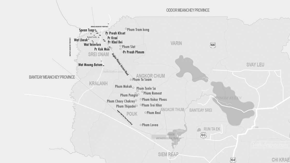
Overall, the area has a collection of clues that indicate the area is something interesting, something with a bigger story to tell. I’ve mentioned a lot of points of interest, so let’s visualise them all. In the image below, Preah Phnom village is to the south, and Phum Slat is to the east-northeast, and Kon Mon temple and the ancient road are around 4km to the east.
Near Kok Mon temple, there is another circular moated area which is intersected by the ancient road, and 1.5km to the north is the outline of what might be another circular site. Keep going another 10km northwards, at Phum Tram Kong, there is the outline of another. The more you keep looking, the more you find.
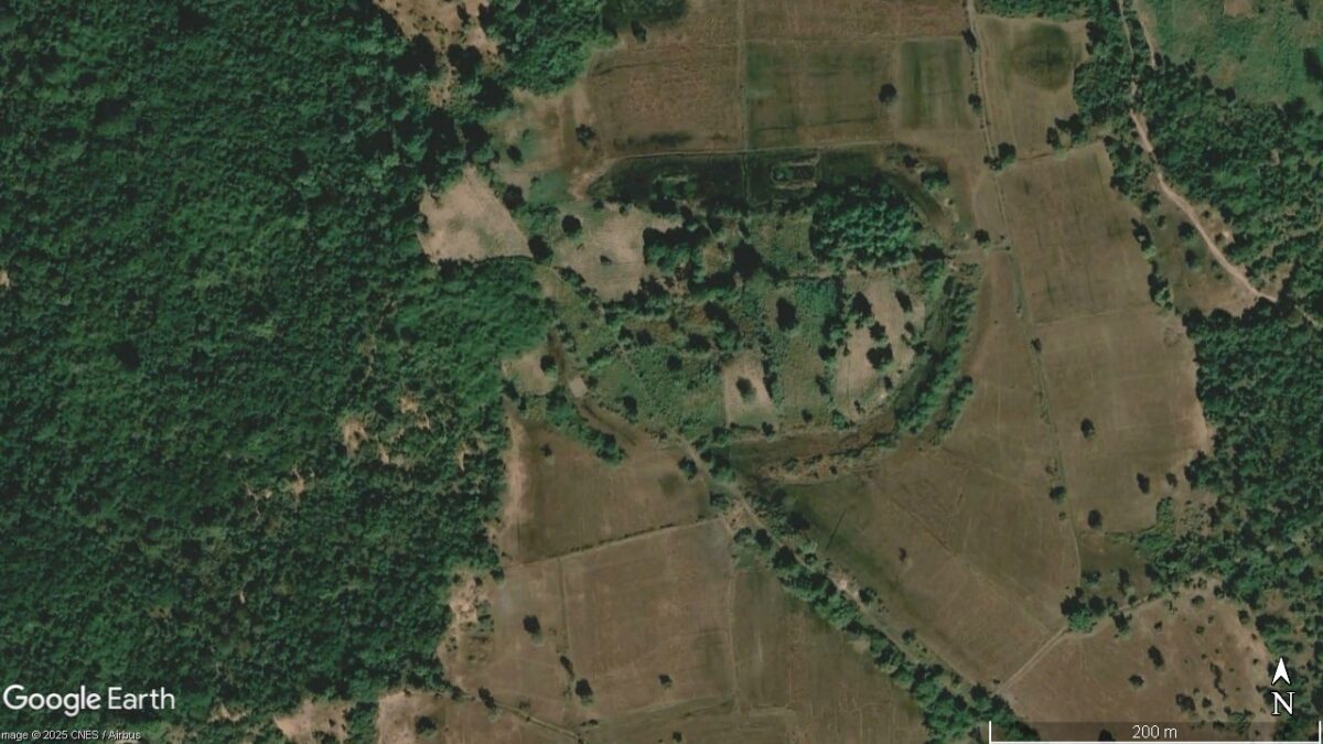
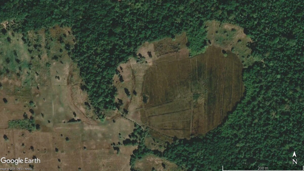
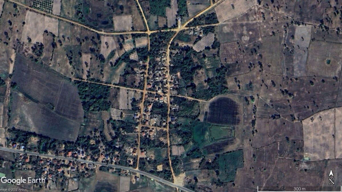
As for the moated circular site. What is its story? Does it have an ancient story?
First, let’s get our bearings on the timeline of prehistoric times to ancient times of Cambodia and the larger region. This is a little long-winded, but many people may find it surprising that Angkor Wat, for example, is a relatively modern addition to the Khmer timeline.
The foundational research into prehistoric Cambodia and the greater region does have a good body of published research, including that of Ea Darith, Chhay Rachna, Chhay Visoth, Heng Piphal, Im Sokrithy, Phon Kaseka, Thuy Chanthourn, Heng Sophady, Tep Sokha, An Sopheap, Elizabeth Moore, Dougald O’Reilly, Louise Shewan, Charles Higham, Alison Carter, J.P. Carbonnel, Paul Levy, Miriam Noel Haidle, and Scott Hawken, among others. Full bibliography at the bottom of the page.
Timeline of Ancient Cultures and Developments
Paleolithic – Neolithic (c. 60,000 – 2000 BC)
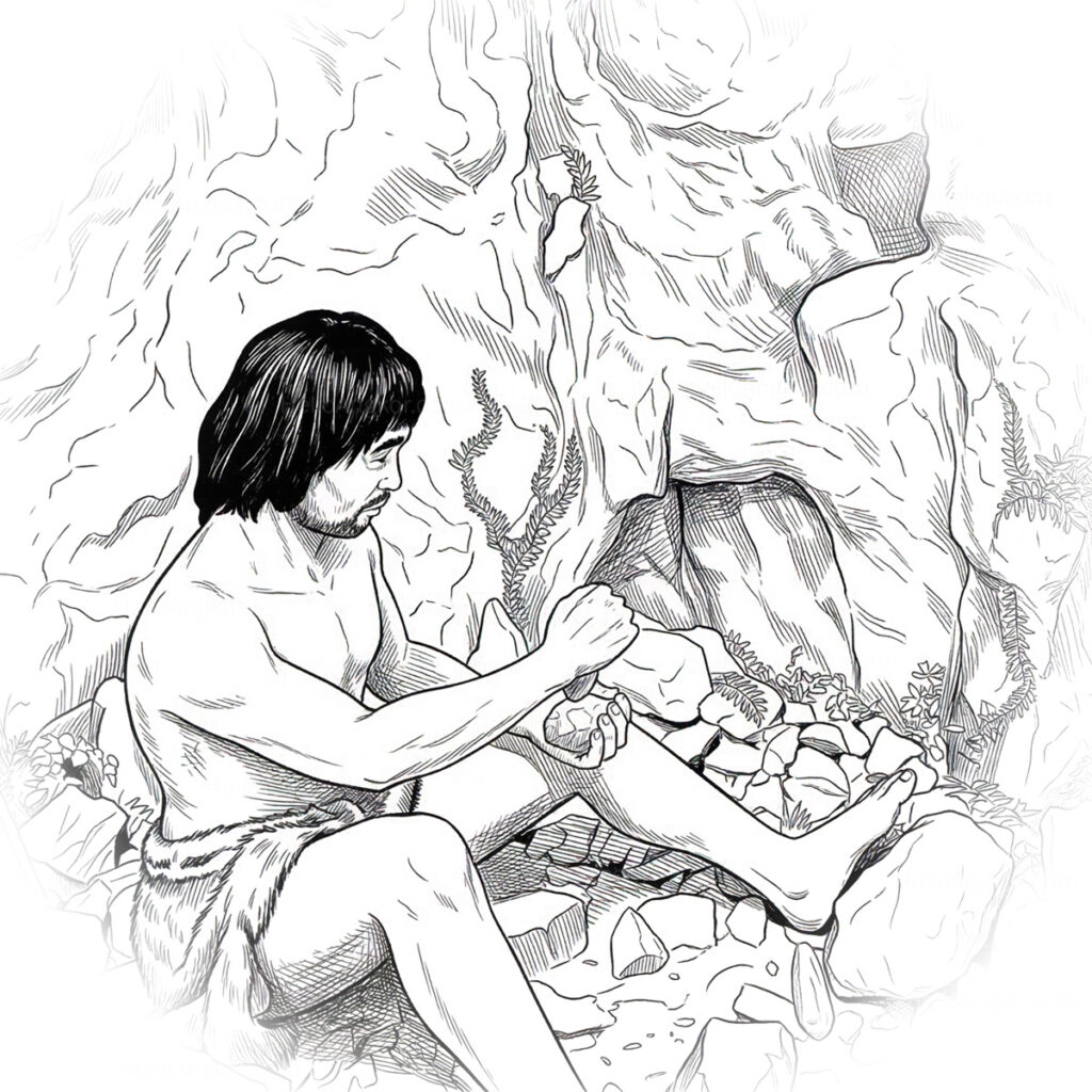
Small, nomadic groups of hunter-gatherers occupied caves and rock shelters, with a famed example being Laang Spean in Battambang Province, Lang Rongrien in the former Khmer territories, and Houay Pano in Laos.
Developments were dominated by what is called the Hoabinhian tradition, characterised by flaked pebble tools and other stone tools known as sumatraliths.
The excellent museum in Battambang features an exhibition dedicated to the Laang Spean site, including some of the rock tools discovered. It’s also possible to visit the site itself. It’s heralded as the largest prehistoric cave site in Cambodia.
Neolithic (c. 2000 – 1200 BC)
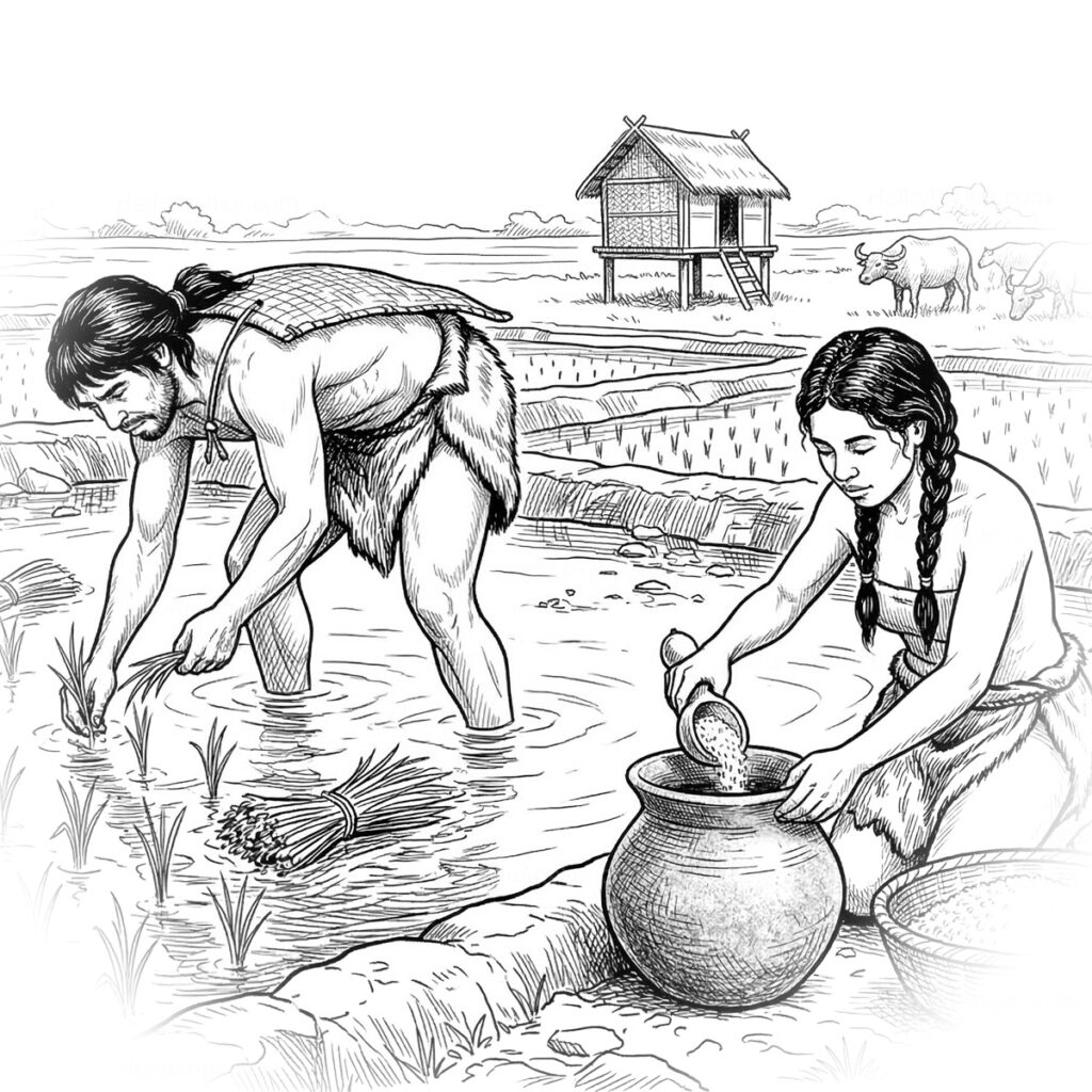
This era is typified by rice and millet farmers likely migrating from the Yangtze Valley and the Yellow River plains, introducing settled village life in a transition from nomadic hunter-gathering. Researchers also find sophisticated incised and cord-marked earthenware, polished stone shouldered adzes, and lithophones (stone musical instruments). They are thought to be the original farmers of the region, giving birth to the “Water Harvesting Moated Sites”, which we will come to discuss further on.
Meanwhile, early Austroasiatic (Mon-Khmer) speakers who migrated down from the Red River or Pearl River regions would give rise to the famed circular sites of what would be labelled Mimotian Culture. The Mimotian Culture developed circular “doughnut-shaped” villages on the basaltic plateaus of eastern Cambodia and western Vietnam. The most notable sites are Banteay Meas (often referred to as the Groslier Site), which is a well-studied circular settlement dated to c. 1930 BC-1690 BC, and another site inventoried as Krek 52/62 that was originally interpreted as a Neolithic defensive structure and later reclassified as a community settlement.
The Mimotien Culture sites are described as independent, small community settlements of cooperative farming. The French researcher, Bernard Philippe Groslier, was the first to excavate these sites, hypothesising they were created by “proto-Khmer people”. They shared a highly homogeneous “terre rouge” (red soil) tradition, characterised by uniquely similar pottery compositions and lithic toolkits. Their lifestyle centred on a diversified economy incorporating cyclical and regenerative land use, flood-recession rice farming, and hunting.
Non-circular and cave sites in this era include Samrong Sen (Kompong Chhnang Province), Mlu Prei (Preah Vihear Province), Phnom Loang (Kampot Province), and the Laang Spean site that we mentioned earlier also shows occupation extending into this era.
It’s important to note the burial traditions that were uncovered that are distinctly different from those of present-day. The deceased were typically interred lying flat and facing upwards, together with pottery vessels, stone adzes, and shell beads.
Bronze Age (c. 1200 – 500 BC)
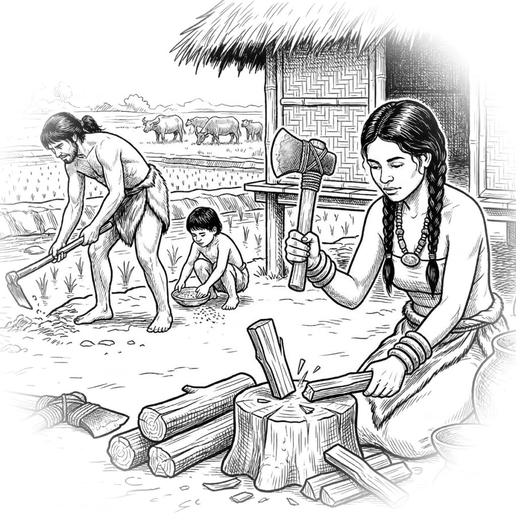
Introduction of copper-base metallurgy. Researchers note that communities were engaged in regional exchange for marine shells and exotic stone. Example sites of this era include Koh Ta Meas, which is one of the most significant Bronze Age sites discovered in what would later become the Angkorian heartland, specifically located within what is now the West Baray.
Mentioned earlier, Samrong Sen (Kompong Chhnang Province), Mlu Prei (Preah Vihear Province), Phnom Loang (Kampot Province), and the Circular Earthworks / Mimotian Culture (Kampong Cham Province) extend into this time period as well.
Evolving Burial rituals grew from being inurned with only a few pots to include dozens of decorated vessels and thousands of shell beads. A trend that continued into the next era.
Iron Age (c. 500 BC – AD 500)
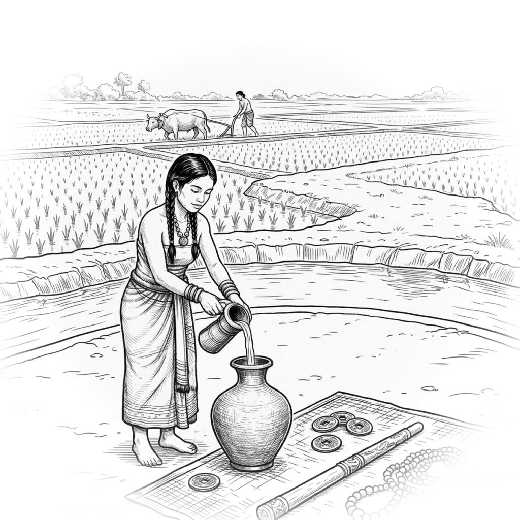
Noted by researchers as a transformative period of rapid social complexity and population expansion that saw a proliferation of circular sites. Hundreds of moated sites were constructed in the former Khmer regions in present-day northeast Thailand, and to a lesser extent in present-day Northwest Cambodia.
In Cambodia, the most well-known circular site from this era is the Lovea site, which consists of an elevated central habitation mound measuring approximately 210 meters (north-south) by 312 meters (east-west), encircled by moats. It is noted for its burial sites that were active between c. 100-400 AD, and rice fields radiating outward from the central mound.
Burial practices continue to evolve with the appearance of rich burials (e.g., the Lovea, Koh Ta Meas, Phum Snay and Prohear sites) containing bronze weapons, bronze drums, carnelian beads, and iron tools. Covering the head with a bronze bowl is seen at some sites, as is seen across Mainland Southeast Asia.
Transition to Early States (AD 100 – 800)
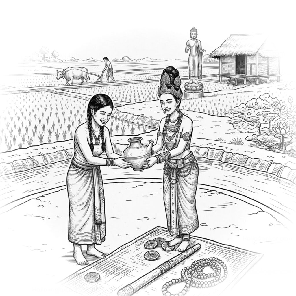
Around this time, maritime trading that centred on Angkor Borei and Oc Eo would pave the way for the spread of Indic systems and beliefs and give birth to the Funan era (AD 100–550).
What’s fascinating is that excavations at the circular sites like Lovea and Phum Snay revealed exotic goods such as glass beads, carnelian, and Chinese coins, indicating that these native inland communities were active participants in these long-distance trade networks. It’s around this time, as new beliefs were adopted, that burial traditions would evolve, and as it remains to this day, cremation would become the standard.
Research points to a smooth transition of existing developments and settlements into the growth of the new empire. Circular landforming would give way to the linear landforming that would continue through the Chenla and Angkorian periods.
The massive Cheung Ek circular site, according to research, likely originated as a large “round village,” possibly contemporary with the later developmental stages of Angkor Borei. Research has identified its peak period of activity extending into the Chenla Period (c. 550-802 AD) as a major ceramic production centre with 61 identified kilns and 11 recorded temple foundations in the area.
More interesting revelations come from the Hindu-Buddhist brick temples that are often found to be constructed directly atop prehistoric burials and pre-existing settlements, such as at Prei Khmeng, Angkor Borei, Thala Borivat and other sites. Research here suggests a deliberate and harmonious merging of ancestral worship and native ancient ways with newly introduced Hindu and Buddhist concepts.
It’s quite fascinating that ancient ancestral worship, a pivotal part of present-day Khmer culture, has its roots all the way back to the earliest archeological records. In my mind, it reemphasises the unique Khmer culture and its true depth, evolving by layering and homogenising rather than being transformed.
When I was studying for the Ancient Cambodia book, it became apparent that the Khmer weren’t “Indianized” in the absolute sense that the word may imply. Rather than being subjects, they layered new beliefs and became unique co-developers of Hindu-Buddhist art, architecture, and belief systems. A wonderful topic for another day, let’s not go down too many rabbit holes.
Angkorian Period (AD 802 – 1431)
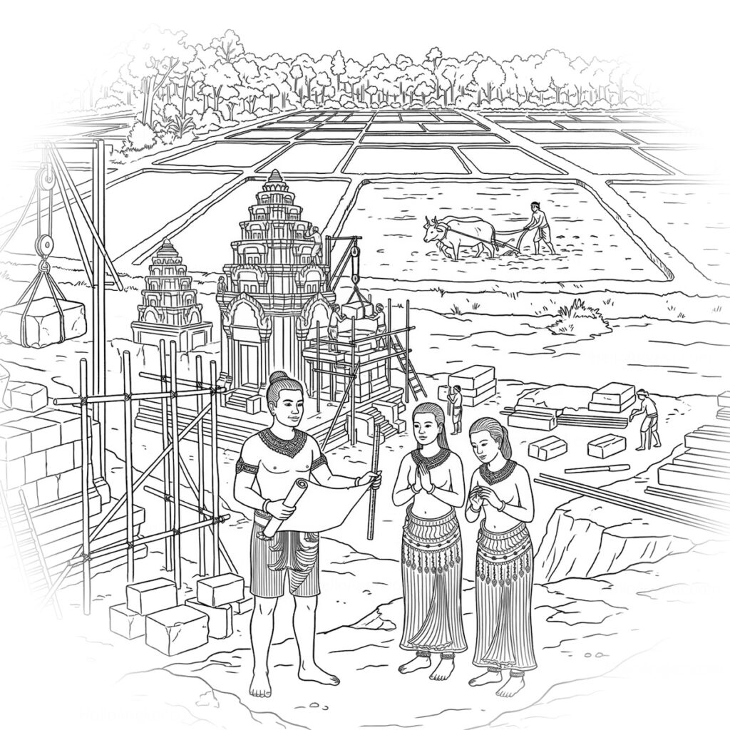
At the Iron Age Lovea site we mentioned earlier, excavations also revealed Angkorian-period stoneware and glazed ceramics in upper layers. Analysis shows that the site was heavily modified during the Angkorian period, including the formalisation of the central mound into a rectangular shape and the addition of a characteristically Angkorian-era basin.
At Baksei Chamkrong in the heart of Angkor, an underlying prehistoric Iron Age settlement was discovered on the northern side of the Bakheng hill. Likewise, the major Angkorian center of Phimai was also built atop a long-term prehistoric sequence. Excavations beneath the central sanctuary revealed a pre-Angkorian brick structure and, even deeper, Iron Age burials.
The three cases alone reemphasise the incredible continuity from prehistoric beginnings through the Funan, Chenla, and Angkorian Eras to the present-day.
Regional Comparison of Ancient Circular Sites
While early circular sites (Mimotien), found in Kampong Cham, were perfectly round, residential and focused on defence, the Iron Age circular sites, found in northwestern Cambodia and present-day Northeastern Thailand, were irregular and functional in providing water harvesting via one or more outer moats. As we’ll come to, the purpose of the moats at the latter sites remains a matter of debate.
What’s truly fascinating about all of these circular sites is that they represent a transition from hunter-gatherer societies to settled, rice-farming communities long before the first stones of Angkor were laid. Moreover, it expands the amazing story of the Khmer people.
To help understand what our circular site in Srei Snam may or may not be, based on research, let’s get our heads around the known circular sites and their transitions.
| Site Type / Culture | Time Period | Regional Location | Development Type & Key Differences | Cultural/Burial Practices & Artifacts |
|---|---|---|---|---|
| Mimotien Earthworks (e.g., Banteay Kou) | c. 2300 – 300 BC | Cambodia: Kampong Cham (Memot, Krek). Vietnam: Binh Phuoc (Loc Ninh). | Settlement: Permanent villages with outer walls and inner depressions; not for water storage. | Incised pottery, stone adzes, lithophones, and early glass bangles. |
| “Water-Harvesting” Moated Sites | c. 400 BC – AD 500 | Present-day Thailand: Northeast Region, Mun/Chi River Valleys (Nakhon Ratchasima). | Hydraulic: Concentric moats following natural mound contours to store water for irrigation. | Phimai Black pottery, iron forging, burials with bronze helmets, and “rice-bed” burials. |
| Angkor Plain Mounds (e.g., Lovea, Reul, etc) | c. AD 100 – 400 | Cambodia: Siem Reap (Puok). | Cemetery to Town: Initially burial mounds; later modified with moats for water management. | Extended burials with carnelian beads, bronze rings, Chinese coins, and marble bangles. |
| Territorial Moated Sites | c. AD 500 – 1000 | Present-day Thailand: Northeast Region (e.g., Mu’ang Sema). | Administrative: Larger, non-topographical enclosures linked to early Khmer state formation (Sri Canasa). | Transition to Buddhism, carving of sima stones, and use of Dvaravati-style art/statues. |
| Large-Scale Earthworks (Cheung Ek) | c. AD 700 – 800 (Pre-Angkorian) | Cambodia: Kandal/Phnom Penh (Cheung Ek). | Industrial Hub: Massive (770m) site with internal kilns; transitional to linear Angkorian forms. | Large-scale kiln-fired pottery production, pre-Angkorian lintels, lingas, and glass bead trade. |
For the remainder of the article, we are going to focus on these circular and semi-circular moated sites that fit into the three central classifications noted in the above table.
In 1998, Elizabeth Moore documented and identified two main types, water-harvesting and territorial. She noted that these prehistoric sites were “original, almost an ‘organic’ adaptation” to local topography, deriving their contours from natural mounds and stream meanders. They were often irregular in shape, varying in size and featuring one or more moats. Sites without moats were noted, and some circular sites were noted to have moats only visible via radar data. Recent research in 2016 (Duke et al), using Ground Penetrating Radar at a site in Nong Hua Raet village (present-day Thailand), showed that soil shifting over time had visually erased the ancient moats, a point worth keeping in mind when analysing sites via Google Earth alone.
How many of these moated sites are there?
In 1998/99, Elizabeth Moore and then, a decade later, Charles Higham, recorded over 150 sites in present-day Northeast Thailand, while in 2015, Dougald O’Reilly and Glen Scott recorded almost as many again. In 2024, Areerut Patnukao integrated GIS and spatial analysis to analyse a dataset of 468 moated sites that he suggests indicates an intentional spatial organisation by ancient communities. A 2024 study by Hong Yang et al, applied a deep learning model to identify moated sites via satellite imagery, producing 629 targets, 116 probable moated sites in NE Thailand and a small number of sites in other regions (only an abstract of the study is available currently).
Sites in northwest Cambodia are not so well documented, apart from Phum Lovea and Koh Ta Meas (possibly a circular moated site).
In a 1998 paper, Elizabeth Moore highlighted more than 11 sites within the Angkor area. One of those is the well-known Phum Lovea site, and heading north, Phum Real, and then several more extending northward to the village of Phum Ta Soam, and this is where things get interesting. The three sites we pointed out in Srei Snam share that same axis. She also pointed out two sites in the Roluos area, one at the northeast corner of the Indratataka Baray, known as Kouk, or Kroes Don Ev, and another in Phum Spean Kaek.
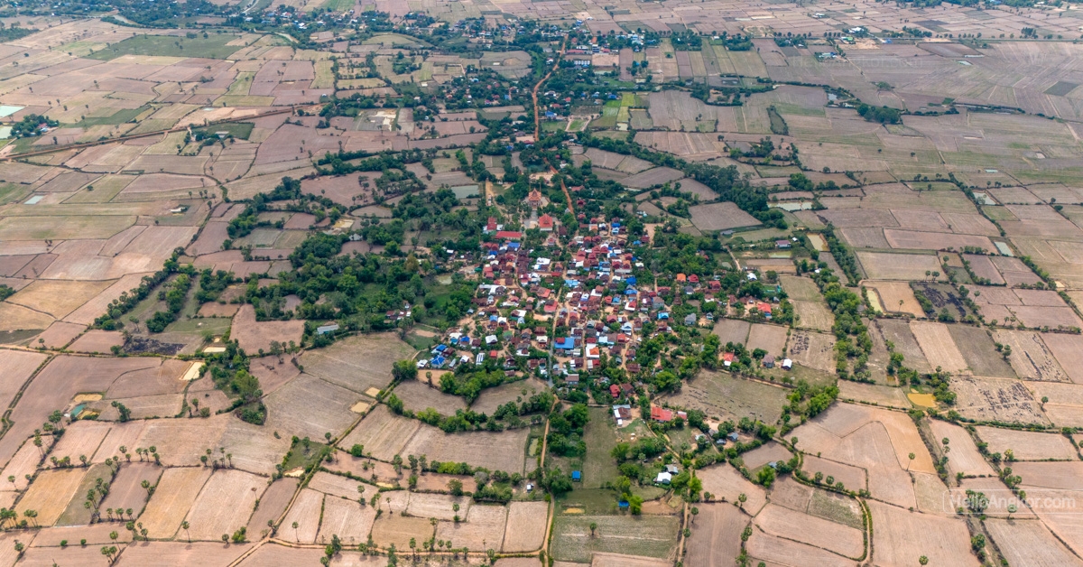
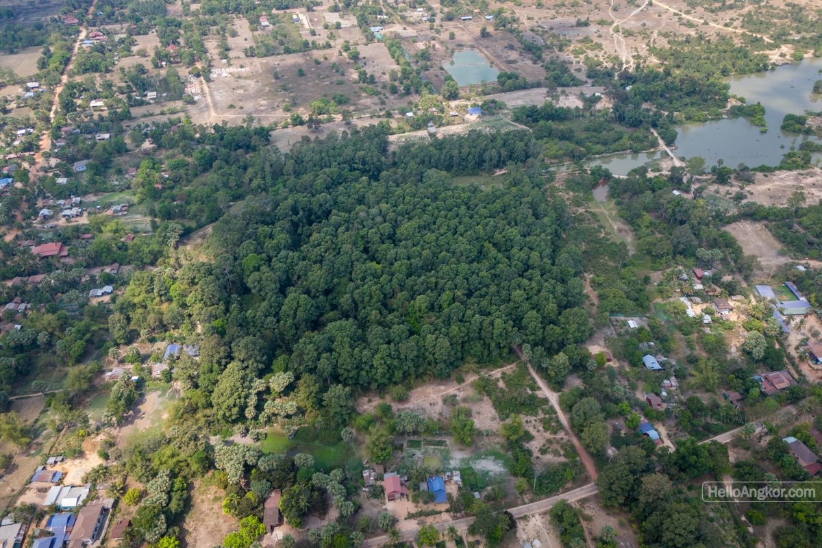
Why Construct Moated Sites?
Some researchers point to a need for water management due to a shifting climate, while other research points to a social hierarchy. In a 2015 study, Dougald O’Rielly presents several theories considered by researchers, including
- defensive purposes – to slow an enemy’s advance (or wild animals?)
- agricultural purpose – used to either grow rice or to irrigate surrounding fields
- symbological – as a statement of power or cosmological belief
- flood mitigation – protecting the site from inundation
- water storage – to preserve water in times of drought/dry-season
Occupation & Burial Traditions
The occupation and population of prehistoric circular moated sites is recognised by researchers as a difficult and “highly speculative” task, as the land use, residential vs. ceremonial, within the mounds is often unknown. In early research by Elizabeth Moore, she suggested a typical moated community might range from roughly 800 to 1,250 people. Charles Higham suggested a similar figure of 50 people per ha, and that the Ban Chiang Hian site, present-day Thailand, could have accommodated 2000 people.
Research at Koh Ta Meas, an assumed circular site approximately 180 meters in diameter, currently submerged beneath the water of the West Baray at Angkor, presents one of the earliest known occupations of the Angkor plain, with radiocarbon dates placing activity in the Bronze Age (c. 1219–897 BC). Between 23 and 27 recognisable graves were recorded with items including earthenware jars, bronze mirrors, and twisted wire bronze bangles. Notably, the population practised tooth avulsion (intentional removal of canines and lateral incisors), a tradition also seen at the nearby Prei Khmeng site.
The Prei Khmeng site, located at the southwest corner of the Western Baray, was revealed by researchers to have had an occupation period from the Iron Age through to at least the 11th century AD. Whilst not recorded as a circular moated site, water management is noted in its evolution. Twenty grave sites were recorded featuring iron tools, ceramics, glass and stone beads, and metal jewellery. The practice of tooth avulsion was noted here too.
Phum Lovea on the other hand is an Iron Age circular moated settlement located northwest of the West Baray that was initially occupied in the 1st or 2nd century AD. Excavations recovered 12 to 14 graves dating between 100 and 400 AD. Here, the grave goods included iron agricultural tools (sickles, knives), bronze jewellery, and glass, carnelian and agate beads. Notable finds include a Chinese coin from the Wang Mang period (7–23 AD) and a repaired marble bangle.
Excellent displays on the findings at Koh Ta Meas, Prei Khmeng, and Phum Lovea can be found at the Preah Norodom Sihanouk-Angkor Museum.
Research in present-day NE Thailand, at Noen U-Loke, a massive circular mound with five concentric moats, revealed it was occupied entirely within the Iron Age. Many burials were interred in clay-lined grave cuts filled with rice, a tradition mirrored at Prei Khmeng but absent at Lovea. At Ban Non Wat, 600 burial sites were recorded across twelve distinct mortuary phases with occupation from the Neolithic period through the Iron Age.
Considering the number of recorded sites, and those yet to be discovered in Cambodia, in my mind, it feels like we are still in the very early days of discovery of a very exciting field of research.
Rice Production
At both Cambodian and Thai circular moated sites, the inclusion of agricultural tools (sickles, digging implements) and rice in graves underscores the reliance on wet-rice cultivation.
Research points to the low banks demarcating the surrounding rice fields, used for managing irrigation flow, that were contemporary to the forging of iron ploughshares. The introduction of these iron ploughshares and iron sickles is noted to take place in the transition to the Iron Age (c. 200 BC – AD 400) which also saw the use of water buffalo and cattle for working the rice fields.
Research by Cristina Castillo, Dorian Q Fuller and others has noted the rice being cultivated was Japonica. Japonica, or more commonly known as sticky rice, would later be superseded by Indica rice varieties around the time of the emergence of the Funan era. Indica varieties (such as Jasmine rice) remain the staple of the region today while sticky rice, or Japonica, is preferred for specialty dishes.
Evolution and Continued Use
The transition to the Funan era (around the 1st-6th/7th century AD) saw these landforms become influenced by Indic urbanisation, eventually replaced or incorporated into the more linear geometry of the Angkorian era.
In studying the Dvaravati Buddhist sites of the Khorat Plateau, Stephan A. Murphy identified 45 moated sites, dating the Buddhist activity at those sites between the 7th and 11th centuries AD. He notes that the passage of Buddhism likely followed the river trade routes, and whilst inscriptions were rare, they carried the Mon, Pali, Khmer, and Sanskrit languages.
For context, it wouldn’t be until much later that the Tai-speaking peoples of southern China began migrating to the area, starting around the 8th century and more substantially between the 11th and 13th centuries.
Research at the Phum Lovea site revealed occupation continued through the Angkorian period, during which the central mound was modified into a rectangular shape oriented to the northeast. The site remains inhabited today.
Regional Trade Networks
The trade element is a fascinating layer to everything so far. Recent studies by Alison Carter at Phum Lovea, Prei Khmeng, and Phum Sophy (Banteay Meanchey Province) have led researchers to propose a “Mekong Interaction Sphere”. Archaeological discoveries revealing similar items, such as ceramics and beads, reveal a trade connection between these inland sites and the coastal communities (Angkor Borei and Oc Eo), which gave rise to the emergence of the Funan era.
Beads would turn out to be the most informative, with rare glass types found at Prei Khmeng strongly associated with Middle Eastern production. Meanwhile, ceramic discoveries indicate connections between the inland sites and the Mun River Valley area (present-day Thailand), which we have mentioned earlier.
Srei Snam District – an Archaeological Wonderland & Potential Tourism Hotspot?
If I were an archaeologist, this might just be a dream destination. In the greater area, there is the ancient road that connected Angkor to Phimai, which retains several ancient bridges, a “firehouse”, related basins plus numerous temple sites from the Angkorian-era. Not far from the ancient road is the possible prehistoric circular site in question, which also features “kiln” like mounds, Angkorian-era basins, and brick remnants of a temple site curiously situated within the moated area. Not far away is another circular moated area and another again. To the south, there are curious radial irrigation fields and more remnants of further Angkorian-era temple sites. There are innumerable other temple ruins and maybe even some post-Angkor heritage too.
Let’s come back to those radial fields I mentioned in the article opening. They are in Klang Hay Commune, around 15km west of the Phum Slat site and the assumed north corridor of moated sites. It’s something curious as to where they may fit into the whole schema. In a 2011 paper by Scott Hawken, they are illustrated as part of the numerous rice-field patterns, but are not commented on in any detail. There appear to be numerous all clustered in this one area, and some are undeveloped.
Visualising all the POI’s mentioned inc. Srei Snam and the “North Corridor” of sites from Phum Tram Kong to Lovea. (The base map layer is from Essential Siem Reap and Ancient Cambodia.)
Could the district be developed into a tourism hotspot? It already has an important section of the ancient road network, as mentioned here on this website, and by many others, the remaining undeveloped roads are a potential tourism gold mine of the future, if preserved. If these circular sites are archaeologically investigated for their true nature, then the possibility opens up to bring them back to life as a cultural tourism zone that spans the prehistoric through to the 13th century of the Angkorian Empire, if not beyond. Not easy by any means, but a lot easier now, rather than moaning about it after the area becomes commercially developed.
Why write and share all this?
As per the opening chapter, this site had been sitting in the back of my mind for many years. After going there, I had to know more, and what a fascinating journey of discovery that was in itself. The Khmer timeline is much, much more than just the temples we admire so much, and let’s hope that there is a lot more discovery on the topic to come our way.
In conclusion, let’s take a look at the circular site of Cheung Ek, near Phnom Penh. Studied by Phon Kaseka & Tep Sokha and others in 2007 (which we should all be thankful for), presents a very interesting story. A large circular site covering 35 ha that features an earthen outer wall formed from the creation of the inner moat. Phon Kaseka connects this wall feature and its characteristics, something not seen at the circular sites in the Angkor area, with the Mimotien sites of the Kampong Cham area. Important ancient pre-Angkorian kilns were discovered at the site along with 11 temple sites in the greater surroundings. Here’s how it looked in 2017 and how it looks today in 2026.
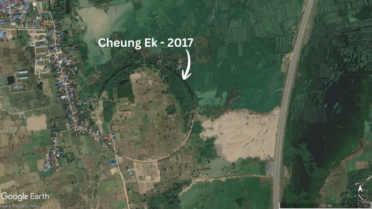
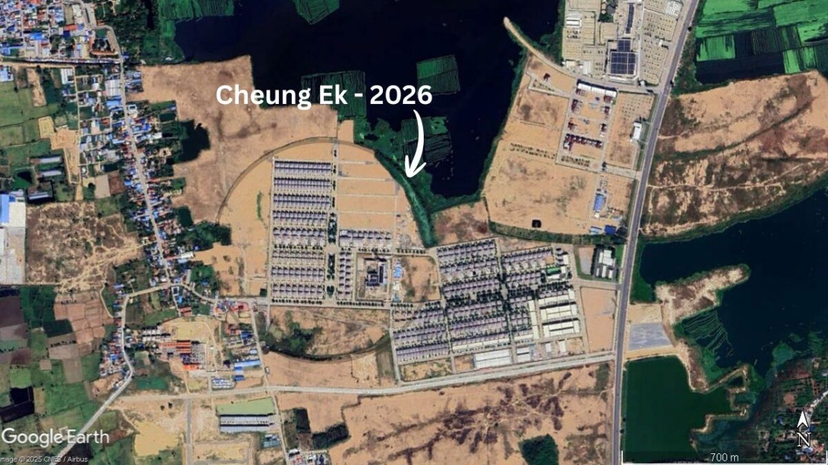
Cambodia will surely rise above current conflicts and troubles and get back on an upward GDP trajectory. It now hovers around 4.5-5% growth, and some reports see that growing to 6.7% in under two years. Growth numbers like that change the face of the earth before you can blink. It’s good news, and we all want that to happen.
But, for archaeological study, and this applies nationwide, it’s a case of use it now or lose it. That’s if it hasn’t already been lost.
Bibliograpghy
1959, Louis Malleret Louis, Ouvrages circulaires en terre dans l’Indochine méridionale
1960, B.P Groslier – various
1989, Elizabeth Moore, Water Management in Early Cambodia: Evidence from Aerial Photography
1989, Charles Higham, “The Later Prehistory of Mainland Southeast Asia”.
2001, Michael F. Dega, “Prehistoric Circular Earthworks of Cambodia” (Doctoral Dissertation).
2001, Gerd Albrecht, Miriam Haidle, Sivleng Chhor, Leang Hong Heang, Sophady Heng, Someaphyvath Mao, Kada Sirik, Sophal Som, Chanthourn Thuy, and Laychour Vin, “Circular Earthworks Krek 52/62: Recent Research on the Prehistory of Cambodia”.
2004, Pierre-Yves Manguin, “The archaeology of early maritime polities of Southeast Asia”.
2005, Heng, Sophady, Excavation Results of an Iron Age Cemetery in the Red Soil Region
2007, Phon Kaseka, “Cheung Ek Circular Earthwork: Archaeological and Cultural Resource Management Investigations”.
2011, Scott Hawken, Metropolis of Ricefields
2011, D. Kyle Latinis and Michael F. Dega, “A Brief Study of Cambodian Circular Earthwork Ceramics as Explained Through EDXRF Analysis”.
2013, Stephen A Murphy, The Distribution of Sema Stones throughout the Khorat Plateau during the Dvaravati Period
2015, Dougald O’Reilly and Louise Shewan, “A report on the 2011–2012 excavation of Lovea: An Iron Age, moated settlement in Cambodia”.
2016, Belinda J Duke, “The Invisible Moats of the Mun River Valley, NE Thailand”
2016, Dougald O’Reilly and Louise Shewan, “Prehistoric mortuary traditions in Cambodia”.
2016, M.A. Frelat, C. Souday, N. Buchet, F. Demeter, and C. Pottier, “Corrigendum for The Bronze Age necropolis of Koh Ta Meas: insights into the health of the earliest inhabitants of the Angkor region”.
2018, Glen Scott, “The Late Iron Age of Northeast Thailand and Central-Northwest Cambodia: a Tale of two Regions”.
2020, Dougald O’Reilly, Louise Shewan, Kate Domett, and An Sopheap, “Revisiting Prei Khmeng: The Excavation of an Iron Age Settlement and Cemetery in Cambodia”.
2022, Alison Kyra Carter, Dougald O’Reilly, Louise Shewan, and Laure Dussubieux, “Northwest Cambodia and the Mekong Interaction Sphere”
Notes
- Like any good history topic, everything is still under debate
- Timeline Illustrations are just an artist’s impression, featuring “hints” of discoveries from the specific era
- Whilst I’ve used research throughout to support this article, mistakes are all mine
Get the Ultimate Passport to Exploring Siem Reap
Essential Siem Reap - City & Temples 2026
Designed especially for short-term visitors, packed with local info and deeper insight, this guide puts you on the fast track to ticking off the city’s highlights & attractions, and local foods, with comprehensive info on the must-see temples of ancient Angkor. Read More
Essential Siem Reap - Explorer Edition 2026
Written for history explorers, culture seekers, and long-stay adventurers alike. It includes everything in Essential Siem Reap, plus expanded details on history, ancient art, architecture, all the remote temple highlights found in the outer districts, and more. Read More