
- Area: Siem Reap Province > Krong Siem Reab > Siem Reap Province
- | Type: Ancient Remains & Temples
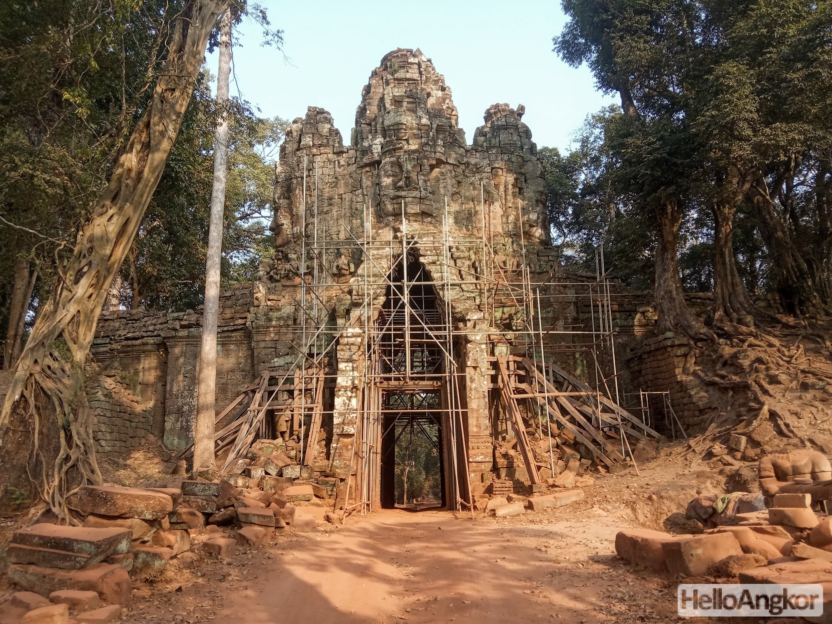
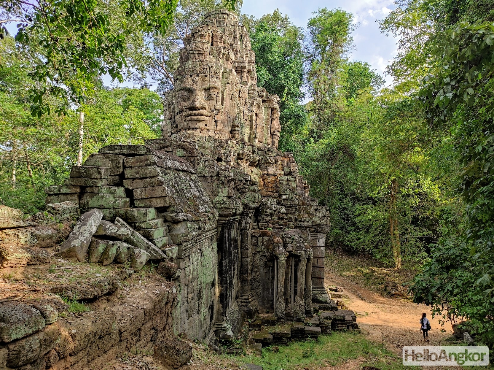
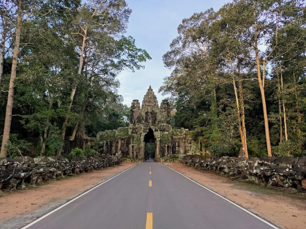
Angkor Thom is one of the most popular areas in the Angkor Archeological Park located minutes to the northeast of Angkor Wat and around 15 mins from Siem Reap city. Angkor Thom, literally: “Great City”, contains several of the must-see temples and ancient sites including Bayon Temple, Terrace of the Elephants, Terrace of the Leper King, Baphoun Temple, and many more. It’s a must-visit on a trip to Siem Reap and its ancient temples.
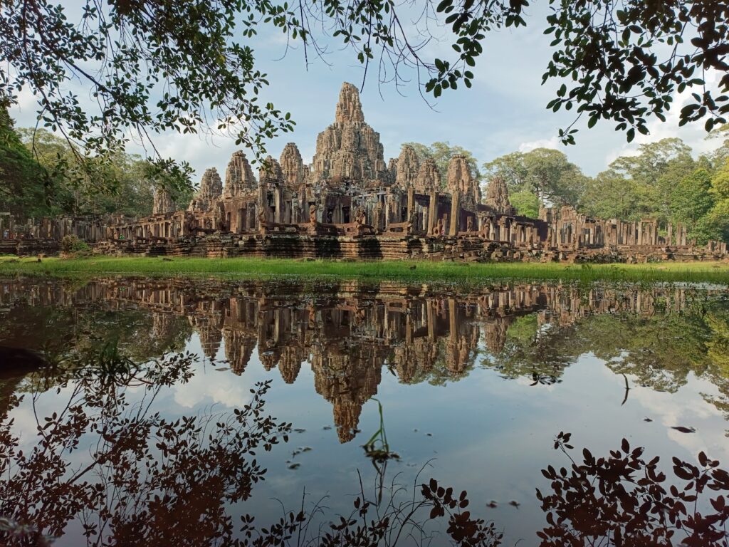
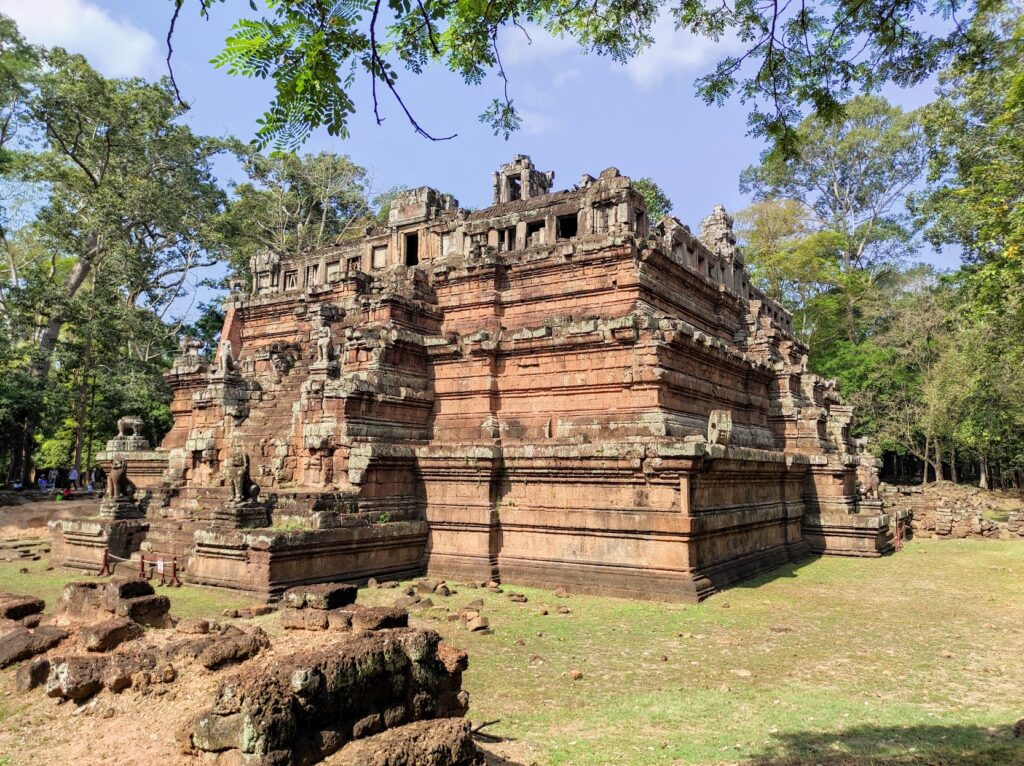
Containing some of the earliest sites of Angkor (Yasodharapura) including the 10th-century celestial temple, Phimeanakas, it would be King Jayavarman VII in the 12th century who would define the area with the construction of the grand state temple, the Bayon, together with the spectacular gates and causeways that have become symbolic of the heights of the Khmer Empire almost to the same extent as Angkor Wat.
Visiting Angkor Thom
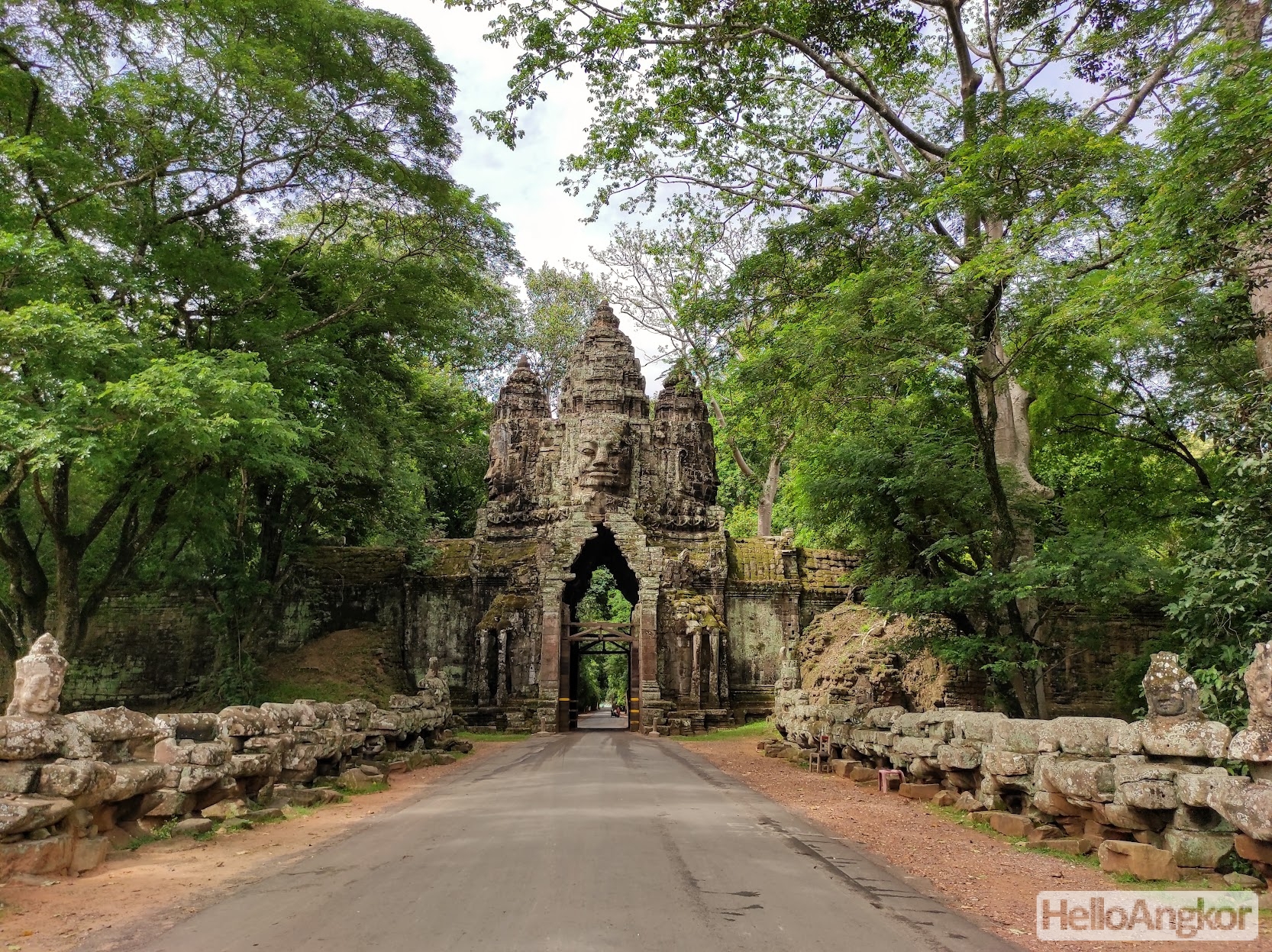
Angkor Thom, located just a few minutes from Angkor Wat, is actually quite large, covering an area of some 9 km² that is surrounded by a wall and moat with entry afforded by beautiful and mystical gates with those large smiling faces. Inside, and array or temples and points of interest. If you are following the small circuit around the temples, you’ll enter via the South Gate and depart via the Victory Gate. Whilst there are a lot of sites to see, the top five must-see sights of Angkor Thom are
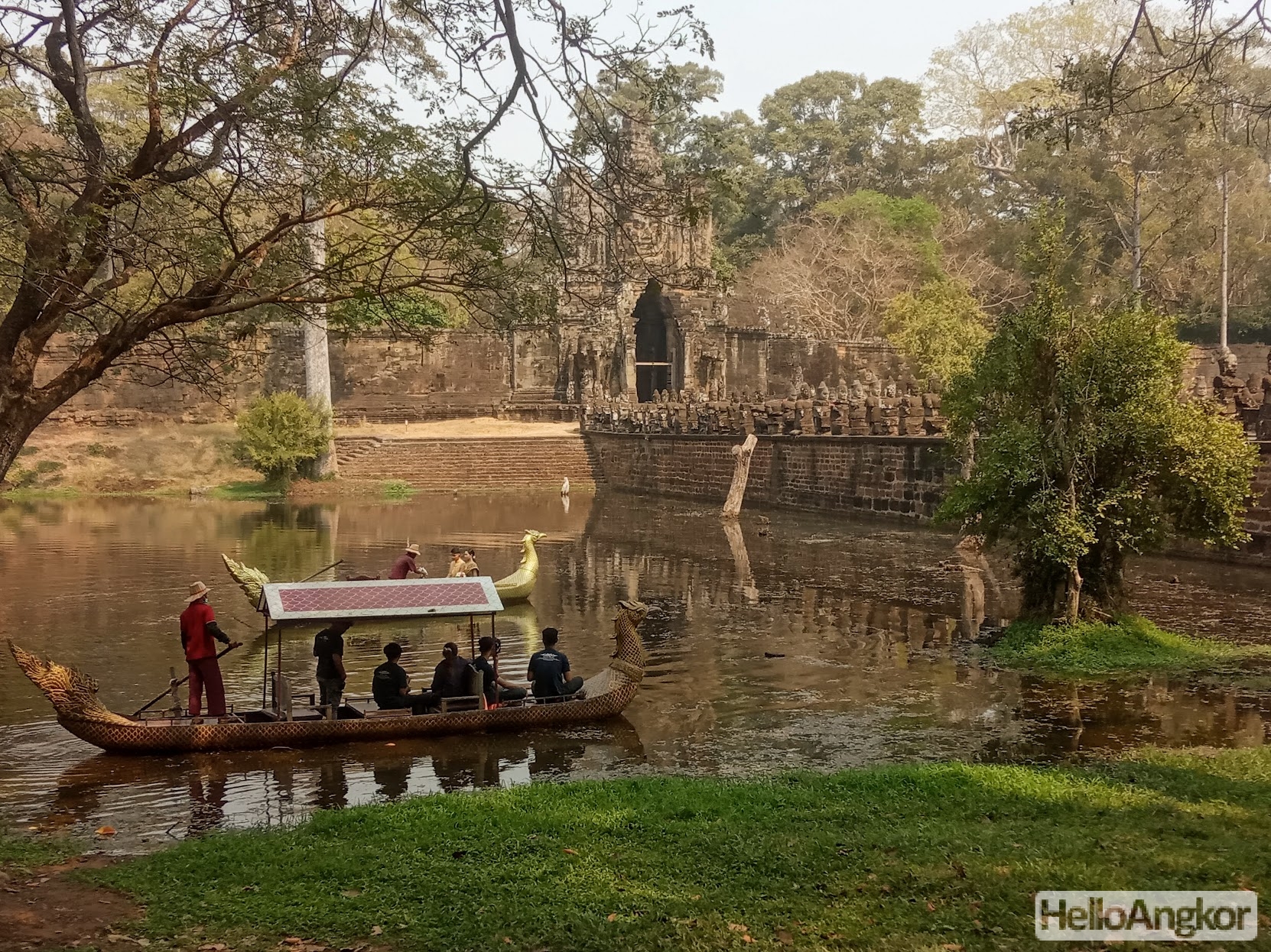
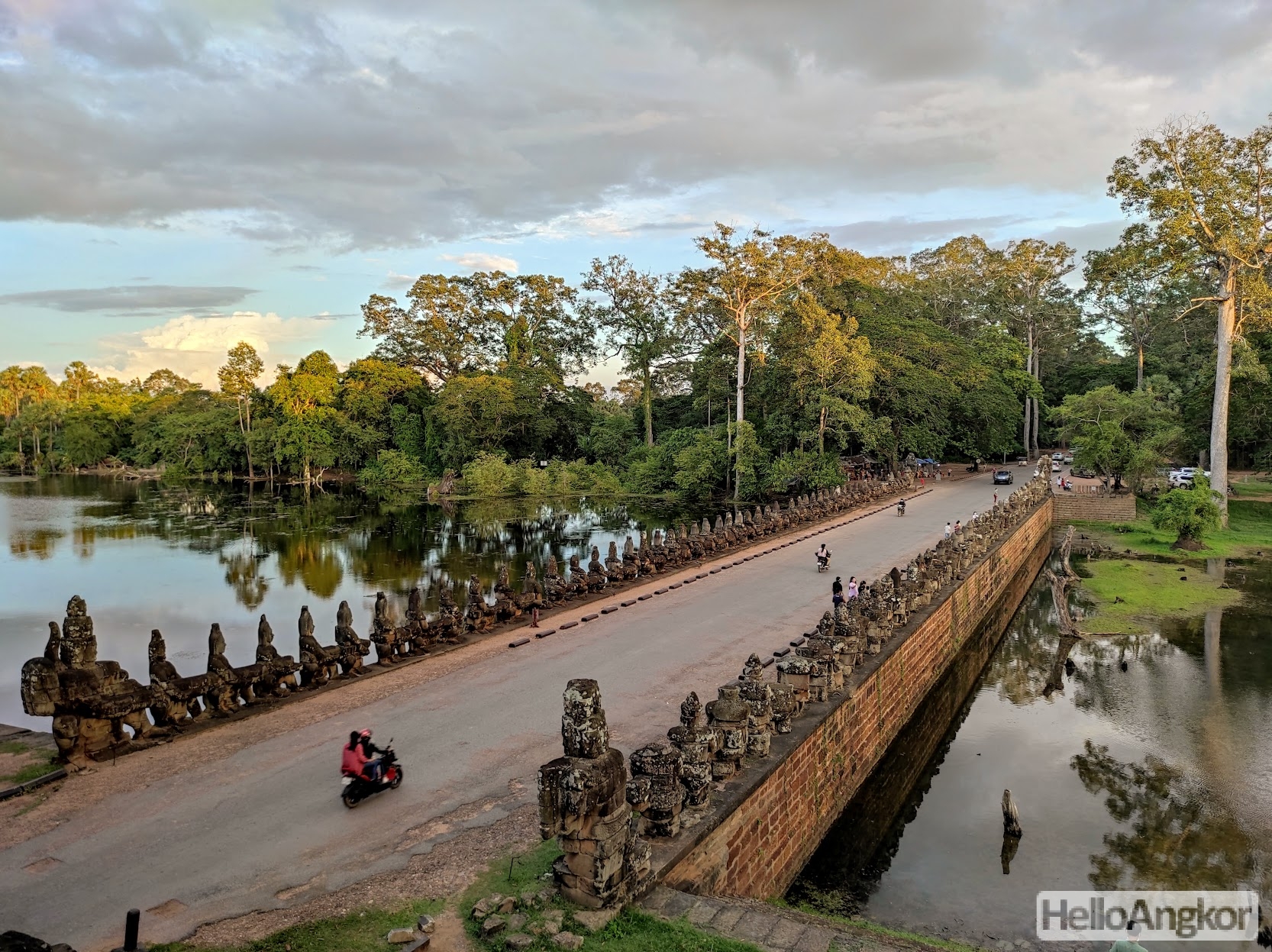
- South Gate and its stunning causeway lined with 54 stone figures in a representation of the famous Hindu mythology, Churning of the Sea of Milk.
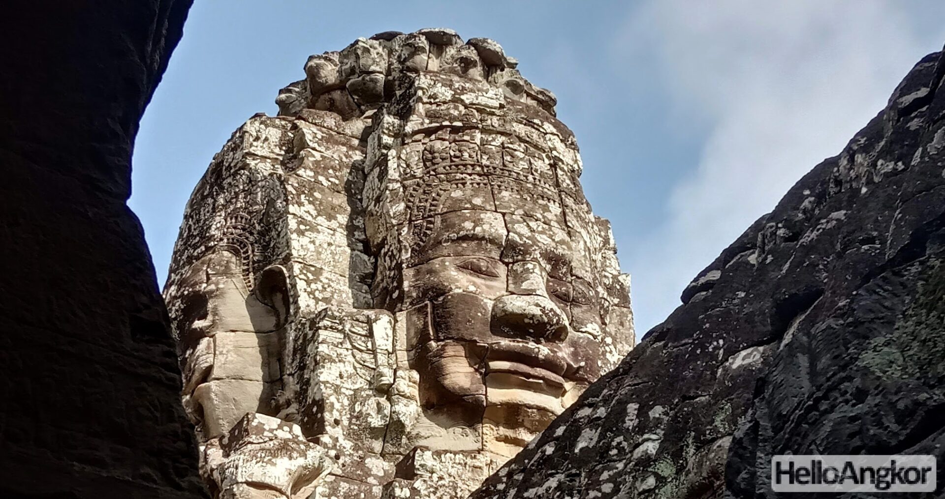
- Bayon Temple and its smiling faces, amazing bas-relief galleries, and friendly monkeys
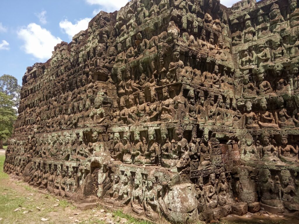
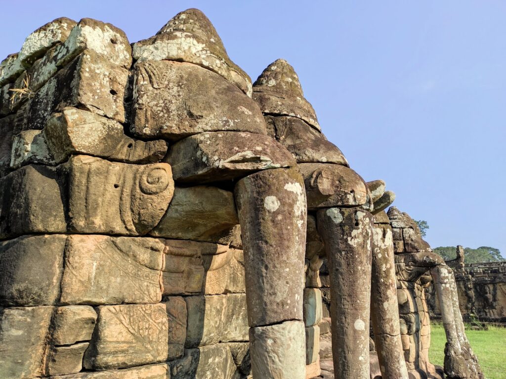
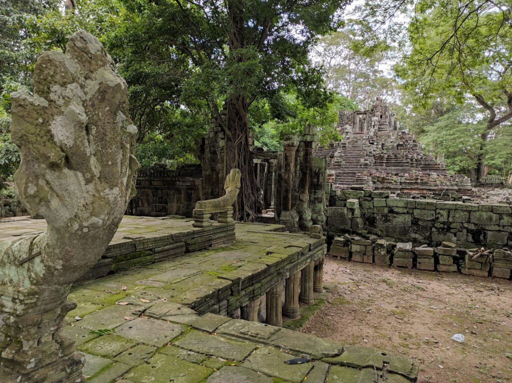
- Terrace of the Elephants and Terrace of the Leper King and their bas-reliefs
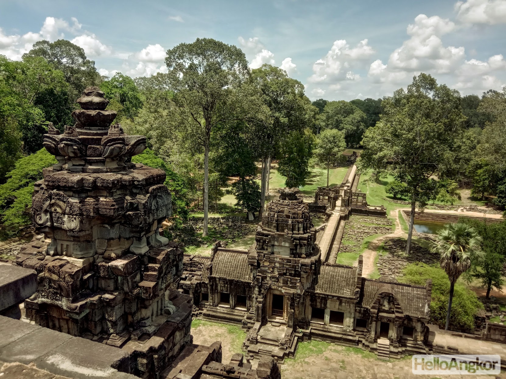
- Baphoun Temple and its amazing bas-reliefs, impressive causeway, and views from up top
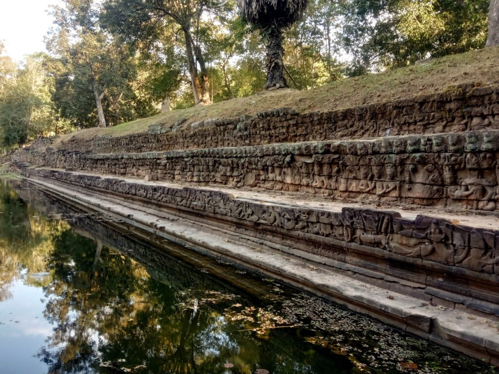
- Royal Palace inc. the Phimeanakas temple and the stunning reliefs lining the basin of Sras Srei.
A suggested tour route through Angkor Thom to cover all the highlights would be:
Bayon Temple > Preah Ngok > Baphuon > Royal Palace South Entrance > Phimeanakas > Royal Palace Ponds > Royal Palace North Gate > Preah Paliliay > Tap Pranam > Lepar King Terrace > Elephant Terrace > Preah Pithu Group > North and South Khleangs & Sour Prat towers.
You can spend around 3 hours here covering the key sites listed above. If you have a lot of time, or the opportunity to make multiple visits, then see this complete list of the ancient temples and remains in Angkor Thom and there’s more links at the bottom of the page. Whilst traffic can pass through the area at any time, the ancient temples are open for visitors from 7:30 am to 5:30 pm and are all included in the Angkor Pass. That said, it is possible to visit the Southwest Prasat Chrung to watch the sunset, more on that below.
You can find several Khmer food and drink stalls (some with English menus) opposite the Terrace of Elephants, also there are toilets nearby.
Angkor Thom Location & Highlights Map
You can star the map to save it and use it to guide you (First check your GPS for accuracy at a known landmark in Angkor Thom!). Alternatively, you can also hire official guides who will help you around the site and fill you in on local culture and history.
Watching the Sunset and Sunrise at Angkor Thom
The Southwest Prasat Chrung, atop the wall of Angkor and reached by foot (or bike) is a popular place with locals to watch the sunset looking over the moat and across the fields beyond. Keep in mind it takes around 20 minutes to walk from the south gate.
Another popular spot is the south causeway, here, looking through the gaps between the stone giants as the sun falls below the moat and trees in the distance. Whilst closed by that time, you can still watch the sun fall behind the face towers of the Bayon temple from the eastern parking area.
You can watch the sunrise from the southeast Prasat Chrung, and the south and north causeways but mostly for the early morning atmosphere as any view is mostly blocked by trees.
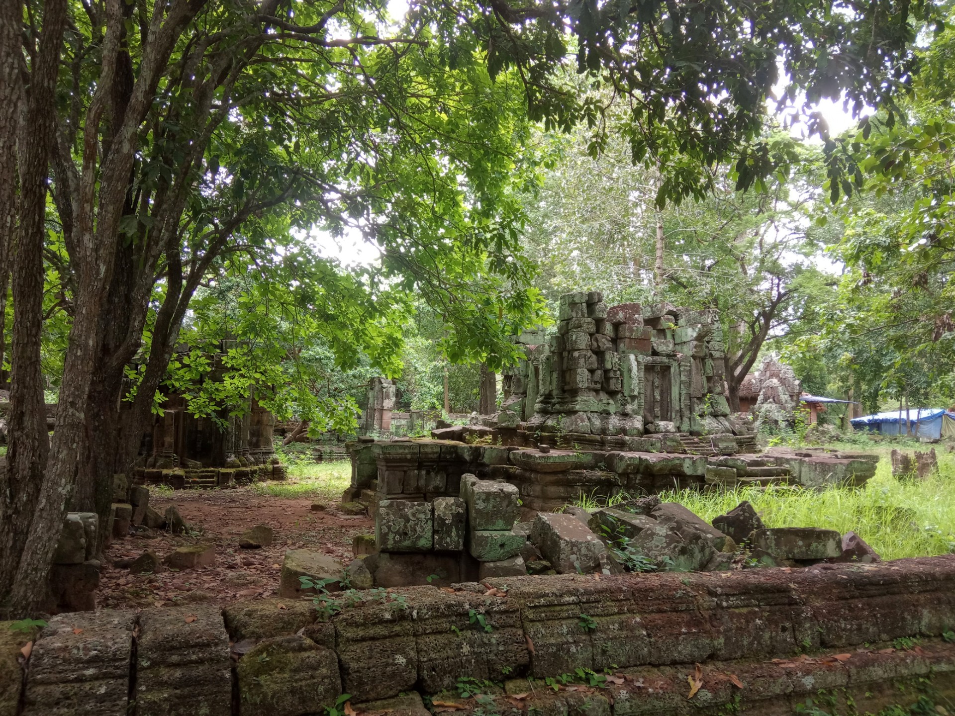
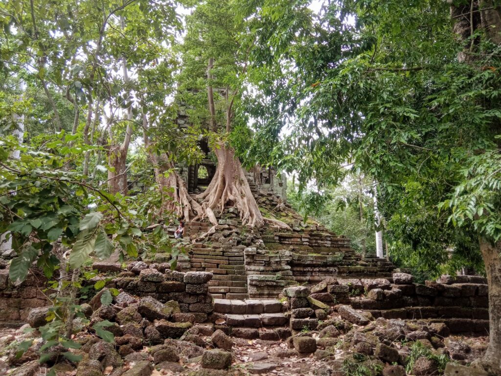
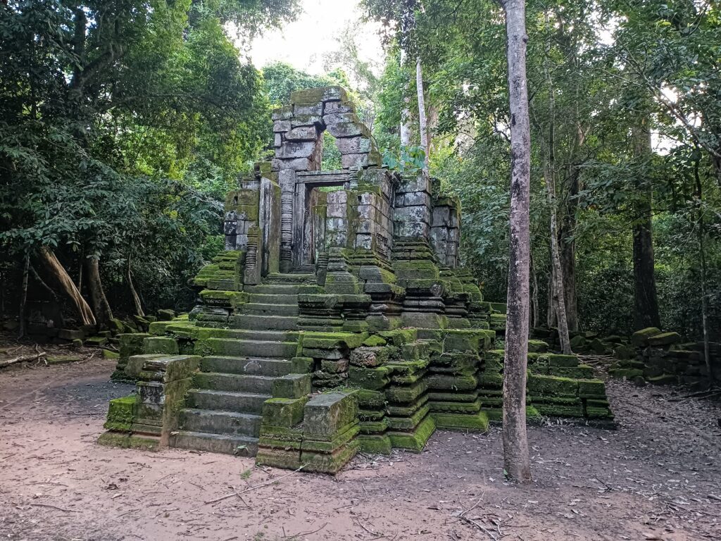
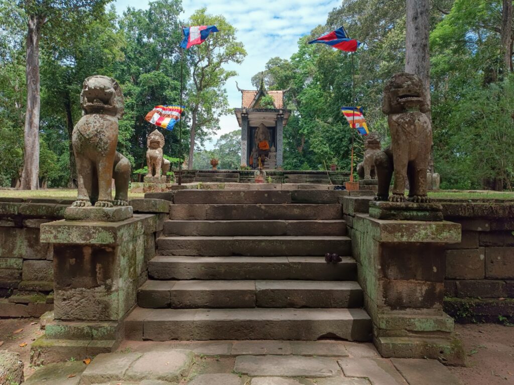
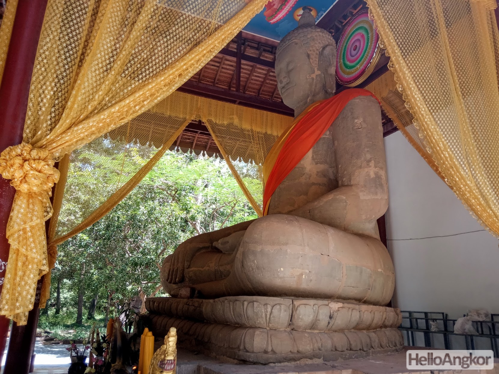
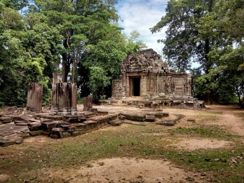
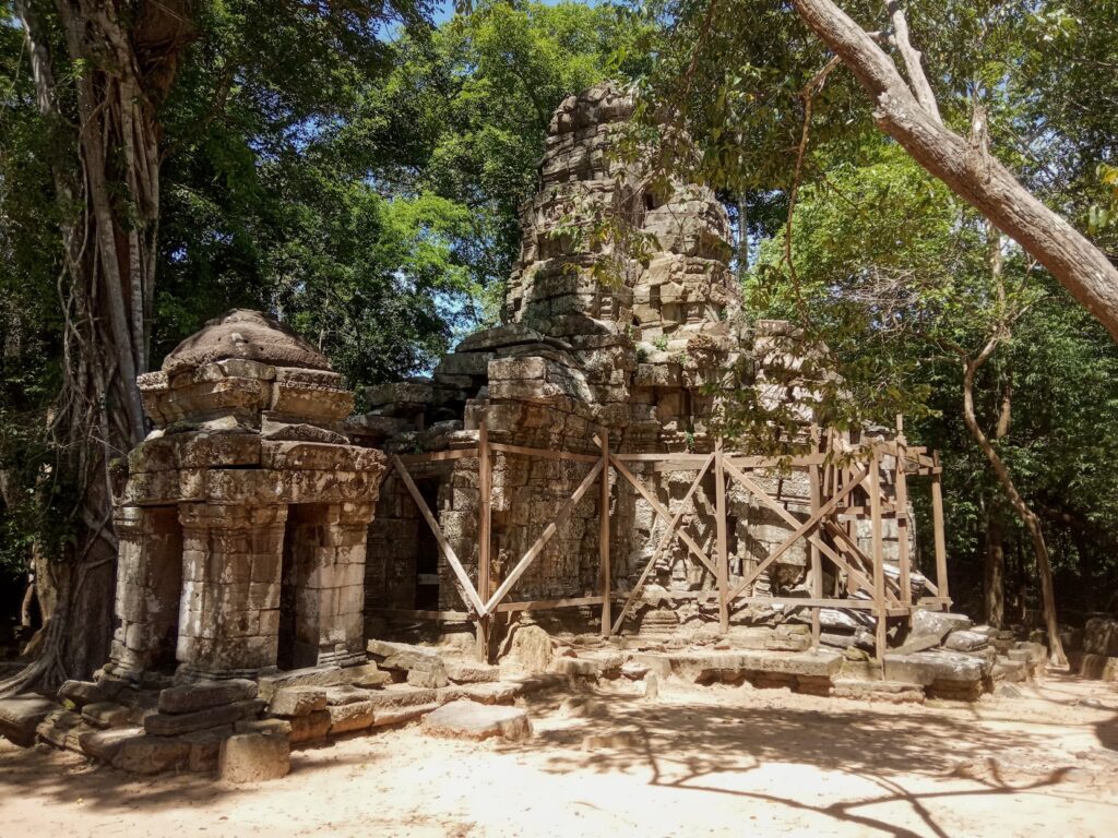
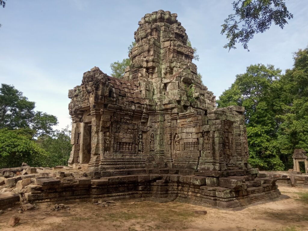
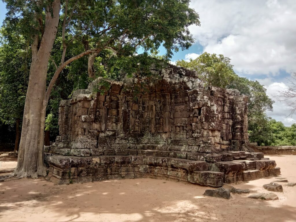
Angkor Thom Highlights Gallery
Temples and other Highlights
Angkor Thom Gates
Corner Prasats, Wall, and Moat
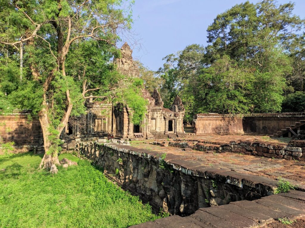
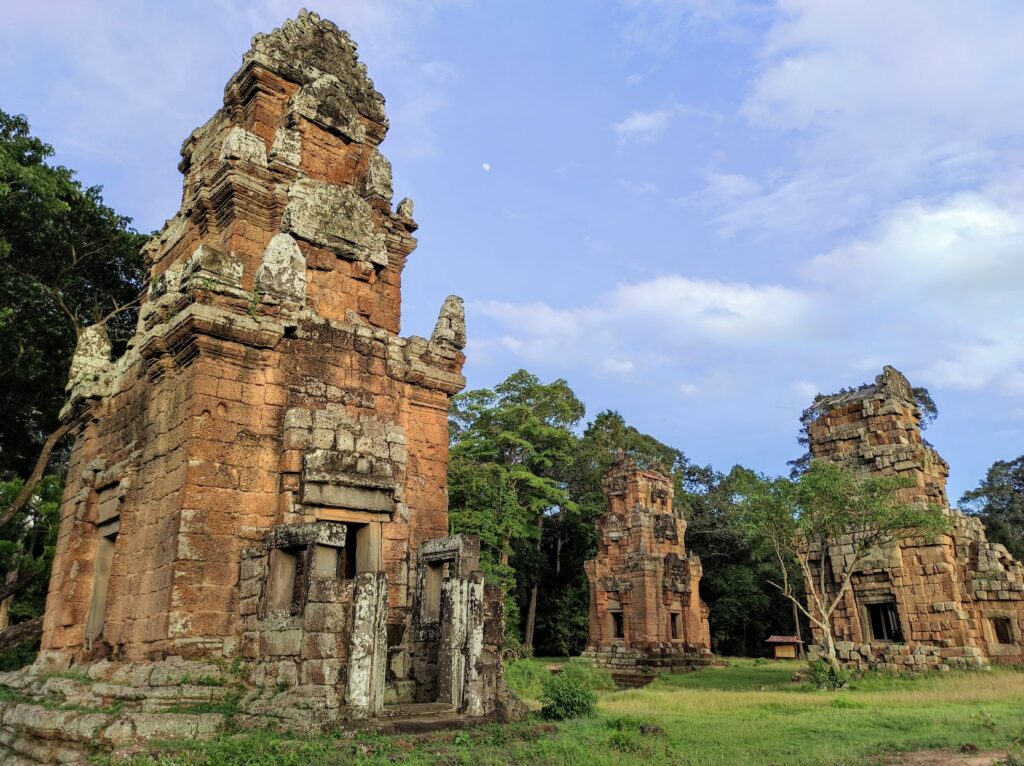
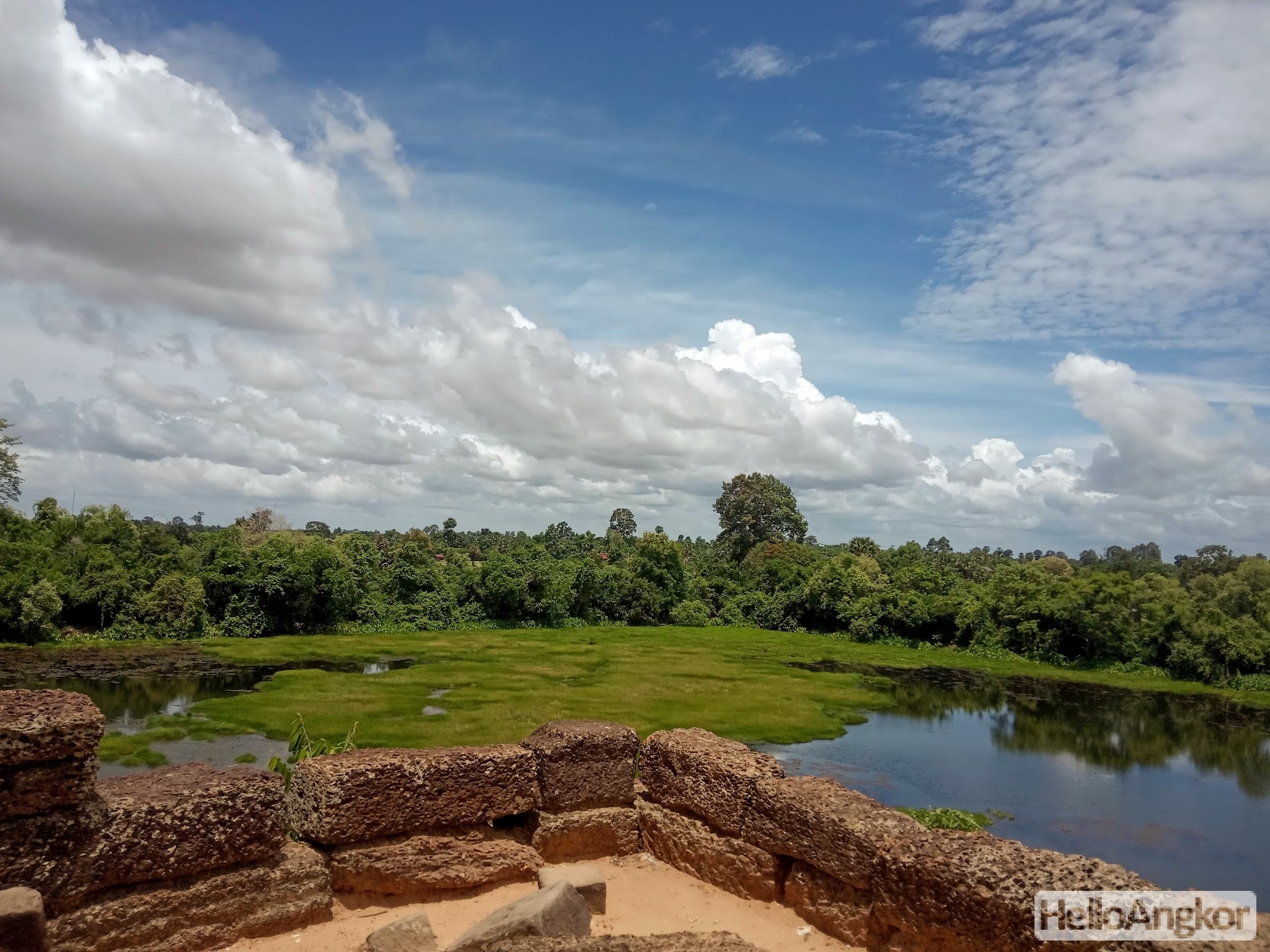
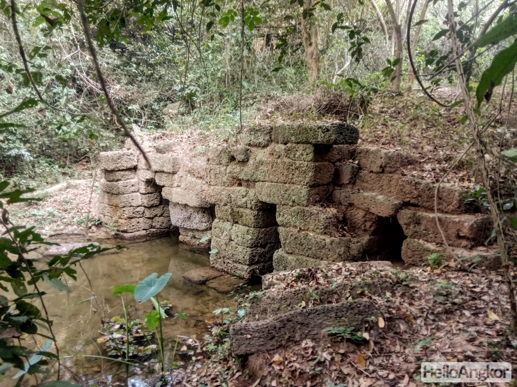
The Prasats on each corner of the enclosure wall are rarely visited being accessible only by foot or bike. Some have some nice detail still and one has nicely preserved pediments. Prasat Chrung (SW) is perhaps the most beautiful and also has a ladder down to the moat. Here’s more on exploring the Angkor Thom wall and corner prasats.
Around the top of the wall, you can get many scenic views across the moat, and on the inside of the southwest corner, you can find the outlet that drains the waters of Angkor Thom into the moat.
History
Angkor Thom as we see it today is a product of consecutive kings beginning in the 10-11th century, known as Yasodharapura at that time, with the construction of the Phimeanakas temple, followed by the North and South Khleang, the first Royal Palace, then Baphuon Temple. In the 11th century, the Chams invaded and occupied the area until Jayavarman VII overcome the occupying forces. Triumphant, Jayavarman would begin a building spree over several decades that would truly put Angkor Thom at the centre of the Khmer universe. He would rebuild the Royal Palace, reconstruct the Royal Terraces, and add the monumental grand Bayon Temple at the very center. At the same time, adding monumental gates at each cardinal point, all depicting the gigantic smiling faces radiating in all directions, with causeways crossing the moat adorned with monumental balustrades in a representation of the Churning of the Sea of Milk.
After Jayavarman VII, researchers point to dramatic religious change from Mahayana Buddhism under Jayavarman and a return to Hindu beliefs leading to the destruction of a lot of the art, in particular the defacing or alteration of central idol figures. But, there is still a lot of conjecture on which of the following kings did what exactly, there are no inscriptions or records revealing the true events, just theories formed from a curation of knowledge.
In the late 13th century the empire had returned to Buddhism as the state religion under the reign of King Indravarman III, knowledge of which is in a large part thanks to the notes of the famed visiting diplomat, Zhao Daguan, who would reside in the Khmer Empire from August 1296 until July 1297 staying just outside the north gate of Angkor Thom.
In Zhao Daguan’s notes, he describes a special yearly celebration taking place around the Royal Palace including platforms built in front of the Royal Palace for the thousands of spectators to watch grand fireworks shows that shake the whole city with their explosions. This particular celebration would last for fourteen days, and smaller festivals and rituals were also held monthly. Daguan also provides a description of Angkor Thom at that time under the rule of King Indravarman III
THE WALLED CITY
The walls of the city are about twenty li in circumference. They have five gates, and each gate is double. On the east side, there are two gates, and the other sides have only one. Outside the wall is a huge moat, across which are the great bridges of the access roads. On each side of the bridges are fifty-four stone divinities’ which seem like generals carved in stone; they are huge and frightening. The five gates are similar. The parapets of the bridges are entirely built of stone, carved in the form of snakes, each of which has nine heads. The fifty-four divinities each hold the snake in their hands, and appear to be trying to stop it from escaping.
Above each gate in the wall are five large stone Buddha heads, four of whose faces are turned towards the cardinal points; in the centre is the fifth head, gilded. On both sides of the gates the stone is carved in the shape of elephants. The wall is entirely made of superimposed blocks of stone: it is about two fathoms high. The bonding of the stones is very compact and solid. and no weeds are found there. There is no crenellation. On the ramparts, in certain places guanglang trees have been planted. At regular distances are found empty casemates. The inner side of the wall is like a ramp wider than ten fathoms. On top of each ramp are huge doors, closed at night, and open in the morning. There are also guards at the gates. Only dogs are forbidden entry through the gates. The wall is a very regular square, and on each side is a stone tower. Criminals who have had their toes cut are also forbidden entry.
In the centre of the kingdom is a golden tower, flanked by more than twenty stone towers and several hundred stone chambers. On the east side is a golden bridge; two gold lions are placed to the left and right of the bridge. Eight gold Buddhas are arranged at the base of stone chambers. About one li to the north of the golden tower is a bronze tower, higher still than the golden tower and really impressive to see; at the foot of the bronze tower there are also more than ten stone chambers. About a li further north again is the sovereign’s palace.
Excerpt from: Zhou Daguan. A Record of Cambodia. Translated by Peter Harris – Silkworm Books
Researchers still till this day debate the events surrounding the departure of the Royal elite and shifting of the capital southeast to Chaktomuk (Phnom Penh) in the 15th century and later, Longvek, Srei Santhor, and Udong. Was the area still maintained as a capital, was it completely abandoned, or inhabited only by small Sangha (Buddhist community)?
There is some anecdotal evidence from reports by visiting European traders in the late 16th and early 17th century that the area was mostly abandoned at that time. One such example, in 1604, Fr Gabriel Quiroga de San Antonio, published his notes on experiencing Angkor
In the year 1570 a town was discovered in this kingdom which the natives had previously seen not known about. This town is located on the shores of the Mekong 170 leagues from the sea. It is a marvellous construction, possessing a very strong stone wall four leagues around, four spans in thickness and five in height, having crenellations in close proximity, where elephants, tigers, lions, eagles and dogs are depicted; also to be found there are many devices and letters which no one recognizes or understands. The houses are built of stone, very fine, constructed alongside roads with much regularity, and the workmanship of these houses, porticoes and courtyards rooms, and chambers appears to be Roman. To be found there are many fountains and canals for cleanliness, and from time to time temples and squares are met with. On the River Mekong is a bridge of seventy columns: they are very high, but the bridge is not very broad. The columns are in the form of giants, whose heads and hands uphold the bridge. The parapet is more than one vare (one metre) in height, and on it ball alternate at intervals with pyramids, which top it. There are five towers in this town and on top of each is a ball of gilded bronze. The Cambodians who discovered this town went to hunt rhinoceros there. They gave it the name of Angor, which signifies the town with five summits, because of the five towers it possesses. And in the place Fr Antonio Dorta and Brother Luis de Fonseca, of the Order of St Dominic, our father and the Congregation of the Easter Indies, spent many long days
Finot – Angkor Wat
See the history section of Angkor Wat for more notes about this period and activity there.
Based on inscriptions, the last temple constructed in Angkor was Mangalartha (Monument 487) in 1295 AD, although, construction quite actively continued after that time with the recycling of sandstone blocks to create viharas according to Theravadin Buddhist practice which would become the dominant religion in the post-Angkor era as it still is today. Examples are Prampi Lven, Tep Pranam, Preah Ngkok and many, many more as discussed further here. Another example, Prasat West Top which featured extensive modification as it transformed into a Theravadin Buddhist monument in the post-Angkor period.
A new wave of research coming from archeological research in Angkor Thom, such as from the Angkor Vihara Project, will likely help answer some of those questions and provide a lot more detail about some of the structures in Angkor Thom related to this time period.
Also see
- List of all the ancient sites in Angkor Thom
- The Secret Angkor Thom Wall Trail and its Hidden Prasats
- Unsolved: The Hidden Terrace of the Leper King
- Angkor Thom and its Lost World of Hidden Ancient Terraces
- Beyond Angkor Thom’s Royal Palace – The Royal Citadel, Forgotten Shrines, and a Mystery of Form and Function
Site Info
- Site Name: Angkor Thom Khmer Name: អង្គរធំ
- Reference ID: HA16448 | Last Update: July 17th, 2022
- Other Names: Nokor Thom
- Tags/Group: 12th Century, Angkor, Angkor Small Circuit, Angkor Thom, Map: Angkor's Top 30 Temples & Ancient Sites, Map: Top 100 Temples & Ancient Sites (Siem Reap)
- Location: Siem Reap Province > Krong Siem Reab > Siem Reap Province