

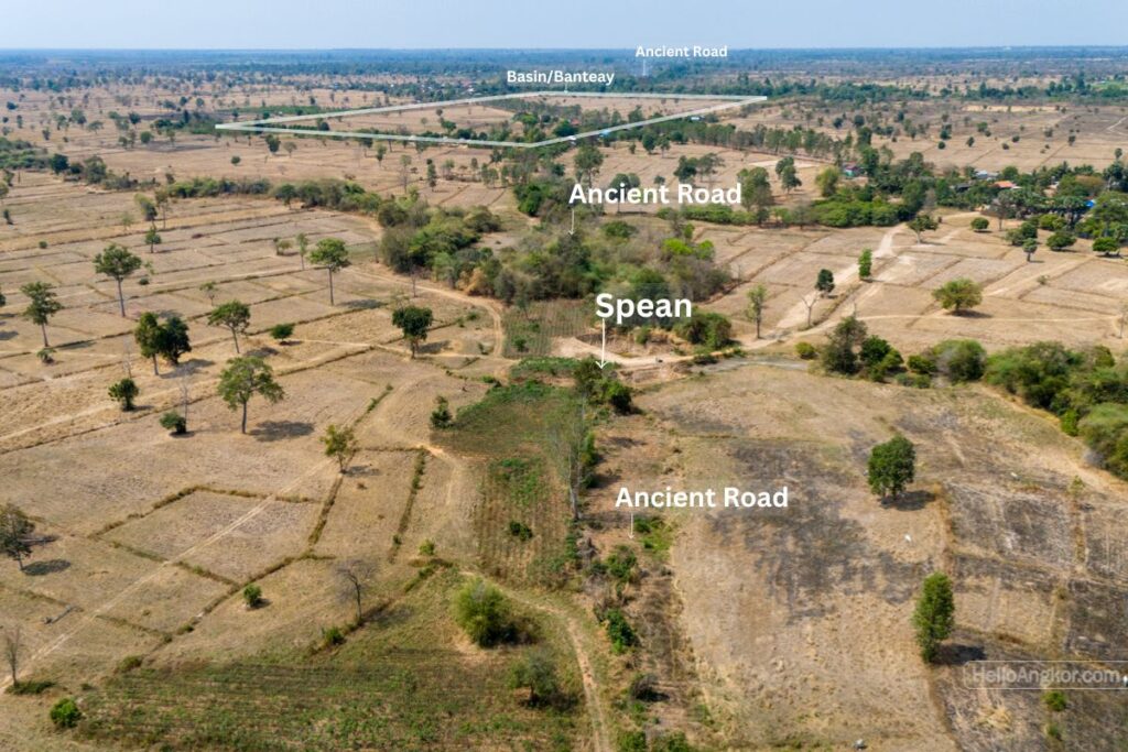
It is located 2.7km west of Beng Mealea temple and 1.5km east of Sam Yot temple, along the ancient East Road that joined Angkor to Beng Mealea and Preah Khan of Kampong Svay and 500m east of Road 64 and the village of Trapeang Ruessei.
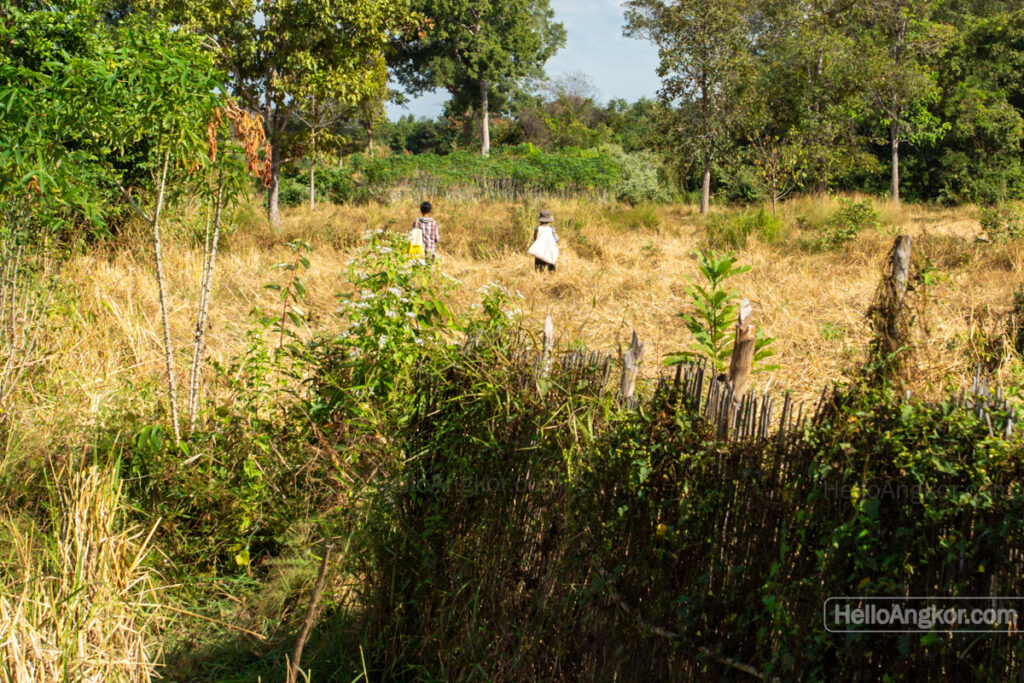
When asking about the old road, local villagers pointed us toward the bridge, which we accessed following the old road from the east, where it crosses Road 64 and follows what is presumed to have once been a large basin. We spent around wandering around where it was suggested to be and, by chance, bumped into a local farmer who pointed us in the right direction, and then, we still couldn’t locate it! By chance, once again, two ladies wandering out in the fields led us straight to it. It turns out we were in the wrong spot by only a couple of hundred meters, but we never would have found it without their help. We are very thankful for that.
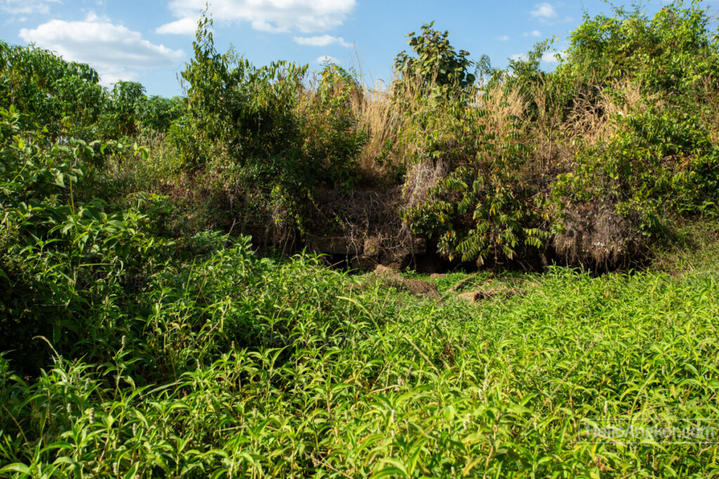
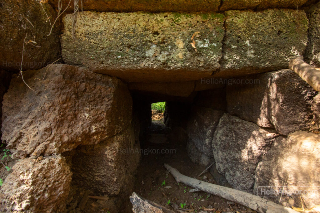
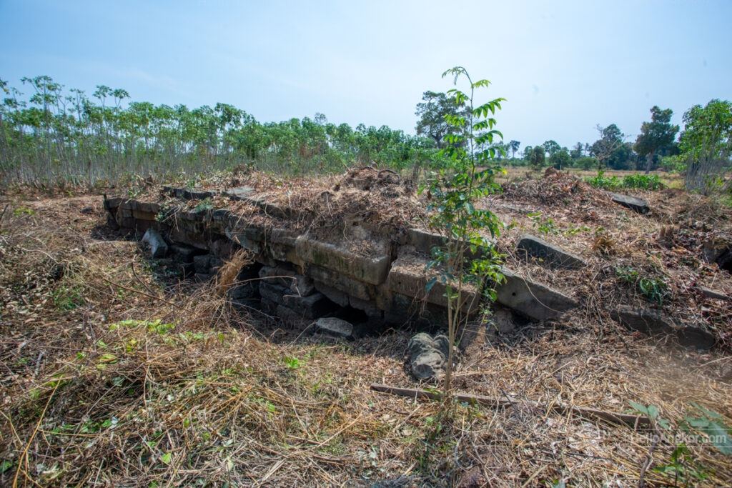
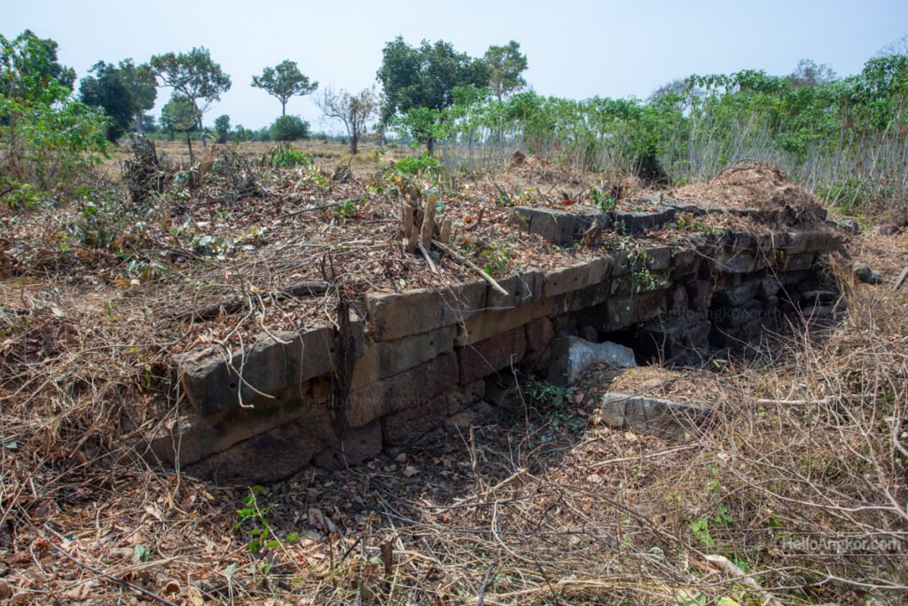
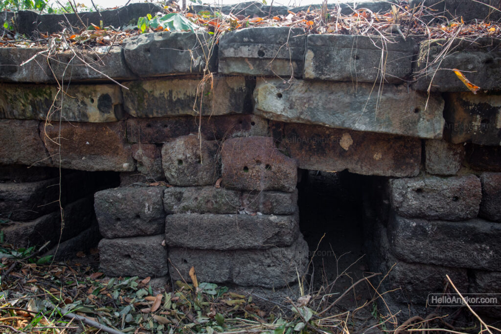
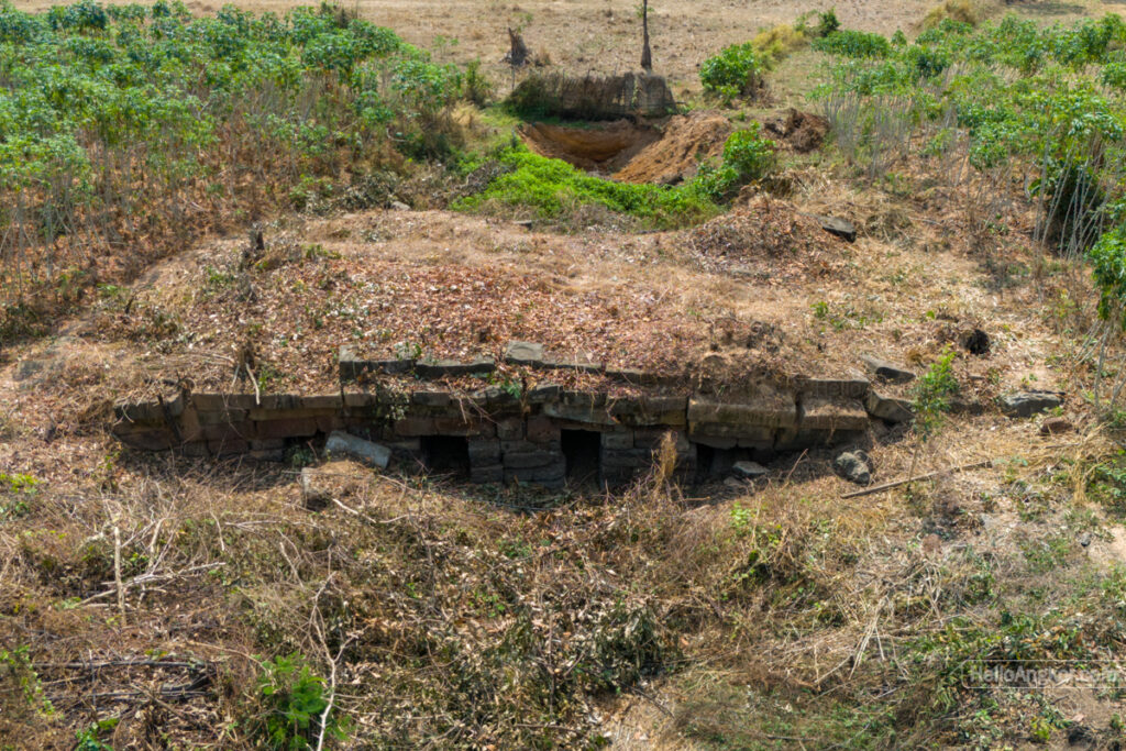
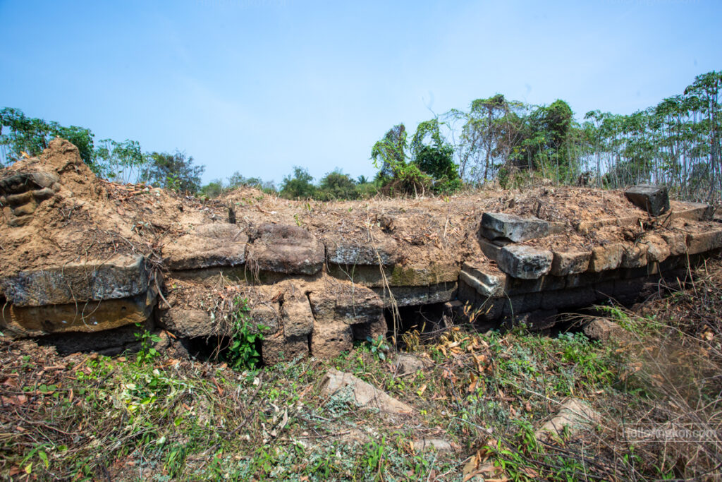
This bridge and section of the ancient road are no longer in use and are reasonably well-preserved, with the rise of the earthen-formed road still clearly visible. Farmlands and small cassava plantations surround the bridge itself. The bridge is small, around 10-15m long and 8 m wide by eye. It is constructed using a post and lintel method and built with laterite while featuring sandstone blocks lining the top layers. Some of that sandstone may have been side capping or a balustrade that was never completed.
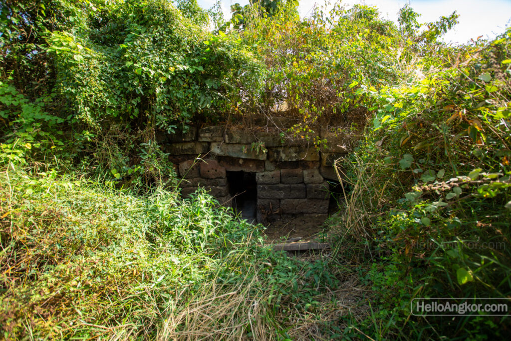
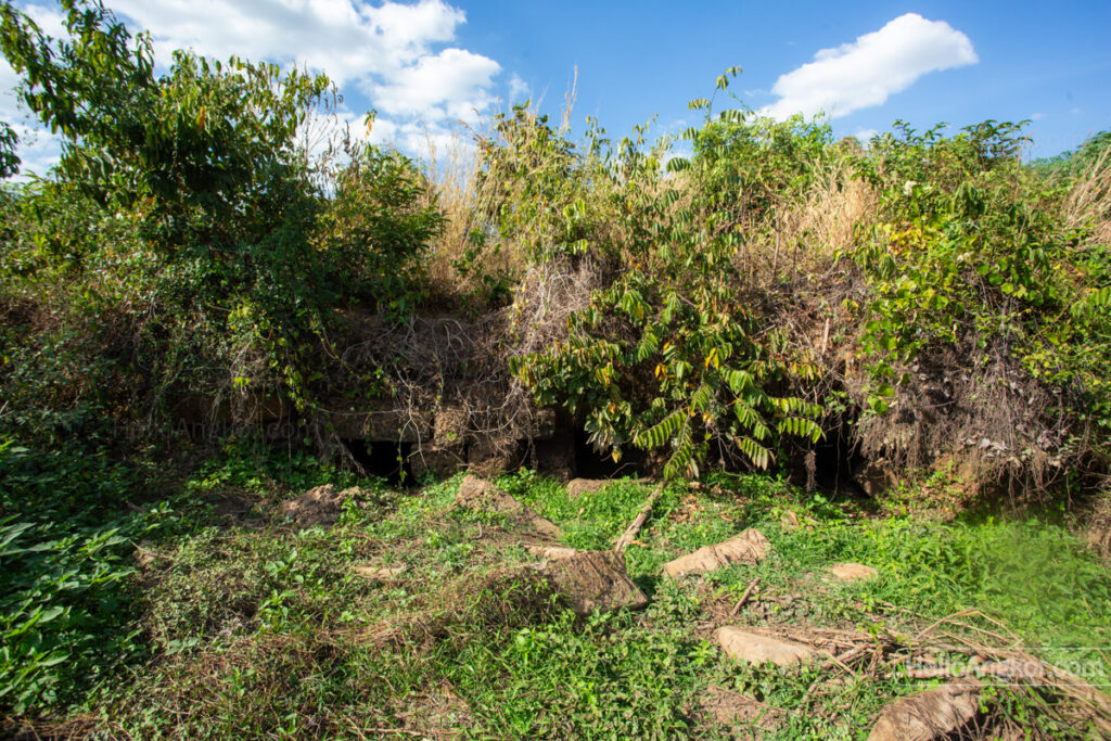
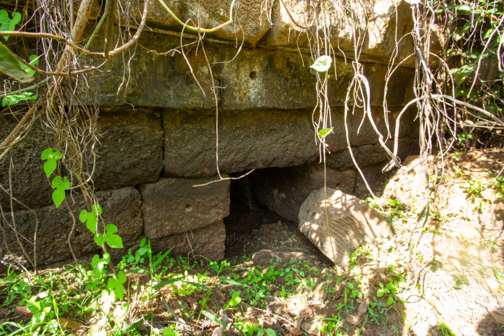
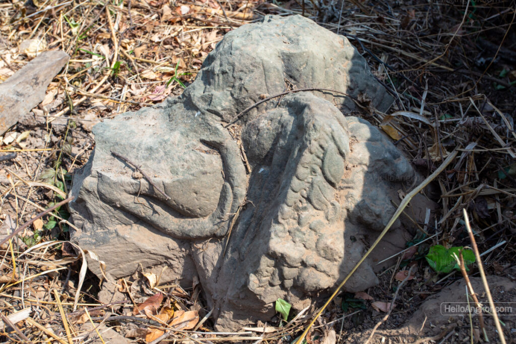
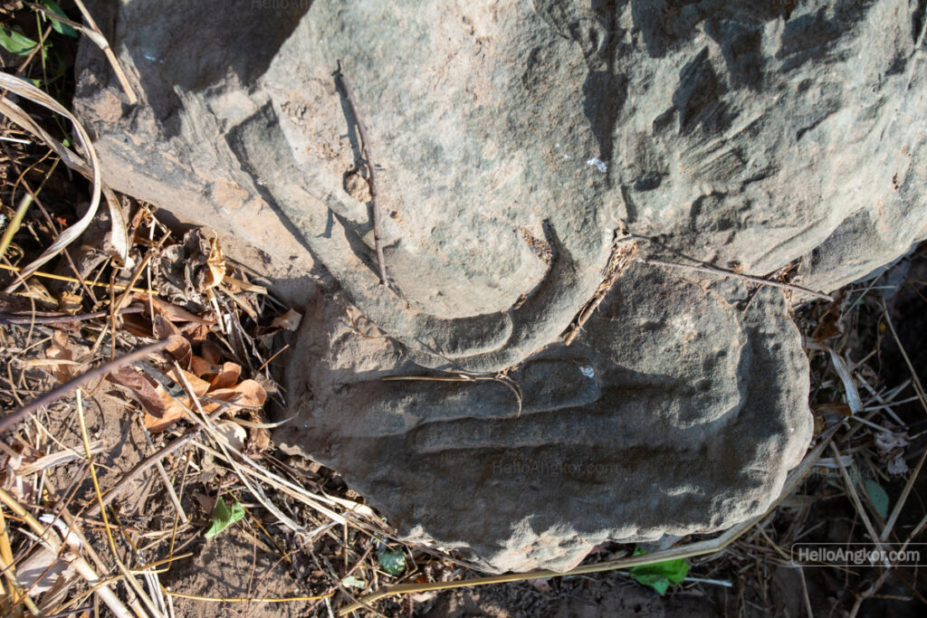
Update Feb 2025 – we returned to the site after authorities (APSARA team at Beng Mealea) had cleared the site. In the clearance, they revealed a fragment of one of the sandstone Naga headstones, which is similar to other bridges along the route, featuring a seated Buddha-like figure carved into the Naga. It also seems apparent that, while constructed of laterite, its surface may be topped by sandstone, which is unusual. Moreover, its construction is notably crude in comparison to other bridges, which could infer a timeline of development.
Map
Site Info
- Reference ID: HA44078 | Last Update: January 1st, 2026
- Site Name: Spean Trapeang Ruessei | Khmer: ស្ពានត្រពាំងឫស្សី
- Location: Siem Reap Province > Svay Leu District > Boeng Mealea Commune > Trâpeang Russei Village
- Tags/Group: Ancient Bridges, Ancient Royal Road, Beng Mealea, Royal Road Angkor-Beng Mealea, Temples