
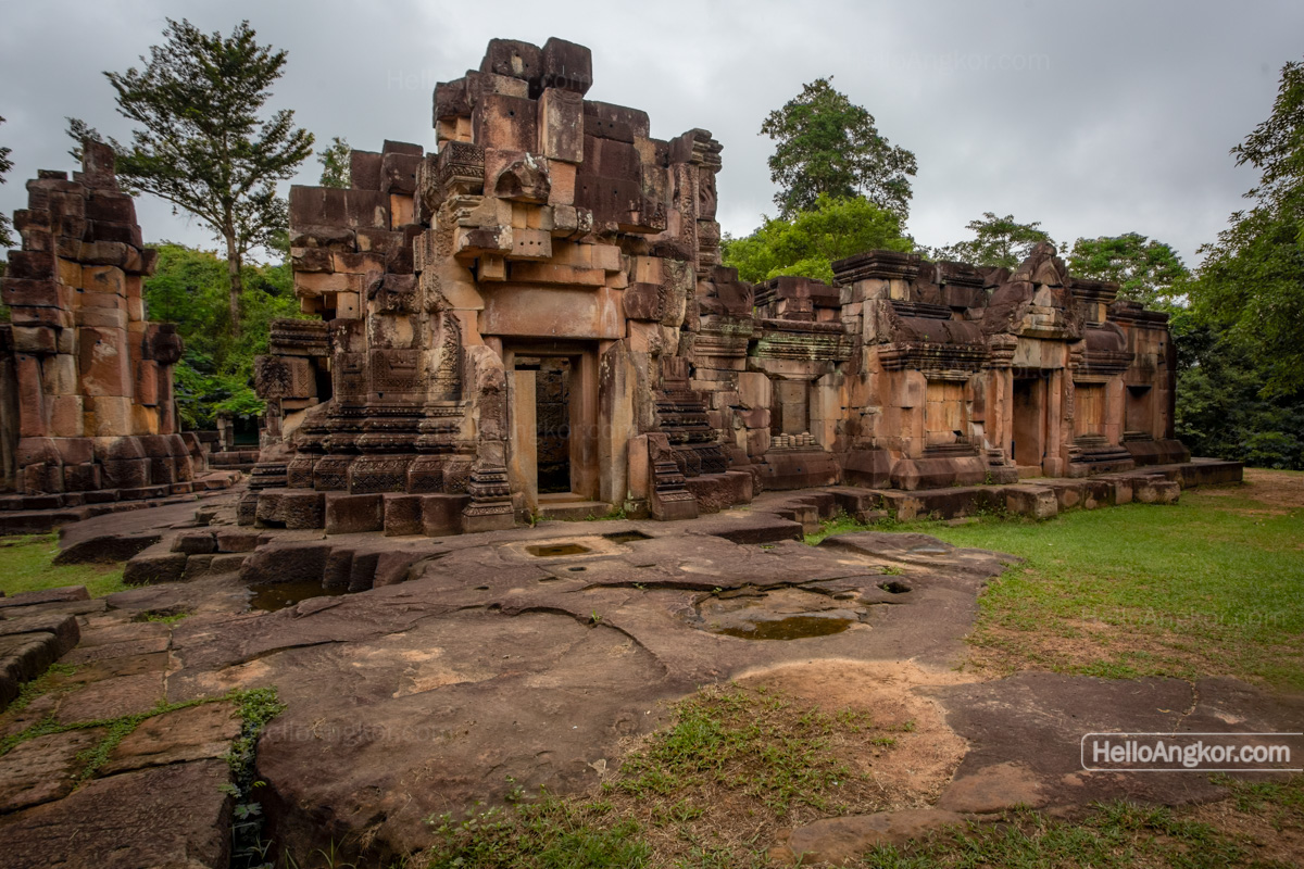
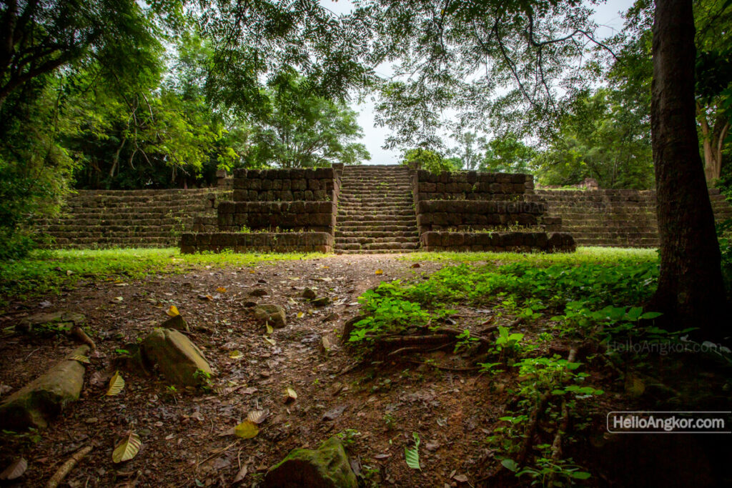
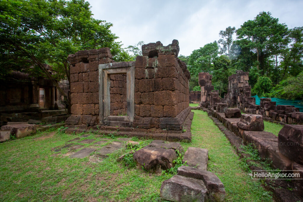
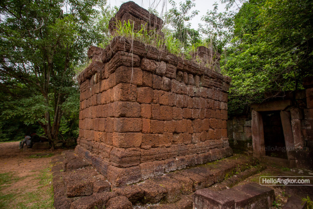
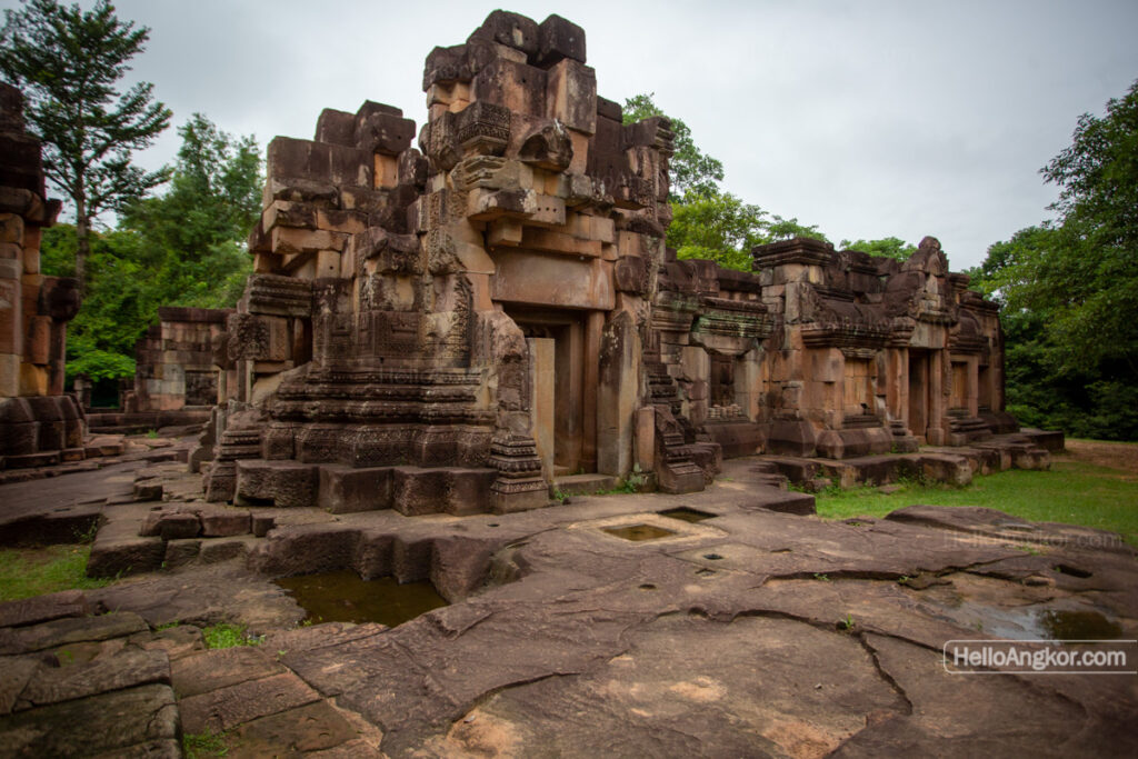
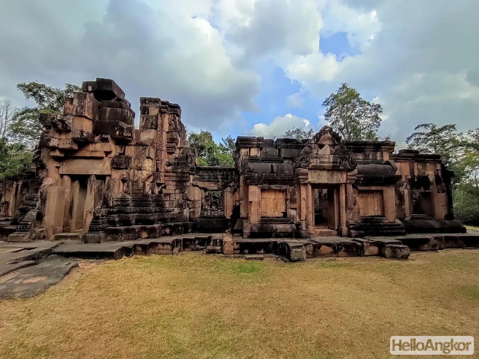
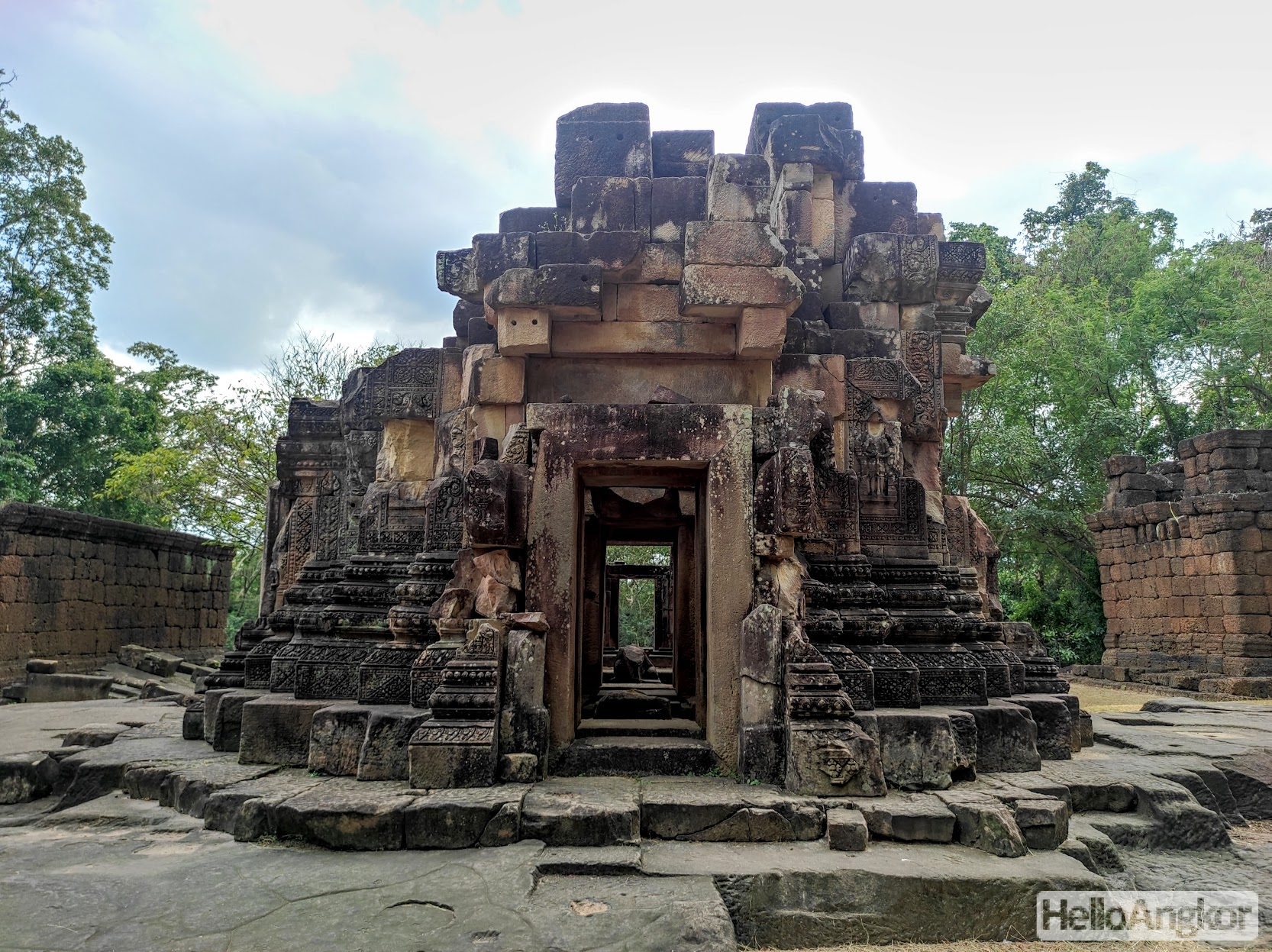
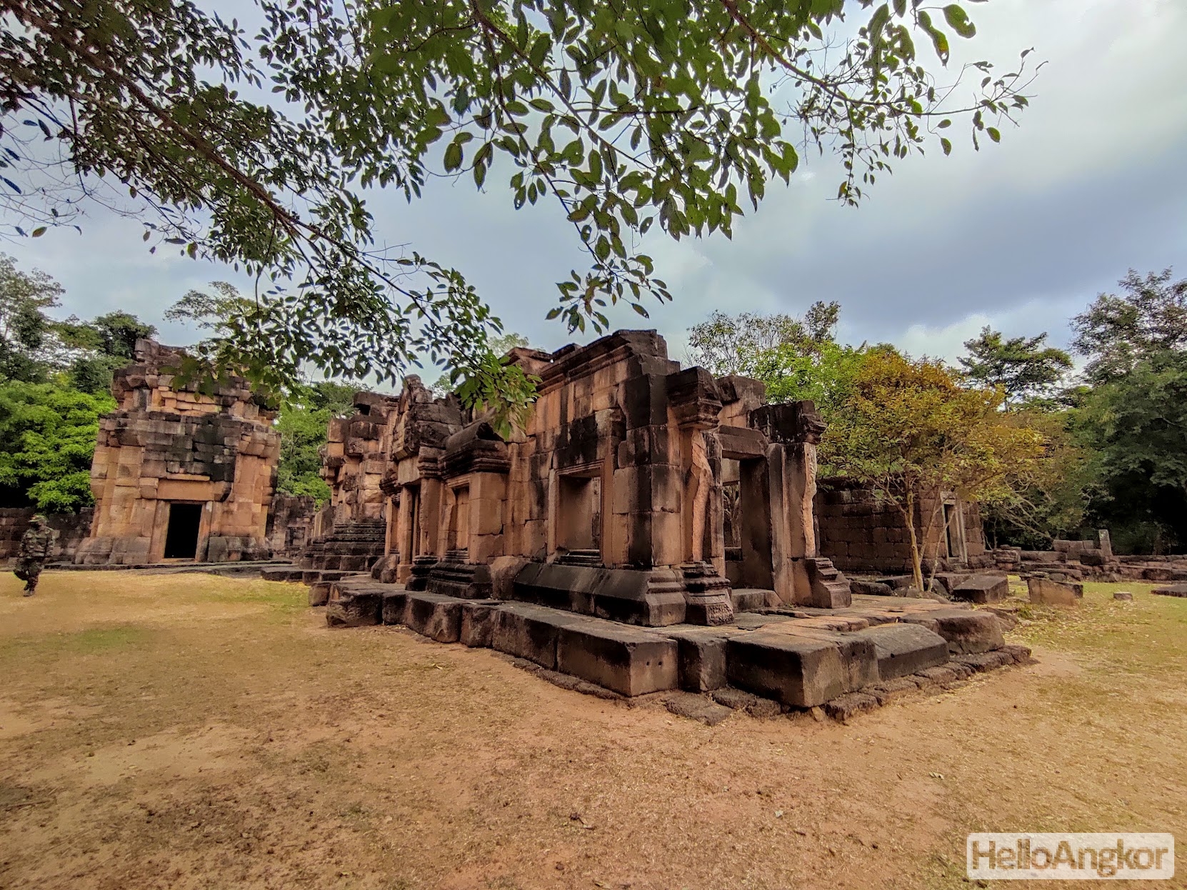
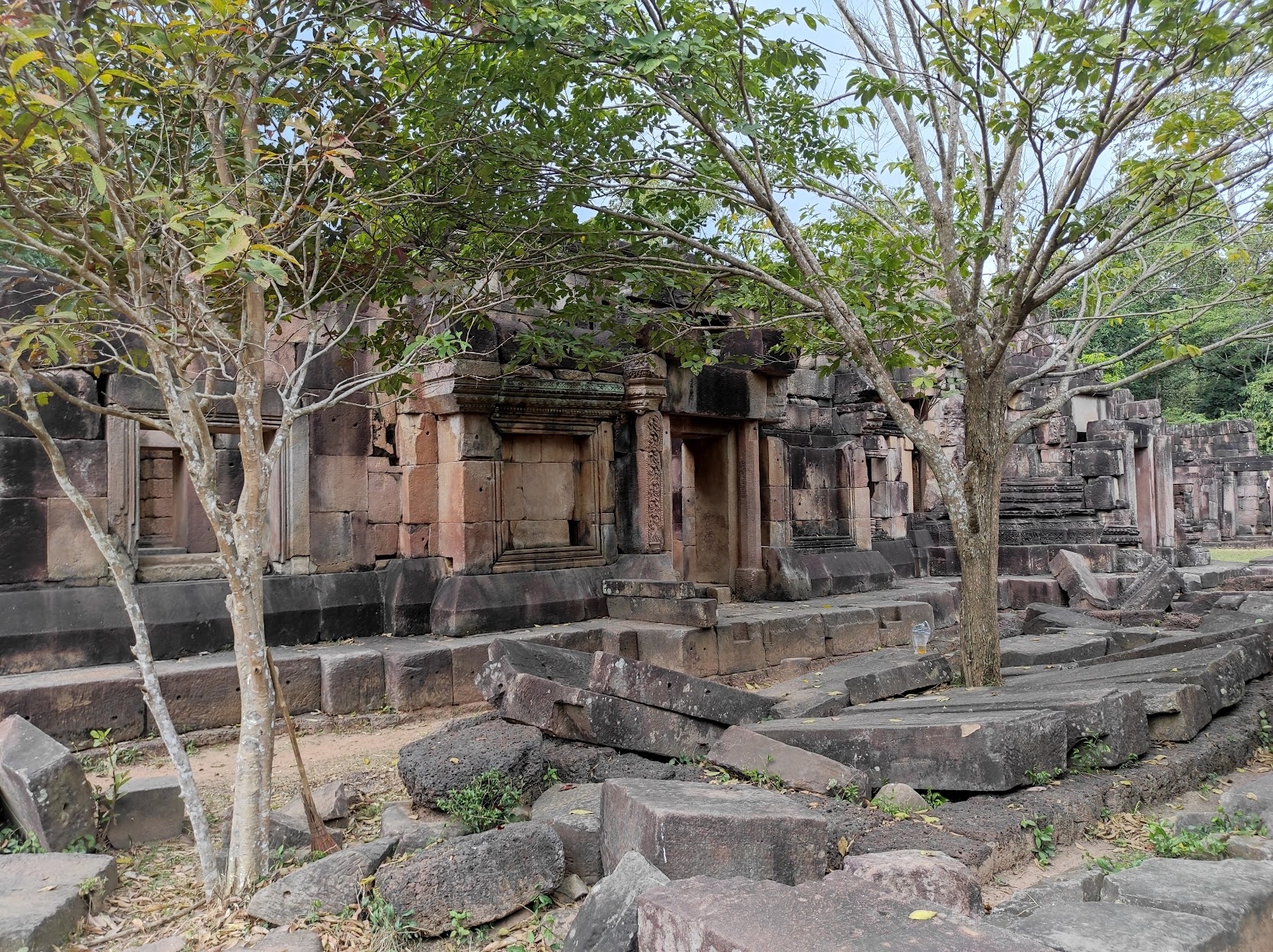
Prasat Ta Muen Thom is located on Cambodian-Thai border and was a feature along the ancient Royal Road that led from Angkor to Phimai (in present-day Thailand). The site is accessed by sealed roads that lead all the way to the site and up the small but steepish rise of the mountain range. The site is orientated and opens to the south featuring a laterite buttress wall and staircase leading to the remains of a galleried enclosure, with an entrance gopura on the south and faux chambered entrances at the other cardinal points. Inside the enclosure, a central shrine flanked by two smaller shrines and fronted by two annex or library buildings.
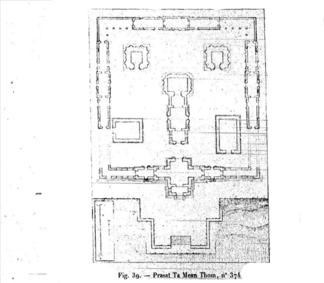
The site is entered from the southern side via a friendly Cambodian military base along a trail past some bunkers and a basin leading to a laterite staircase and buttress wall that leads up to the main entrance pavilion or gopura. The layout image below is by Etienne Lunet de Lajonquière who first surveyed the site sometime around 1902.
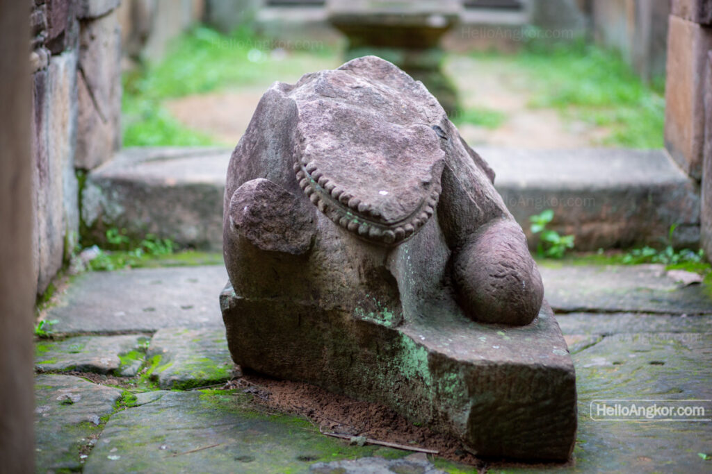
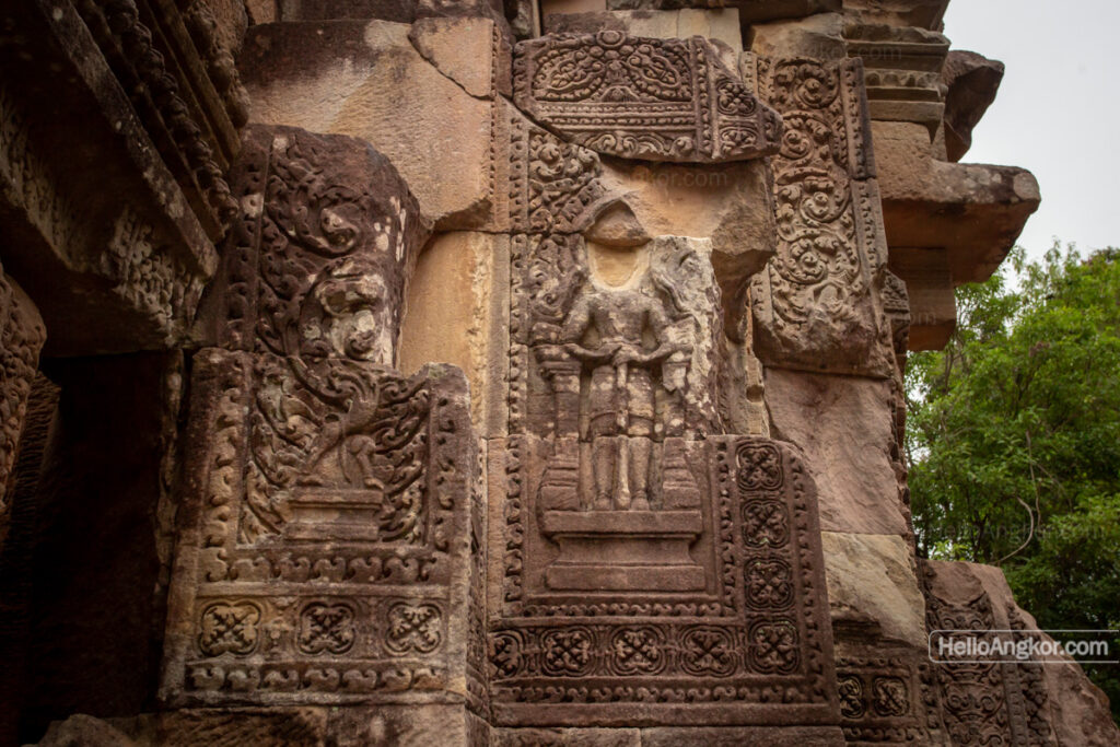
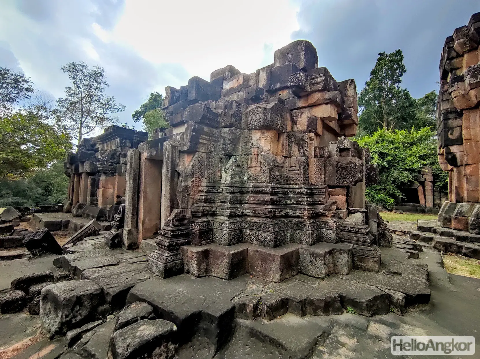
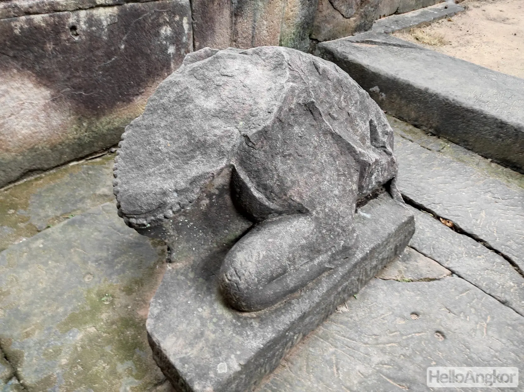
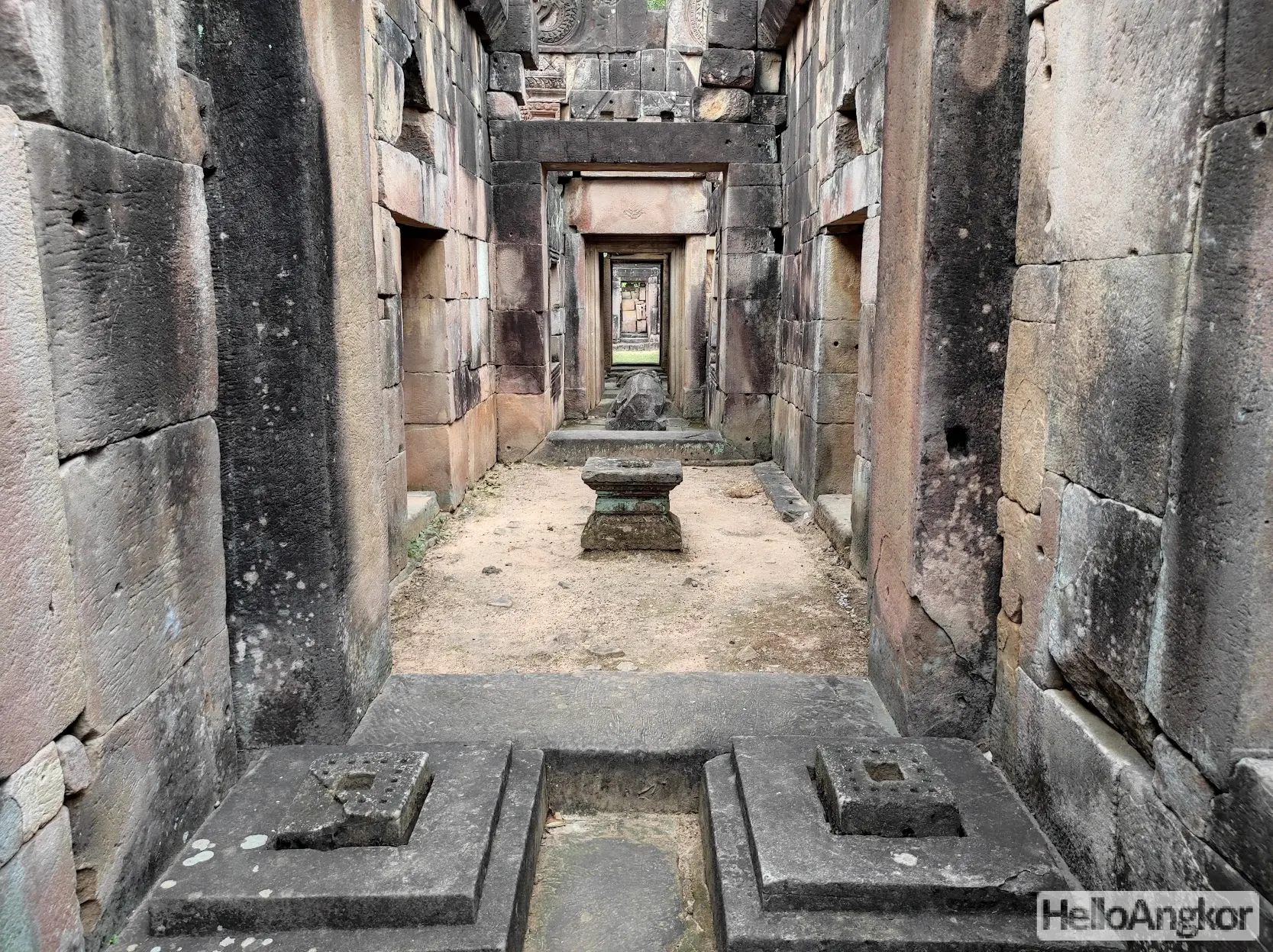
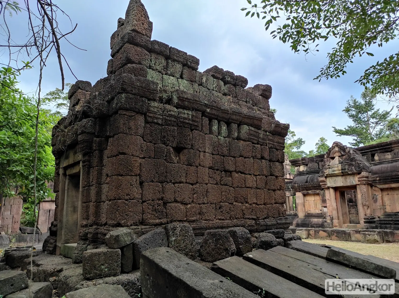
The central shrine features a long chambered hall, or mandapa, leading to the shrine whose base and linga are carved from the natural bedrock. The exterior walls of the central shrine feature images of Dvarapala (guardians) and ornate decorations on the pilasters and base molding. Looking closely around the mandapa, you can see parts of the molding that were left unfinished never receiving the final decorative carving. Inside the mandapa, you can see deposit stones and the remnants of a statue of Nandin the sacred bull looking towards the linga of the central shrine.
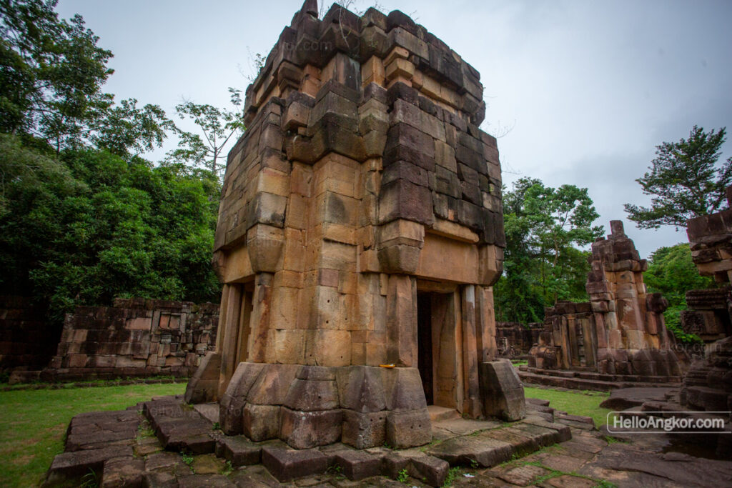
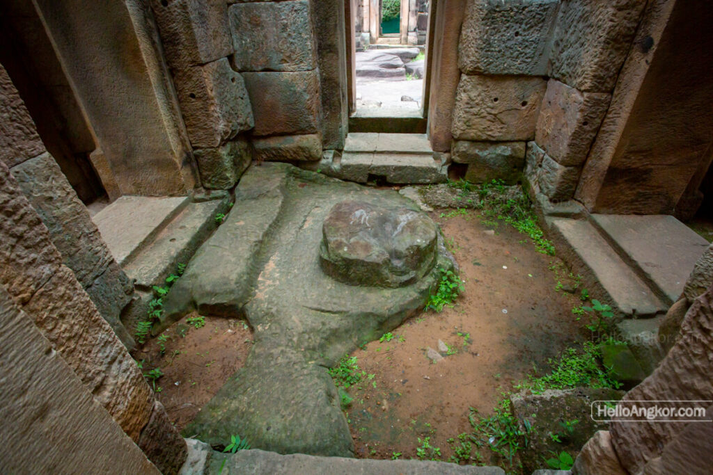
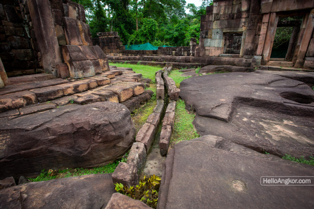
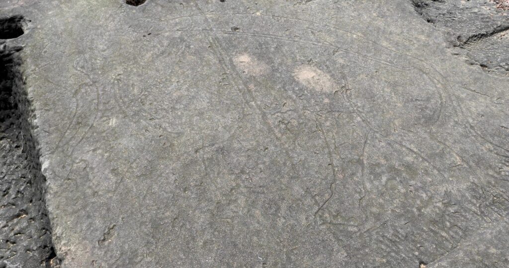
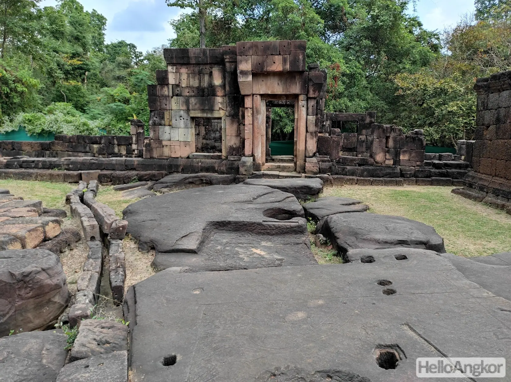
On the eastern side of the central shrine, you can see the bedrock continuing into which a channel has been carved for the flow of sacred water to the exterior of the temple (see the 360 image further below). Look closely as there is also an outline of an elephant carved in the stone.
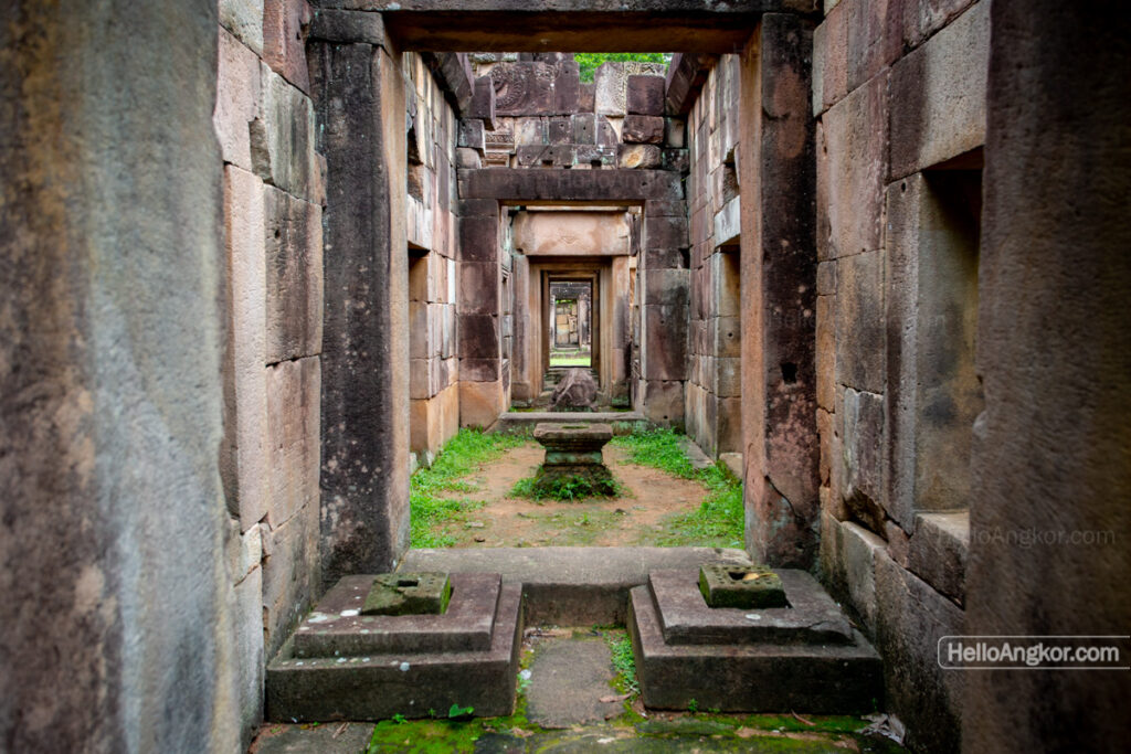
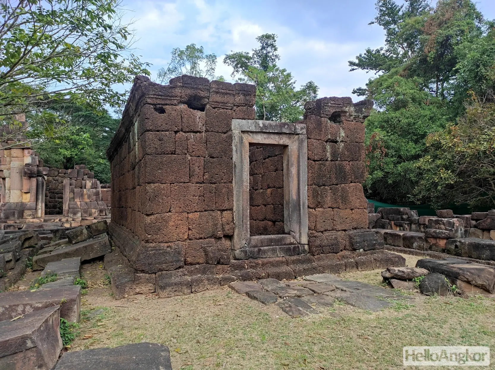
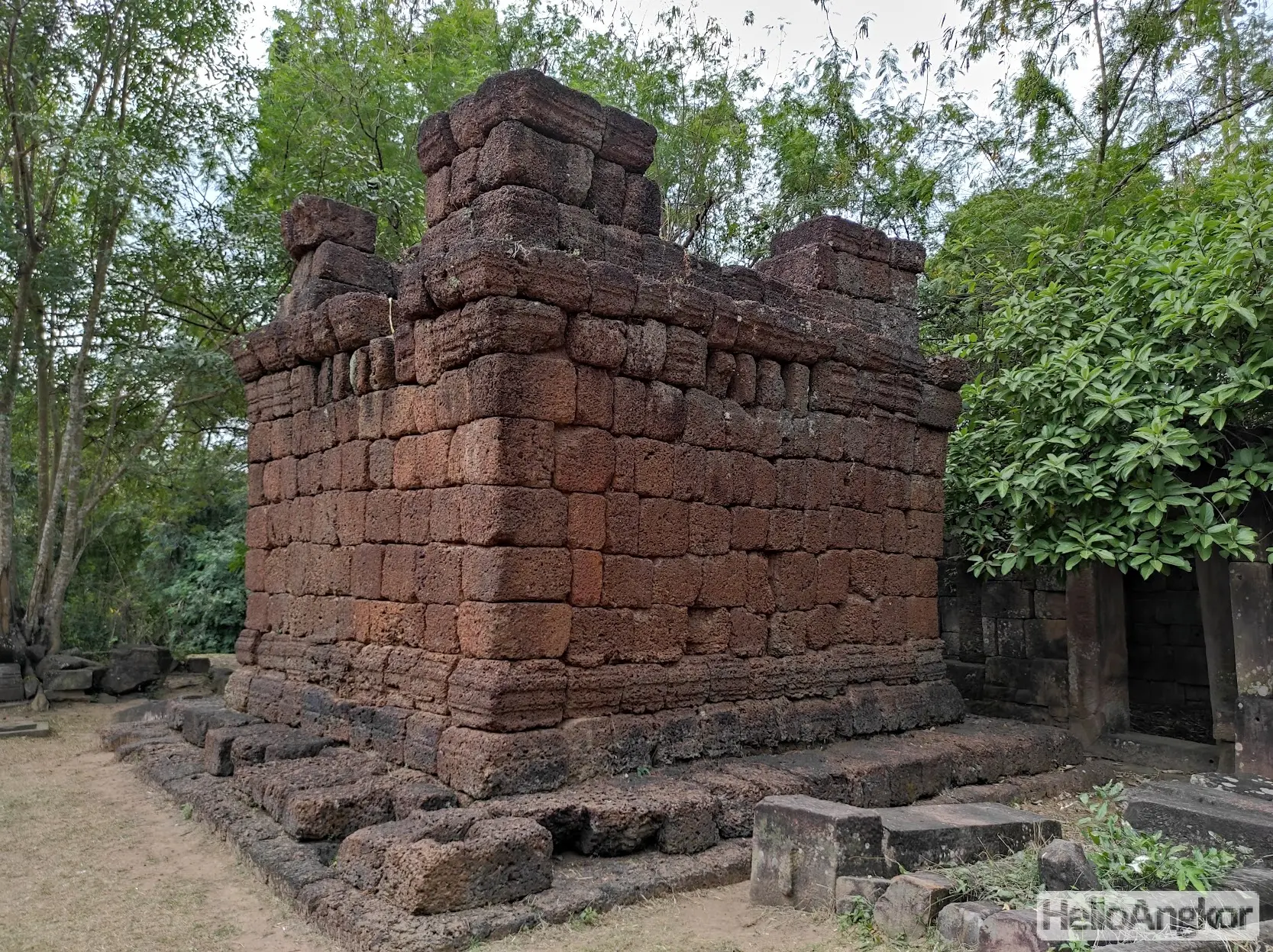
The southern wall is mostly gone and only the gopura stands after which you’ll see the central shrine straight ahead which is flanked on either side by laterite buildings, one that opens to the south and one that opens to the west, and further flanked on either side by lesser shrines at the rear.
Inscriptions
One of the steles from the site is held in the Surin National Museum, recorded as Prasat Ta Muen Thom Inscription 5, Sor. 16, or K. 1187. It is a leaf-shaped stele on which side 1 has 19 lines, side 2 has 19 lines, and side 3 has 2 lines. Its text is largely attributed to King Suryavarman I (more).
Another stele, K. 376, or is it the same stele, was recorded by Coedes as having Khmer text of 15 to 20 lines on two sides with only one side being legible, mostly in Khmer with two lines in Sanskrit.
Khmer/French Classification
- K. 376 – a stele (not in situ) with three inscriptions, 23 + 13 lines of Khmer and 2 lines of Sanskrit – IC VII, p. 60
- K. 1180 – a rock (not in situ) with 2 lines of Sanskrit
- K. 1181 – a door frame with 2 lines of Sanskrit
- K. 1182 – a stele (not in situ) with Sanskrit text
- K. 1184 – a stele (not in situ) illegible
- K. 1185 – a stele (not in situ) with 10 lines of Sanskrit and 12 + 6 lines of Khmer
- K. 1186 – a stele (not in situ) with 19 + 18 lines of Khmer
- K. 1187 – a stele (not in situ) with 19 + 19 + 3 lines of Khmer and 6 lines of Sanskrit
- K. 1188 – a stele (not in situ) unknown
Thai classification
- Prasat Ta Muen Thom Inscription No. 1, Sor. 13 – two lines of Sanskrit (more)
- Prasat Ta Muen Thom Inscription No. 3 – noting land boundaries and offerings to Brahma and Shiva
- Prasat Ta Muen Thom Inscription No. 4 – noting land boundaries set under King Suryavarman I (more)
- Prasat Ta Muen Thom Inscription No. 5 (K. 1187) – noting offerings to the gods made under King Suryavarman I (more)
- Prasat Ta Muen Thom Inscription No. 9 – noting allocation of lands under King Jayavarman III (more)
Getting There
The site can be reached easily by a sealed bitumen road leading from Kuok Mon or along the sealed border that leads all the way from Poipet. As mentioned, the site is right on the border, from the Cambodian side the site is accessed via a military post who are very friendly and will point you in the direction of the temple to meet the Thai military post who will grant access to the site. Also, note that once you reach the base of the mountain there is a short but very steep ascent, perhaps around 40-45 deg which you can either walk, drive, or ride up with caution.
Around 500 m to the northwest (in present-day Thailand) and also along the ancient road, are the hospital chapel of Prasat Ta Muen Toch and another 500 m away is Prasat Ta Muen, a “firehouse” or rest house chapel. To the south, in Cambodia, is Prasat Chan and Wat Ta Muen where ancient temple relics are seen.
Update 2024
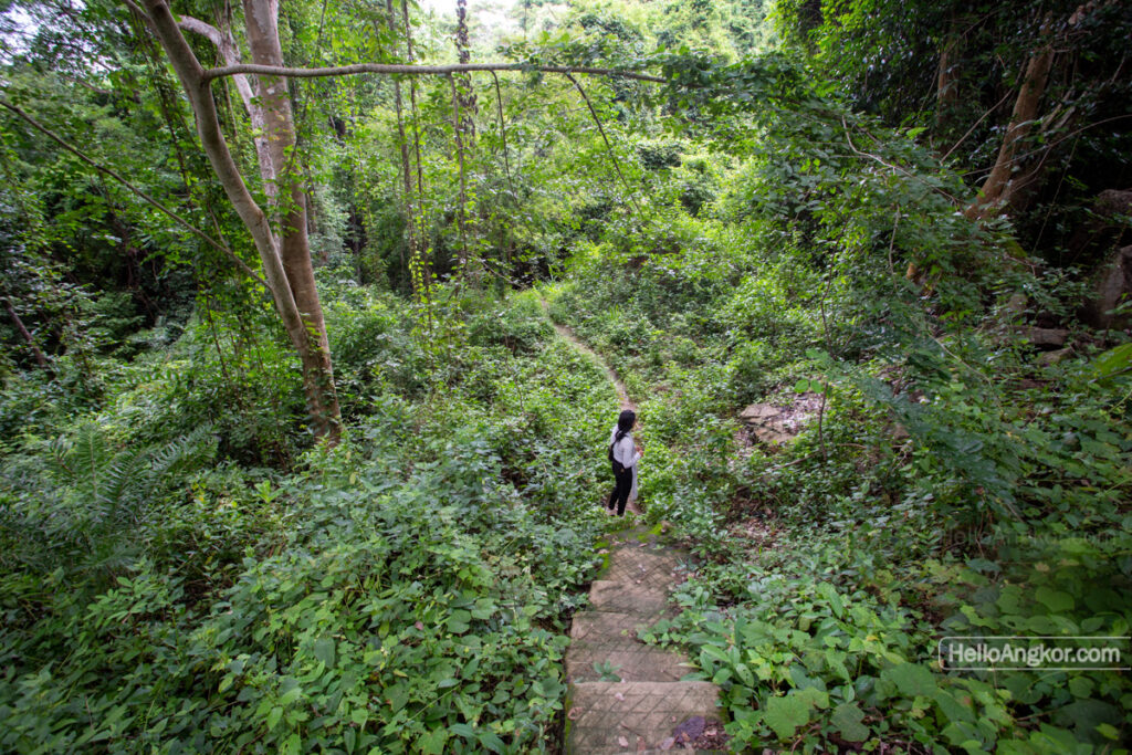
On our most recent visit, we found the site to be just as wondrous as our visit back in 2021. This time we also took the foot trail from near the parking area over to Prasat Damrei Troam which features a revered elephant sculpture, a collection of remnants, and laterite paving and what appears to be an ancient pathway down to the base of the mountain. There’s also a great lookout there too.
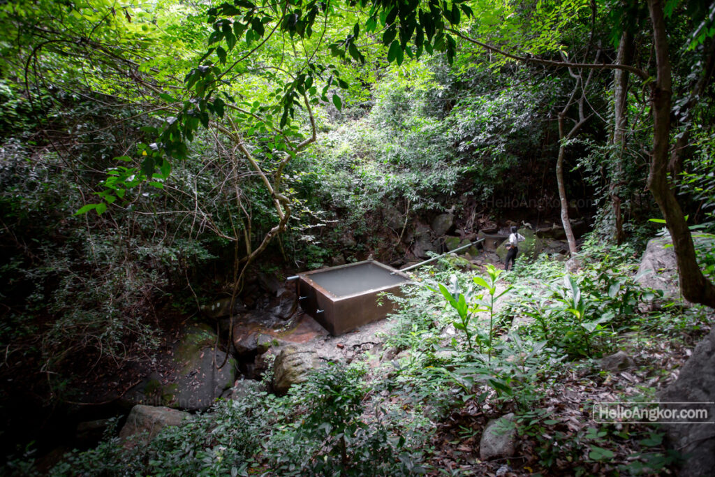
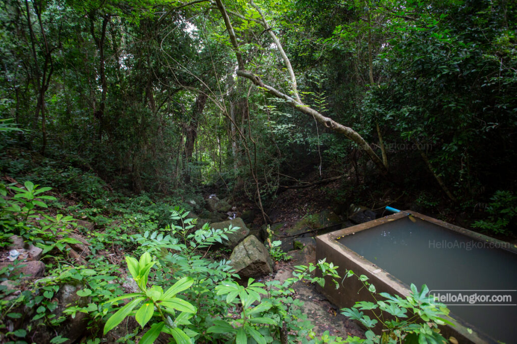
Partway up the road, between the base of the mountain and the parking area, there is also a trail that leads to a cascade where they’ve added a basin for swimming which could be just what you are looking for on a hot day.
Photos 2021
*this article was originally written in 2021 and updated in 2024 with new photos and additional info
Map
Site Info
- Site Name: Ta Muen Thom (Pr.) Khmer Name: បា្រសាទតាមាន់ធំ
- Reference ID: HA12148 | Posted: May 21, 2021 | Last Update: September 17th, 2024
- Other Names: Prasat Ta Moan Thom, Prasat Ta Muean Thom
- Tags/Group: Ancient Royal Road, nwgc, pr, ra, Royal Road Angkor Phimai, T24, Ta Muen (Ta Muean), Temples
- Location: Oddar Meanchey Province > Banteay Ampil District > Ampil Commune > Prei Veng Village
- MoCFA ID: 913
- IK Number: 374
- Inscription Number/s: K. 376, 1180, 1181, 1182