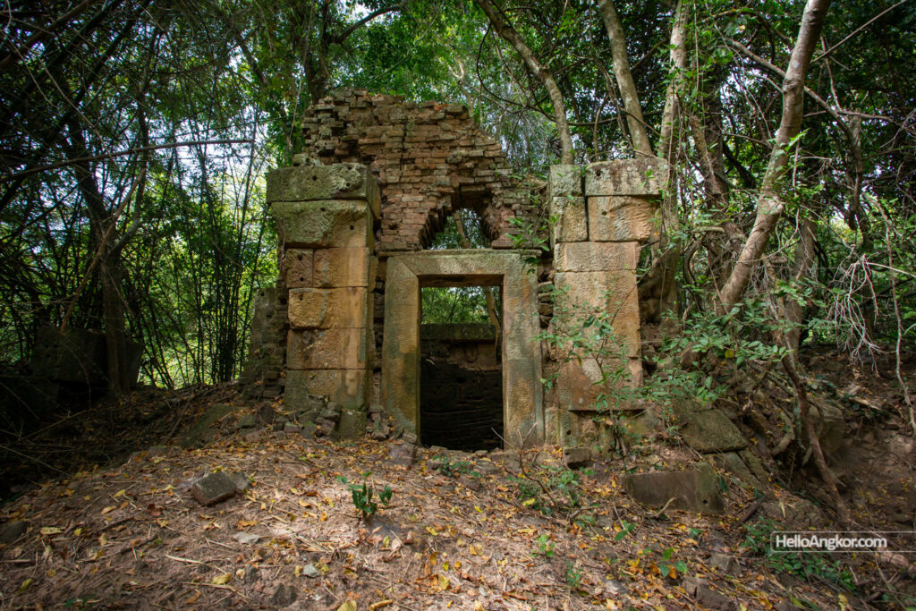
Recorded as Prasat Kre in the 1900s by the French explorer and geographer, Etienne Lunet de Lajonquiere, the site features the remains of a three-brick temple group with an outer laterite wall and moat. Locals know it by Kon Krang or Koun Kreng (Khmer: ប្រាសាទ កូនគ្រែង) as it is recorded likewise on Google Maps.
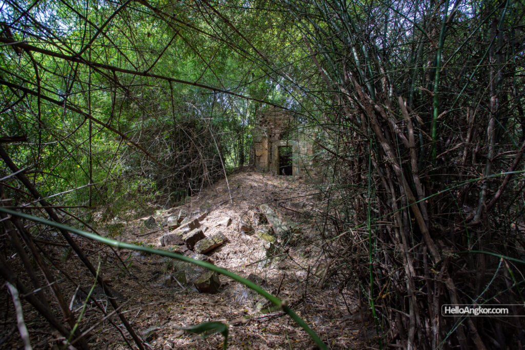
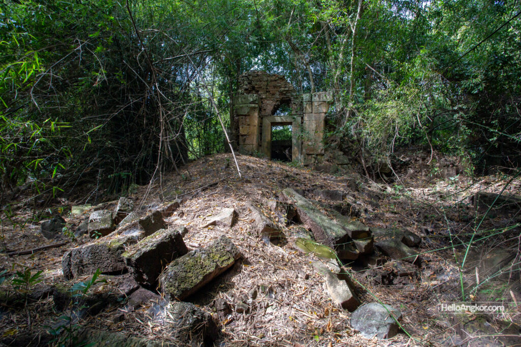
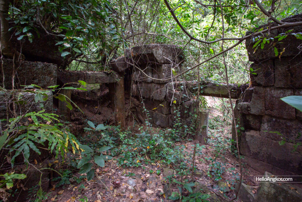
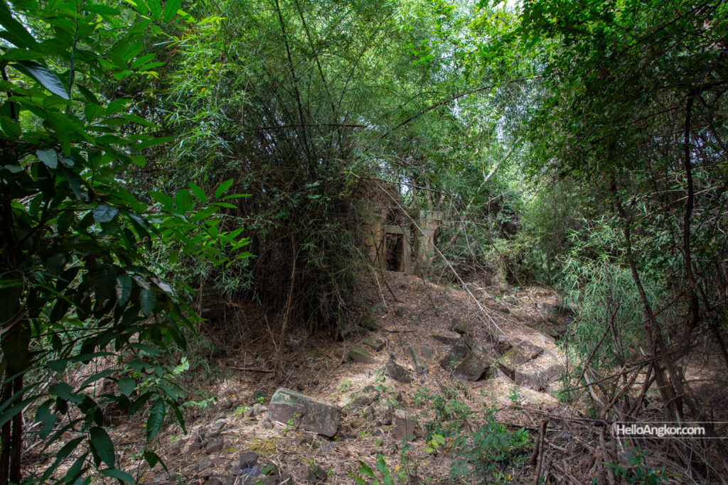
The site features an outer moat that still retains water during the wet and irrigation seasons, accessed by a causeway from the east. This meets with an outer laterite wall with remnants of a large entry gopura, also on the east. On the south wall, a gallery/annex building is built into the wall as seen in many temples around this same era, the 11th-12th century; it features a single opening to the courtyard and two side chambers.
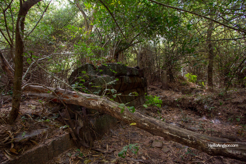
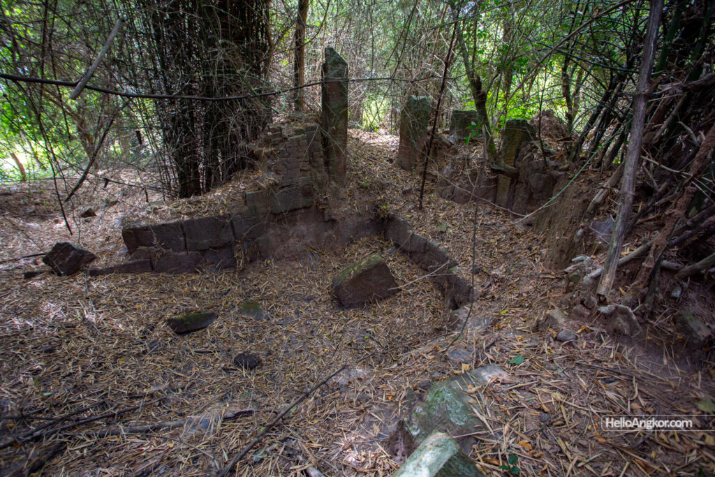
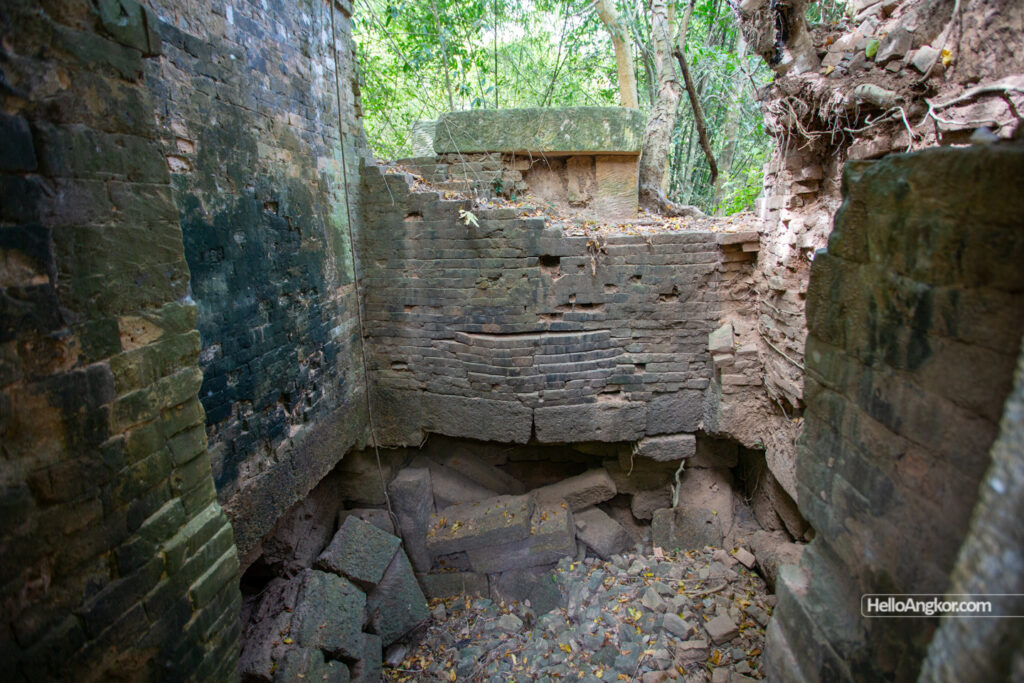
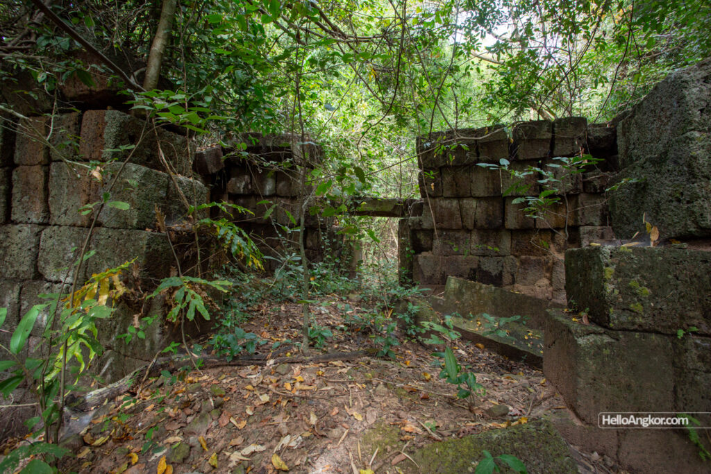
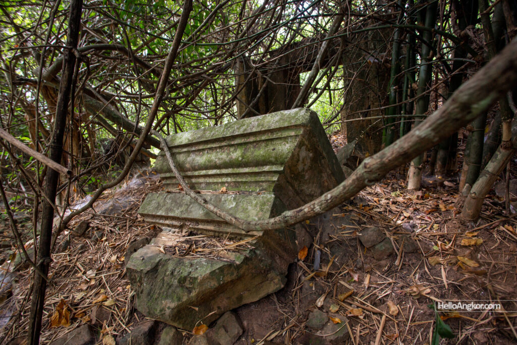
The three brick towers rise on a common and elevated laterite base and feature sandstone base molding, pilasters, false doors, and doorframes, while their body and superstructure are, or were, formed in brick. All are in ruin with the central tower being the best preserved of the trio. Remnants of a small brick library are seen in the southeast corner of the courtyard while a a pile of brick may indicate the same in the northeast corner. The site appears to have been left incomplete, or at least undecorated by final artistic carving.
The site features raised earthen embankments leading north from its southern wall and another leading east. Whether they are contemporary to the site or later times is unknown to me but may well be something of interest.
Outer WallGopurathrough the thornsCentral tower and its collapsed forebodyCentral towerCentral towerNorth towerSouth wall annexeSouth wall annexeView of the trio of towersNorth tower – the only refined sanstone fragment seen
The site can be reached from the northern end of the sealed road of Srei Snam village taking the main dirt road that leads east towards the site which is in good condition At the time of visiting – 12/23) bar the last section which features deep sand. The temple surrounds can be flooded during rice irrigation and wet season. As mentioned, access to the temple is from its eastern side.
Historical Notes
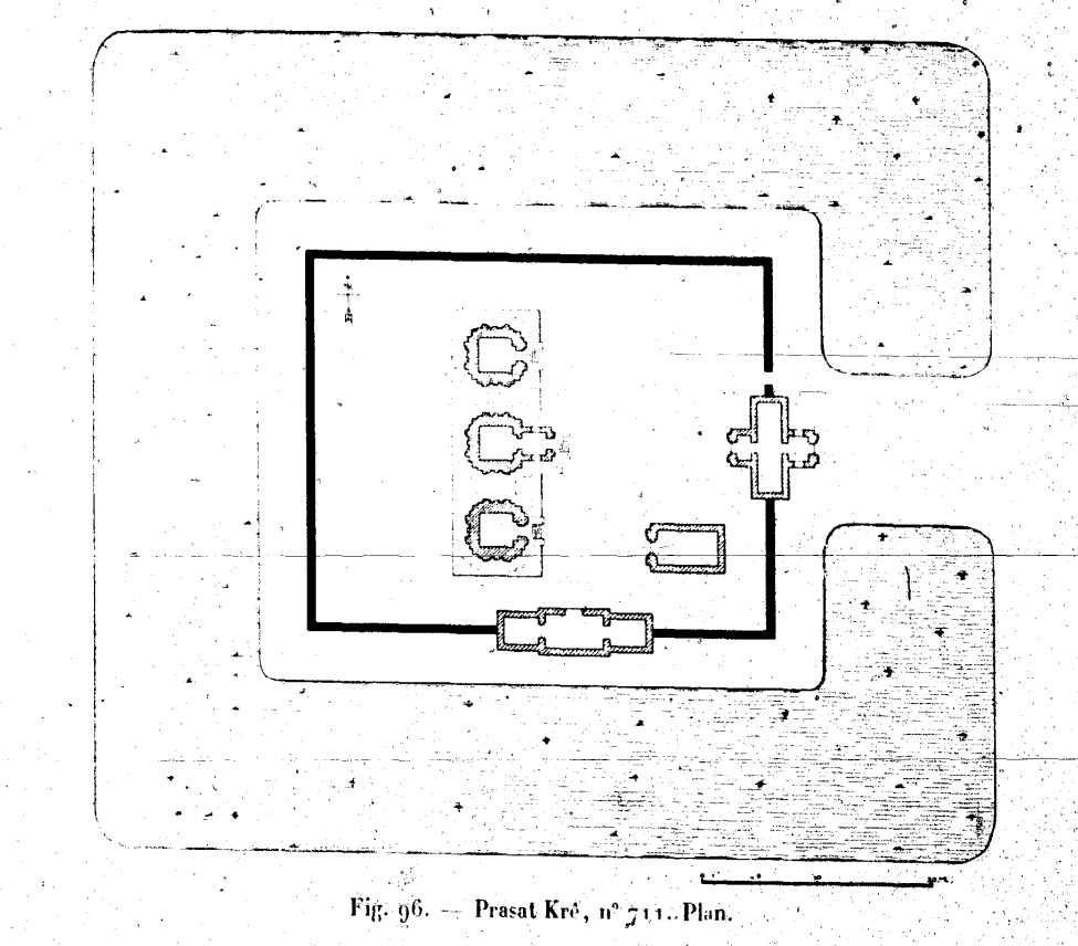
Prasat Krê. It is located 7 kilometers to the East, Southeast of the village of Sleng. It is a group of three brick sanctuaries (fig. 96), square, measuring 4.5m of facade, regularly arranged on a North-South axis and oriented to the East. They are built on the same limonite base, probably in several tiers; but these disappear under the debris of collapsed sanctuaries up to half the height of their facades. The central sanctuary is preceded by a sandstone façade with large windows.
A limonite wall with a coping, partly collapsed, determines, around the group, a courtyard that measures 40 meters in the E-W direction and 32 meters in the N-S direction. It is interrupted: on the East, by a brick gopura with a sandstone front lit by large windows, that is in ruin; and on the East face by a limonite gallery which has not been completed. A small entry opens in the E. on the north side of the gopura.
A brick annex building, regularly placed and oriented in the south east corner, is completely ruined.
All the sandstone pieces of the various buildings of this temple, which, spread in profusion, announced an ornate very rich mention, remained rough without presenting any outline of the sculptural work. A basin-ditch, interrupted on the E. face by a causeway surrounds the enclosure wall.
Inventaire descriptif des monuments du Cambodge, E. Lunet de Lajonquière, 1902-1911
Map
*Important: mapped location may only be approximated to the district level/village only. To visit sites outside the tourist zones you should seek a local guide from the area read more.
Site Info
Site Name: Krae (Pr.) Khmer Name: បា្រសាទគ្រែ
Reference ID: HA11859 | Posted: January 20, 2021 | Last Update: December 24th, 2023
Other Names: Prasat Kre, Kon Krang, ប្រាសាទ កូនគ្រែង, Koun Kreng Temple